St. Louis to Erie Corridor Braces for Destructive Gorilla Hail and Tornado Threat as Intense Supercells Erupt Today
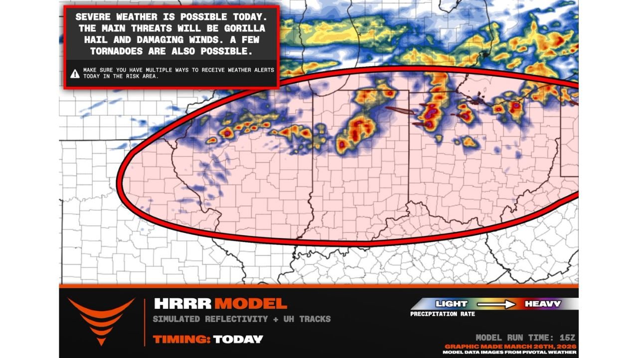
MISSOURI, ILLINOIS, INDIANA, OHIO, PENNSYLVANIA — A high-impact severe weather event is unfolding today across the Midwest and Ohio Valley, where destructive “gorilla hail” is emerging as the primary threat, alongside damaging winds and a growing tornado risk.
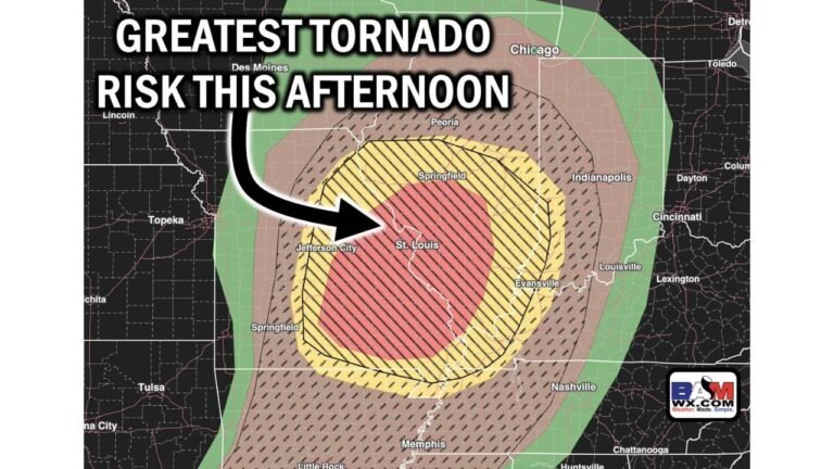
Storm models indicate multiple clusters of intense supercells developing from the St. Louis region through Indiana and Ohio into Erie, Pennsylvania, creating a dangerous corridor of severe weather through the day.
Supercell Clusters Expected to Intensify Across the Region
The risk zone stretches from:
- St. Louis, Missouri
- Across central and eastern Illinois
- Through Indiana and Ohio
- Into northwestern Pennsylvania, including Erie
This setup favors organized clusters of supercells, rather than isolated storms, increasing the likelihood of widespread severe impacts.
Gorilla Hail Could Cause Significant Damage
The standout concern with today’s storms is the potential for extremely large hail — often referred to as “gorilla hail.”
This type of hail can:
- Exceed golf ball size and become destructive to vehicles and roofs
- Fall with intense storms capable of maintaining strong updrafts
- Occur repeatedly as multiple storm cells track across the same areas
Residents in the core risk zone should be prepared for rapidly developing severe conditions with little warning.
Damaging Winds and Tornado Risk Also in Play
In addition to hail, storms are expected to produce:
- Damaging straight-line winds capable of knocking down trees and power lines
- A few tornadoes, particularly with storms moving southeast along the boundary
While hail may be the dominant threat, the presence of supercell structures means tornado potential cannot be ruled out, especially in the most intense cells.
Timing Points to Afternoon and Evening Impacts
The severe weather threat is expected to ramp up during the afternoon hours, with storms becoming more intense into the evening.
- Initial development likely begins near Missouri and Illinois
- Storm clusters then expand eastward into Indiana and Ohio during late afternoon
- The threat continues into Pennsylvania through the evening and early night
This progression means multiple regions will face severe weather at different times throughout the day.
High-End Severe Weather Setup Requires Immediate Attention
With destructive hail, damaging winds, and tornado potential all aligned, this is shaping up to be a dangerous and fast-evolving weather event across multiple states.
Residents in the risk area should ensure they have multiple ways to receive weather alerts and be ready to take action quickly if warnings are issued.
Stay with CabarrusWeekly.com for continuous updates as this severe weather outbreak unfolds across the Midwest and into the Northeast.