Indiana, Ohio, Kentucky, and West Virginia Face Wednesday Flood Concerns as 1 to 2 Inches of Rain Targets Already Saturated Soils Through 9 PM
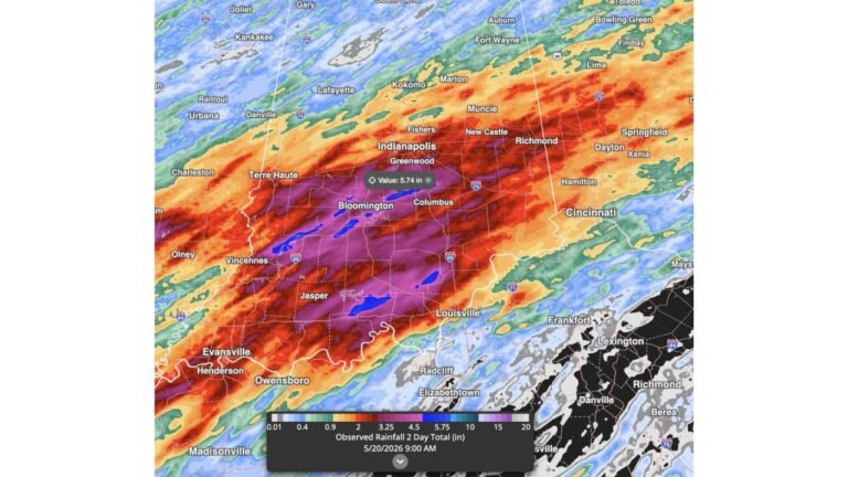
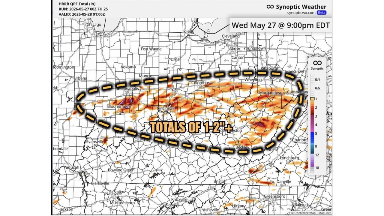
INDIANA — Flooding risks remain in play throughout Wednesday May 27, 2026 as heavy downpours are expected to persist across a broad corridor from central Indiana through West Virginia, with the HRRR forecast valid through 9:00 PM EDT Wednesday showing totals of 1 to 2 inches or greater across the entire dashed concern zone. Flood-prone areas and already saturated soils from previous rain events will be the most susceptible locations.
Where the 1 to 2 Inch Zone Is Focused
The Wednesday flood concern area outlined by the dashed yellow border covers a wide swath of the Ohio Valley and surrounding states.
Forecast rainfall totals through 9 PM Wednesday:
| Area | Expected Total |
|---|---|
| Indianapolis / Bloomington corridor | 1 to 2 inches or more |
| Dayton / Cincinnati | 1 to 2 inches or more |
| Columbus / Zanesville | 1 to 2 inches |
| Morgantown / Cumberland | 1 to 2 inches |
| Charlottesville / Beckley | 1 to 2 inches |
| Evansville / Southern Indiana | 1 inch or more |
| Pittsburgh / Wheeling fringe | Near 1 inch |
Why This Rain Is More Dangerous Than the Numbers Suggest
1 to 2 inches of rain on saturated ground is not the same as 1 to 2 inches on dry soil. The entire Ohio Valley corridor has absorbed repeated rounds of rainfall over the past several days, leaving soils at or near capacity across much of the region.
Key flooding risk factors today:
- Saturated soils from prior rain events have no remaining absorption capacity
- Flood-prone areas including low lying roads, underpasses, and creek corridors face the highest immediate risk
- Heavy downpours lasting throughout much of the day rather than a single brief event
- Runoff moves directly into drainage systems, streams, and rivers with no ground absorption buffering
- Even moderate rainfall rates can produce rapid water rises when soils are already at capacity
Flood Safety for Wednesday
- Never drive through flooded roadways under any circumstances
- Monitor NWS flood watches and warnings for your specific county throughout the day
- Avoid low lying areas and creek banks as water levels can rise rapidly
- Allow extra travel time across all affected corridors through Wednesday evening
Stay with CabarrusWeekly.com for continuing flood updates across Indiana, Ohio, Kentucky, and West Virginia through Wednesday night.