Texas, Oklahoma, Kansas Lead Expanding Severe Storm Zone While Central and Eastern U.S. See Widespread Thunderstorm Corridor
UNITED STATES — A broad and evolving storm pattern is being monitored across much of the country, with the most organized severe weather potential centered over the Southern Plains while a widespread thunderstorm corridor stretches eastward.
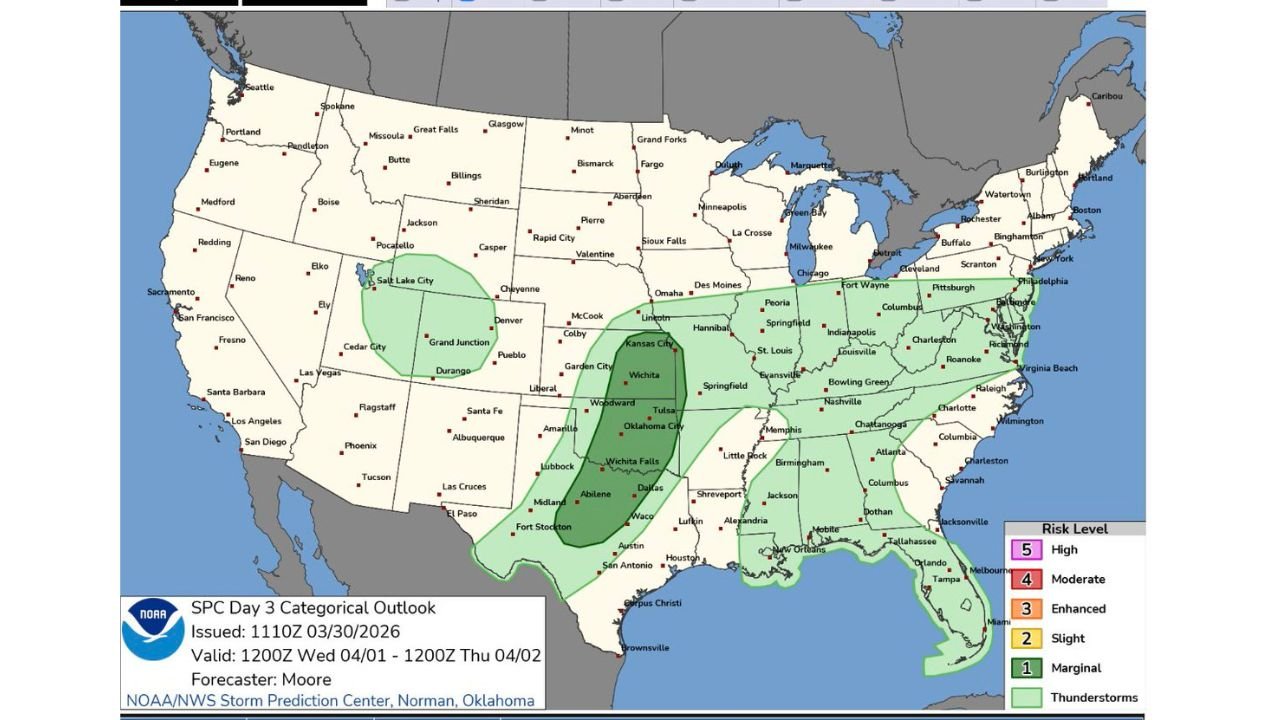
Southern Plains Emerge as Core Storm Zone
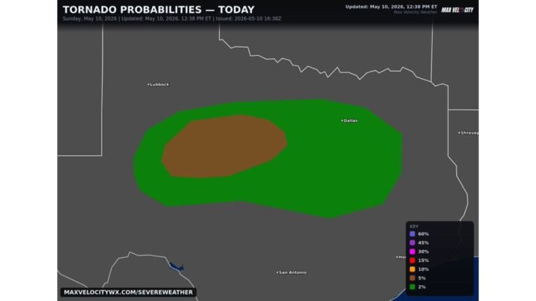
Forecast guidance highlights Texas, Oklahoma, and southern Kansas as the primary region for stronger storm development.
This area shows the greatest concentration of ingredients needed for organized storms, suggesting higher chances for stronger thunderstorms capable of producing gusty winds and localized severe impacts.
Cities including Oklahoma City, Wichita, and areas of North Texas sit within this more focused zone where storm intensity could be highest.
Broad Thunderstorm Corridor Extends East
Beyond the core severe zone, a much larger area of general thunderstorm activity stretches from the Central Plains through the Midwest and into the Ohio Valley and East Coast.
States including Missouri, Illinois, Indiana, Kentucky, Tennessee, and parts of the Southeast are all within this broader corridor.
While storms in these regions may be less intense overall, they could still produce periods of heavy rain, lightning, and brief gusty winds.
Rockies and Interior West Also See Isolated Activity
A secondary, more isolated area of storms is expected across parts of the Intermountain West, including Utah and western Colorado.
These storms are likely to remain scattered and less organized, but may still bring localized rain and occasional lightning in higher terrain areas.
Pattern Suggests Increasing Spring Instability
This setup reflects a classic spring transition pattern, where warm, moist air from the Gulf interacts with disturbances moving across the country.
The result is a wide coverage of storms, with the most concentrated severe threat in the Southern Plains and more scattered activity elsewhere.
As this pattern evolves, additional rounds of storms may develop in the coming days, especially along this active corridor.
Monitoring Continues as Pattern Evolves
While confidence is highest in the Southern Plains for stronger storms, the overall setup remains dynamic, with conditions capable of shifting.
The broad nature of the thunderstorm corridor means that multiple regions could experience changing conditions within a short time frame.
Residents across the central and eastern United States should stay aware as this pattern develops further.
Stay with CabarrusWeekly.com for continued updates, and share what conditions you are seeing in your area as this widespread storm pattern unfolds.