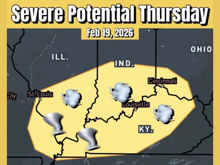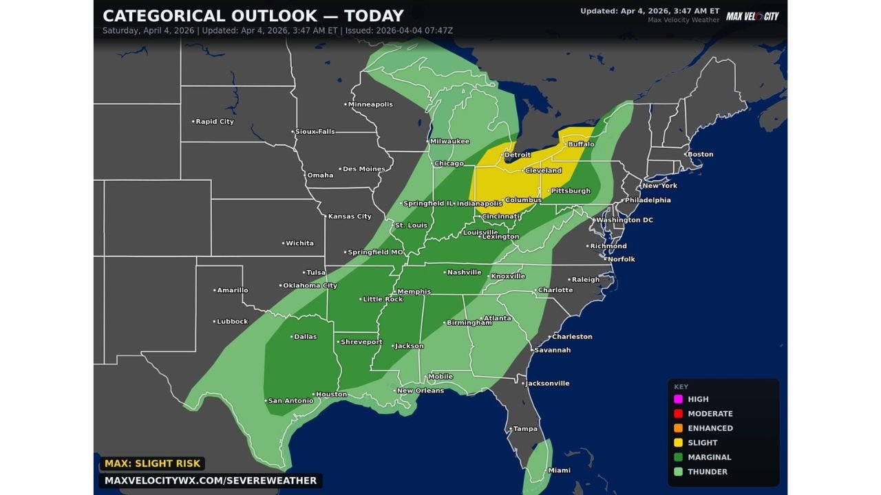
Damaging Winds Take Lead BUT Tornado Risk Still Lingers Across Illinois, Indiana, Ohio and Kentucky in Today’s Midwest Storm Setup
MIDWEST AND OHIO VALLEY — A new round of severe weather is expected to develop today, with damaging winds emerging as the primary threat across Illinois, Indiana, Ohio, Kentucky, and surrounding states, while a limited tornado risk remains in place.
Wind Damage Expected to Be the Main Hazard
Forecast data shows that storms moving through the region could produce wind gusts between 50 and 65 mph, especially across a broad corridor from Missouri and Illinois into Indiana and Ohio.
Cities including St. Louis, Indianapolis, Cincinnati, Columbus, Cleveland, and Nashville are all within this risk zone, where storms may organize enough to produce impactful wind damage.
Tornado Risk Remains Low but Not Zero
Although the overall setup does not strongly favor widespread tornado development, there is still a low-end potential for a strong tornado or two, particularly in areas highlighted within the more focused risk zone.
If storms are able to organize more efficiently later today, isolated rotating storms could briefly develop, increasing the tornado threat in localized areas.
Storm Coverage Expands Across the Region
The severe weather threat is expected to stretch across a wide portion of the Midwest and Ohio Valley, with storms developing and tracking eastward through the day and into the evening hours.
While not all areas will experience severe conditions, scattered storms capable of producing damage are expected across multiple states, making this a broad-impact event.
Not a Major Outbreak but Still Impactful
This setup is not expected to become a widespread severe weather outbreak, but conditions are still favorable for localized damaging storms capable of producing real impacts.
Even outside the strongest storms, heavy rain, lightning, and gusty winds may affect travel and outdoor plans throughout the day.
Timing and Intensity Will Vary by Location
Storm intensity and timing will vary depending on location, but the afternoon into evening period remains the most likely window for stronger storm development.
As storms move through, conditions may change quickly, especially where storms begin to organize into clusters or short lines.
Residents across Illinois, Indiana, Ohio, Kentucky, and nearby states should remain weather-aware today and be ready to act if warnings are issued.
If you experience strong winds or storm impacts in your area, share your updates with CabarrusWeekly.com to help keep others informed.