Late Week Into Mid-April Timeline Shift: Southeast Ridge Builds While Cooler Waves Track North Bringing Warmer East Coast Trend
UNITED STATES — A major pattern shift is beginning to take shape as we move into mid-April, signaling a clear transition away from winter-like setups and toward a more summer-leaning atmospheric pattern across the eastern half of the country.
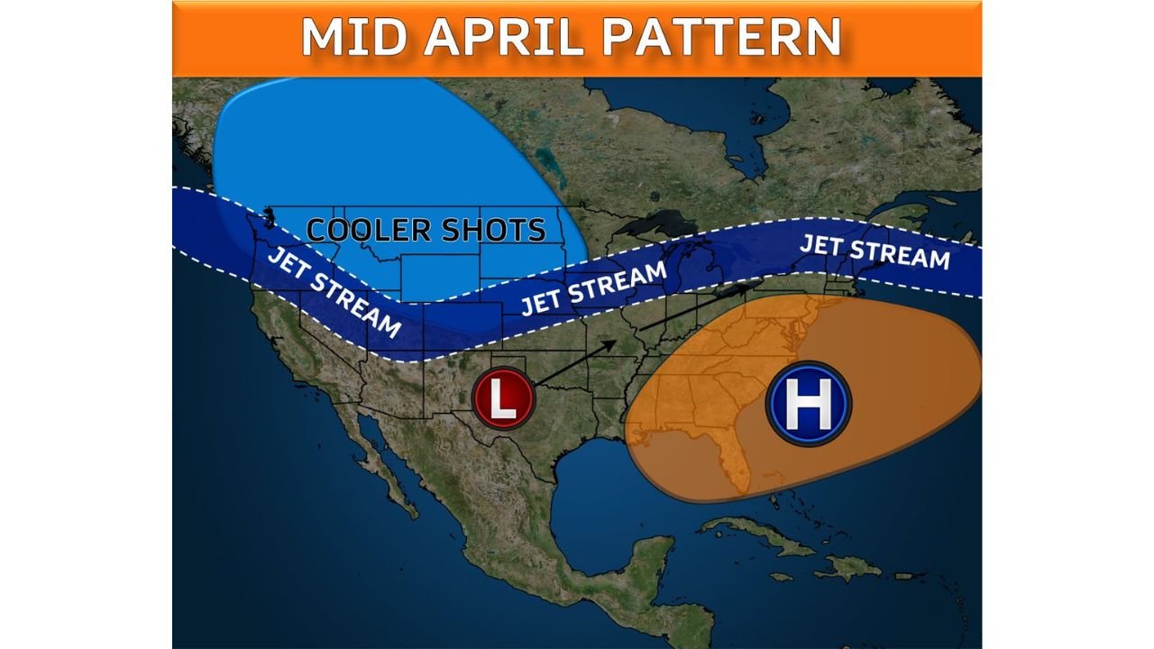
Southeast Ridge Begins to Take Control
Starting next weekend, a strengthening Southeast/Bermuda high-pressure system is expected to expand and flex across the eastern United States. This feature will:
- Push warmer air northward along the East Coast
- Support above-average temperatures across much of the Southeast and Mid-Atlantic
- Begin establishing a more stable and warmer spring pattern
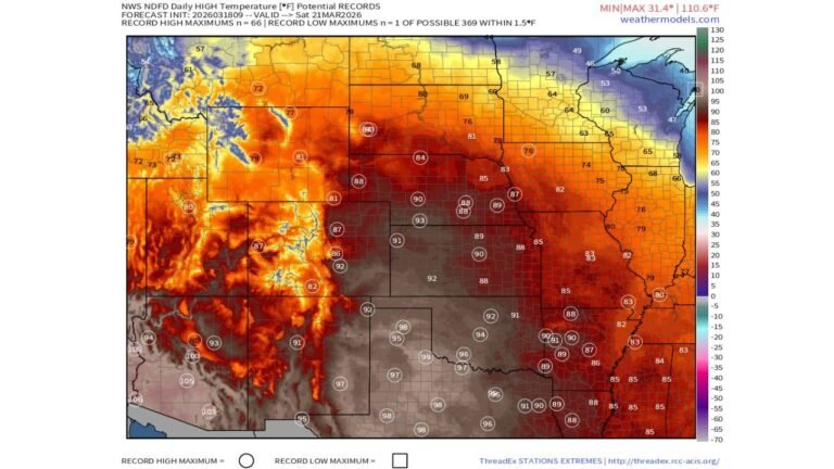
This setup is a complete reversal from the persistent winter pattern, where cold air dominated much of the country.
Jet Stream Shifts North, Keeping Cooler Air Away
The jet stream will reposition itself farther north, creating a divide between air masses:
- Cooler air remains locked across parts of the Northern Rockies and Upper Midwest
- Warmer air dominates across the South, Southeast, and East Coast
- Storm systems track primarily north and northwest of the Southeast ridge
This means fewer direct cold intrusions into the eastern U.S., though not completely eliminating them.
Not a Perfect Warm Stretch, But Overall Above Normal
Even with a warming trend, conditions won’t be completely steady:
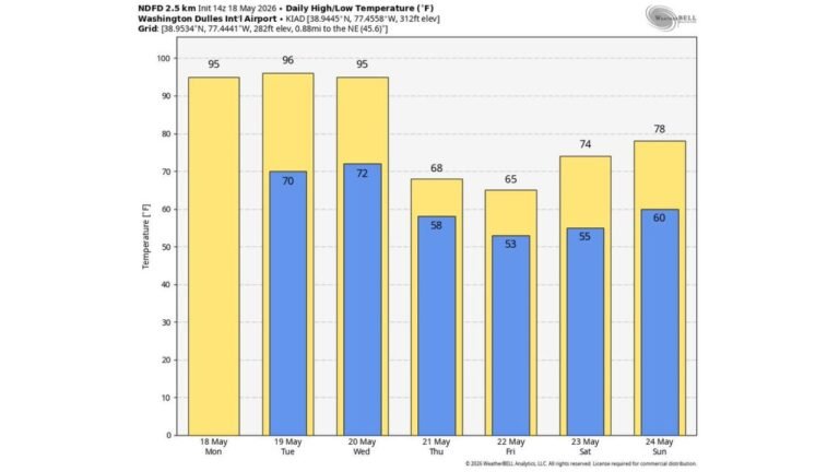
- Occasional cold fronts may slide in, briefly interrupting the warmth
- A backdoor front could bring temporary cooler conditions to parts of the Northeast and Mid-Atlantic
- However, the overall pattern strongly favors consistent above-average temperatures
The key takeaway is that while there may be short-lived cooldowns, the dominant theme remains warm.
Rainfall Depends on Ridge Strength and Position
Precipitation chances will vary depending on how strong and where the ridge sets up:
- A stronger, westward ridge keeps storm tracks farther north, limiting rainfall in the Southeast
- A weaker or east-shifted ridge allows more systems to slide through, increasing rain chances
This creates some uncertainty, but overall suggests no prolonged widespread wet pattern for the East Coast.
What This Means Moving Forward
As this mid-April pattern locks in:
- The eastern U.S. trends toward a warmer, more stable spring regime
- Cooler air becomes less dominant and more confined to northern regions
- The overall setup begins to resemble early summer-like behavior, especially across the Southeast
This transition marks a significant seasonal shift, with the atmosphere clearly moving away from winter influences.
Stay Updated With Cabarrus Weekly
For more detailed breakdowns of changing weather patterns, temperature trends, and regional impacts across the United States, stay connected with Cabarrus Weekly—your trusted source for clear, data-driven weather updates.