Active Severe Weather Pattern Continues Through Middle Of Next Week From Southern Plains To Great Lakes As Multi-Day Stretch Brings Severe Storm Chances Saturday Through Wednesday April 11 To 15 2026 Across Central And Eastern United States
UNITED STATES — An active and extended severe weather pattern is underway across a large portion of the country, with a multi-day stretch of severe storm chances continuing today, Saturday April 11, through at least the middle of next week. While the overall pattern has trended less favorable for the highest-end severe weather, millions of people from the Great Lakes to the Southern Plains will still face chances for severe storms over the coming days.
Day By Day Breakdown Of The Severe Weather Threat
Forecast discussion data breaks down this multi-day severe weather stretch on a day-by-day basis, revealing how the risk area shifts and evolves through mid-week:
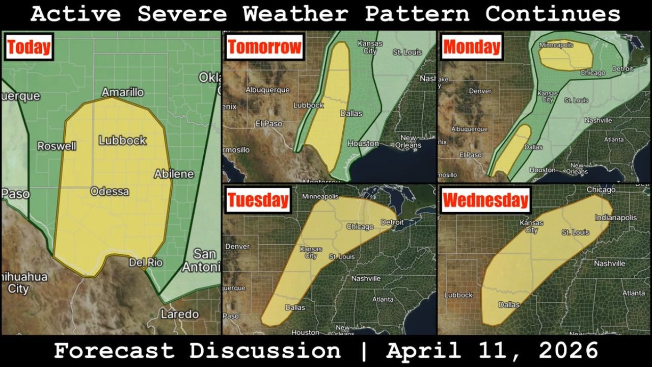
Today — Saturday, April 11
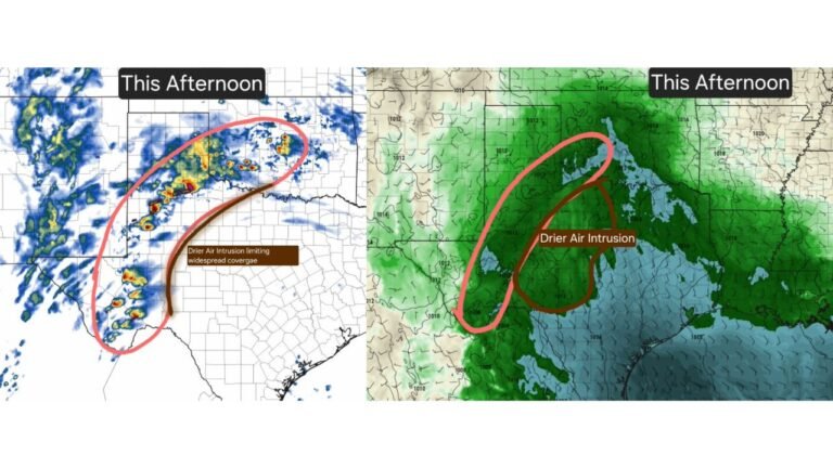
The current severe weather risk is focused across West Texas, covering a broad area from Lubbock and Odessa southward through Abilene, Del Rio, and San Antonio. This area carries the most immediate severe weather threat today as storms develop across the Southern High Plains this afternoon and evening.
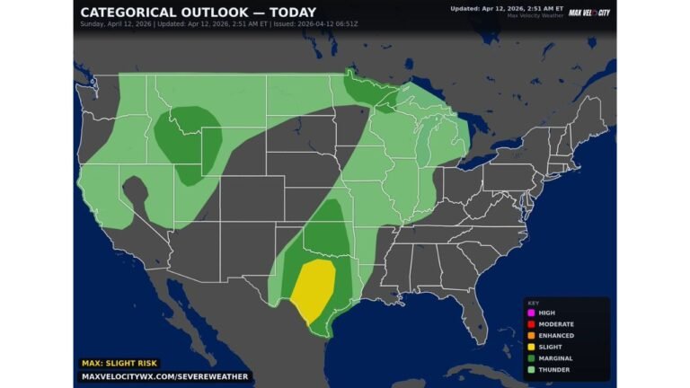
Tomorrow — Sunday, April 12
The severe weather corridor shifts and expands, with the risk zone moving into a north-to-south oriented strip stretching from near Dallas and Houston northward through the central Plains. The threat area covers a large swath of Texas and extends toward the Oklahoma and Kansas border region as the dryline becomes the primary focus for storm initiation Sunday afternoon.
Monday, April 13
Monday brings perhaps the most widespread severe weather threat of the entire multi-day stretch. The risk area expands significantly, pushing northward into the Upper Midwest and Great Lakes region, with the yellow risk zone extending from Minneapolis and Chicago in the north all the way down through Kansas City, St. Louis, and Dallas in the south. A separate risk corridor also extends along the Southern Plains through Texas. This two-pronged setup makes Monday a day to watch closely across a large portion of the central and eastern United States.
Tuesday, April 14
The severe weather focus on Tuesday shifts toward the central Mississippi Valley and Midwest corridor, with the risk zone positioned across areas including Kansas City, St. Louis, Dallas, and stretching toward the Great Lakes region including Detroit and Chicago. The threat remains broad but continues to be driven by the same large-scale pattern pushing through the country.
Wednesday, April 15
By mid-week, the severe weather risk narrows and repositions, with the threat area focused across a corridor from Lubbock and Dallas in Texas northeastward through Kansas City, St. Louis, Indianapolis, and toward Chicago and Nashville. While the risk area is somewhat smaller than earlier in the week, the threat is not over as the active pattern persists through at least Wednesday.
Overall Pattern: Less Favorable For Highest-End Events But Still Dangerous
Forecasters note that while the overall atmospheric pattern has trended less favorable for the highest-end severe weather outcomes compared to earlier forecasts, the multi-day stretch should not be taken lightly. Key points from the forecast discussion include:
- The pattern supports repeated rounds of severe storm chances rather than one single catastrophic outbreak
- Large portions of the population from the Great Lakes to the Southern Plains remain in the firing line over the coming days
- The shifting risk areas from day to day mean different communities face their greatest threat on different days
- Even in a less-favorable pattern, severe storms remain capable of producing damaging winds, large hail, and tornadoes
Who Needs To Be Weather Aware And When
Based on the multi-day forecast discussion, here is a general guide for when each region faces its greatest severe weather risk:
- West Texas — Greatest risk today, Saturday April 11
- Central Texas, Oklahoma, Kansas — Greatest risk Sunday April 12
- Upper Midwest, Great Lakes, Chicago, Minneapolis — Greatest risk Monday April 13
- Mississippi Valley, Missouri, Illinois, Michigan — Greatest risk Tuesday April 14
- Southern Plains through Midwest corridor — Risk continues Wednesday April 15
Prepare Now For A Multi-Day Severe Weather Stretch
With severe weather chances persisting through at least mid-week across such a large geographic area, residents across the central and eastern United States are urged to:
- Stay informed daily as the forecast evolves and risk areas shift
- Have a severe weather plan and shelter location identified before storms arrive in your area
- Keep weather alert notifications active on your devices throughout the week
- Understand that even on days with lower overall risk, individual severe storms can still be dangerous and life-threatening
Stay with CabarrusWeekly.com for complete day-by-day coverage of this extended severe weather pattern as it continues to evolve through the middle of next week across the central and eastern United States.