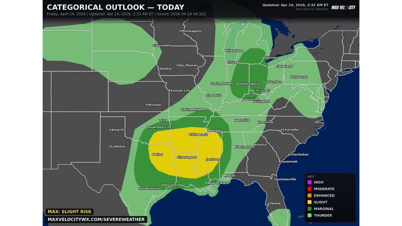
Texas, Arkansas and Louisiana Face Strong Tornadoes, Damaging Winds and Very Large Hail Today April 24
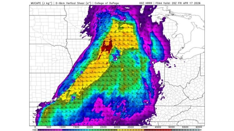
SOUTHERN UNITED STATES — A Slight Risk of severe thunderstorms is in place today, Friday, April 24, 2026, across a corridor covering Texas, Arkansas, Louisiana, and Mississippi, with scattered severe storms capable of producing strong tornadoes, very large hail, and damaging winds during the afternoon and evening hours.
Slight Risk Centered on Dallas, Shreveport and Little Rock
The highest risk zone today is concentrated across a Slight Risk area stretching from Dallas and Shreveport through Little Rock and into Jackson, Mississippi. Within this corridor, a few scattered severe thunderstorms are expected to develop and pose threats across all three primary hazard categories.
A broader Marginal Risk extends outward to include Oklahoma City, Tulsa, Memphis, Nashville, Birmingham, and surrounding areas, where isolated severe storms cannot be ruled out through the day.
Hazards in Play Today
- Strong tornadoes — a couple are possible within the Slight Risk zone
- Very large hail — a significant threat given the atmospheric setup
- Damaging straight-line winds — widespread risk with any organized storm
Risk Zone Breakdown
| Risk Level | Key Cities Included |
|---|---|
| Slight Risk (highest today) | Dallas, Shreveport, Little Rock, Jackson |
| Marginal Risk | Oklahoma City, Tulsa, Memphis, Nashville, Birmingham |
| Thunder Risk | Chicago, Indianapolis, Columbus, Cleveland, Pittsburgh |
Stay Alert Through the Afternoon and Evening
Storms are expected to develop and intensify during the afternoon hours, with the threat continuing into the evening across the Slight Risk corridor. Residents across northern Texas, Arkansas, Louisiana, and Mississippi should monitor conditions closely and have a shelter plan ready before storms arrive.
Stay with CabarrusWeekly.com for continuing updates on today’s severe weather threat.