Illinois, Missouri, Arkansas and Mississippi Face Classic Tornado Outbreak on Monday April 27 With 62 Percent Probability
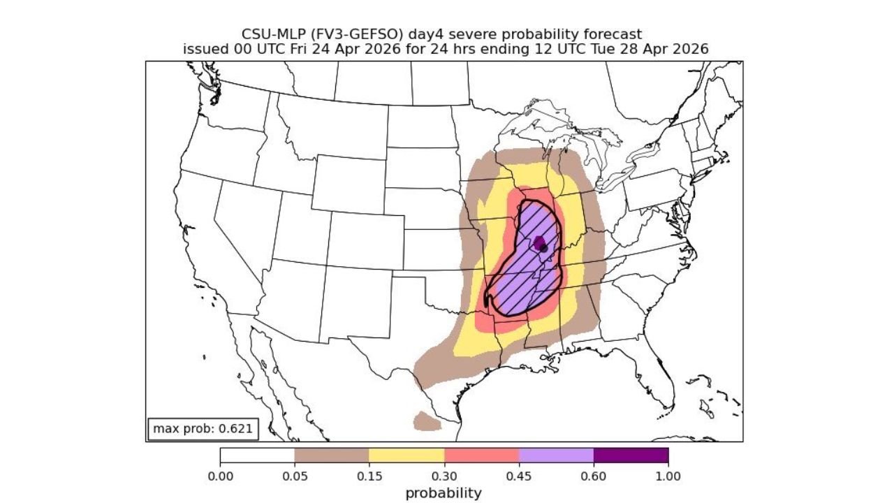
CENTRAL UNITED STATES — Monday, April 27, 2026 is carrying the hallmarks of a classic tornado outbreak, with the latest severe probability forecast showing a maximum severe weather probability of 62.1 percent concentrated across a corridor centered on Illinois, Missouri, Arkansas, and Mississippi — one of the highest probability signals possible at the four-day forecast range.
62 Percent Probability Is an Alarming Signal
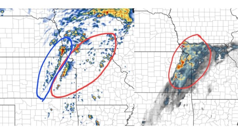
The CSU machine learning severe probability forecast issued April 24 places the peak probability directly over central Illinois and into western Kentucky and Missouri, with the hatched zone indicating the absolute highest confidence area. At four days out, a maximum probability of 0.621 is an exceptionally rare and serious signal that forecasters take as a strong indicator of a major, widespread tornado event.
Probability Breakdown by Zone
| Probability | Zone Description | Areas Covered |
|---|---|---|
| 60%+ (purple/hatched) | Highest outbreak confidence | Central Illinois, western Kentucky, southeast Missouri |
| 45–60% (purple) | Very high tornado probability | Broader Illinois, Missouri, Mississippi corridor |
| 30–45% (pink/red) | High probability | Arkansas, Tennessee, Indiana |
| 15–30% (yellow) | Elevated probability | Iowa, Wisconsin, Louisiana, Alabama |
| 5–15% (tan/brown) | Marginal | Michigan, Ohio, Texas Gulf Coast |
What Makes This a Classic Outbreak Setup
Forecasters are describing Monday’s pattern as a screaming classic tornado outbreak — language reserved for setups where multiple atmospheric ingredients align with exceptional strength and clarity. The combination of deep instability, powerful wind shear, and a well-defined forcing mechanism is producing near-unanimous model agreement on a significant, multi-tornado event across the central United States.
The broad geographic footprint of elevated probabilities — stretching from Iowa and Wisconsin in the north through Louisiana and Alabama in the south — signals this will not be a localized threat but a large-scale, multi-state severe weather event.
Who Must Be Ready Before Monday
The highest-risk residents are located across central and southern Illinois, Missouri, western Kentucky, Arkansas, Tennessee, and Mississippi. However, given the breadth of the probability field, anyone from Iowa to Louisiana and from Kansas to Indiana should be monitoring this event closely through the weekend.
Do not wait for Monday to prepare. Finalize your shelter plan, identify the lowest floor of the sturdiest building available to you, and ensure you have multiple ways to receive tornado warnings — including a weather radio that will alert you even overnight.
Stay with CabarrusWeekly.com for continuing coverage as Monday’s tornado outbreak potential continues to intensify.