SPC Issues Mesoscale Discussion for West Virginia, Virginia, North Carolina, Tennessee and Kentucky With Isolated Thunderstorms Expected This Afternoon
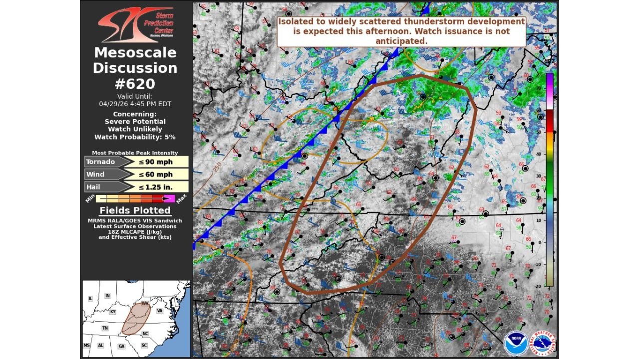
UNITED STATES — The Storm Prediction Center issued Mesoscale Discussion 620 at 1:47 PM CDT on April 29, 2026, valid until 4:45 PM EDT, covering portions of West Virginia, Virginia, North Carolina, Tennessee, and Kentucky. The discussion concerns severe potential across the region, though a watch issuance is considered unlikely with a watch probability of just 5 percent.
What the Mesoscale Discussion Says
The SPC notes that isolated to widely scattered thunderstorm development is expected this afternoon. While the severe potential exists, the overall threat is not expected to be widespread or organized enough to warrant a severe thunderstorm or tornado watch at this time.
Peak Intensity Parameters
The most probable peak intensity values from the discussion are:
- Tornado: up to 90 mph
- Wind: up to 60 mph
- Hail: up to 1.25 inches
Watch Issuance Not Anticipated
Despite the severe parameters in place, forecasters at the SPC note that watch issuance is not anticipated with this discussion. The watch probability sits at just 5 percent, meaning the storm coverage and organization are not expected to reach the threshold needed for a formal severe thunderstorm or tornado watch across the outlined area covering West Virginia, Virginia, North Carolina, Tennessee, and Kentucky.
Residents across this zone should remain weather aware through 4:45 PM EDT as isolated strong to severe storms remain possible even without a formal watch in place.
Stay with CabarrusWeekly.com for continuing updates as this afternoon storm threat develops across the region.