Atlantic Ocean Water Temperatures Tell a Very Different Hurricane Story Depending on Which Baseline You Use to Measure Them
UNITED STATES — A critical detail about how Atlantic Ocean water temperatures are being measured and displayed is drawing attention ahead of the 2026 Hurricane Season, and the difference between the two approaches tells a dramatically different story about what the ocean looks like heading into the season.
The Problem With the Standard Display
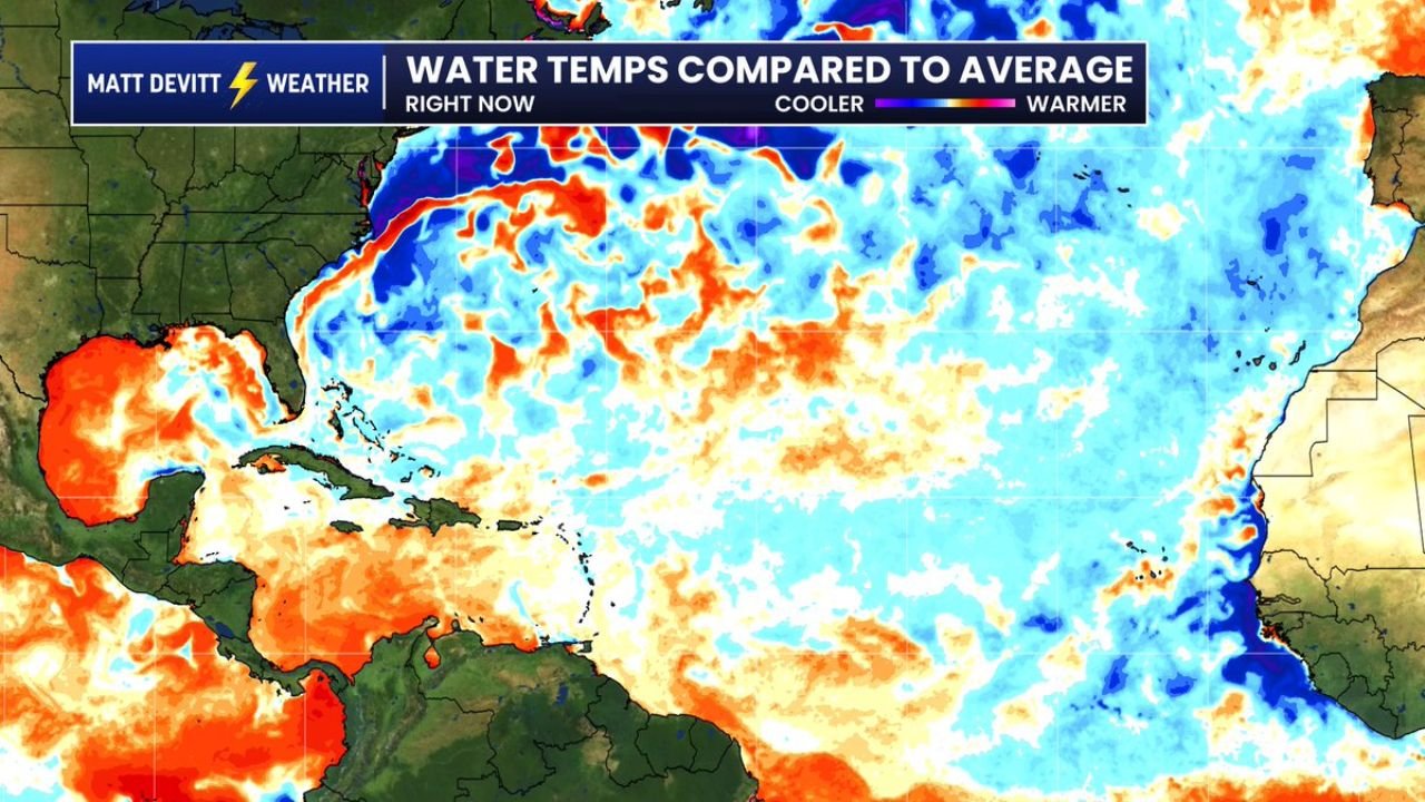
Most TV stations use a standard water temperature anomaly display that compares current ocean temperatures to an outdated average baseline. When that comparison is made, the Atlantic appears to show predominantly warmer than average water temperatures — particularly across the Gulf of Mexico, Caribbean, and tropical Atlantic — shown in deep orange and red across the map.
This warmer signal, when viewed through the outdated baseline, can create the impression that the Atlantic is running significantly hotter than normal heading into hurricane season.
What the More Accurate Baseline Reveals
When the comparison is adjusted to a more accurate and current baseline, the picture changes substantially. The updated map shows a dramatically different signal across the main development region of the tropical Atlantic, where large areas of cooler than normal water temperatures — shown in blue and purple — replace much of the warm anomaly signal seen in the standard display.
The key differences between the two maps:
Standard display — outdated baseline: The tropical Atlantic, Caribbean, and Gulf of Mexico appear dominated by warmer than average water shown in orange and red, suggesting a more favorable environment for hurricane development.
Updated accurate baseline: The tropical Atlantic main development region shifts to show significantly cooler than average water temperatures across a wide zone, while the Gulf of Mexico and Caribbean retain warmer anomalies. The open Atlantic between the US East Coast and Africa shows extensive below normal temperatures in the corrected view.
Why This Matters for the 2026 Hurricane Season
Cooler than normal water temperatures across the tropical Atlantic main development region would act as a natural suppressor of hurricane activity, reducing the fuel available for storm development and intensification as systems move westward from Africa. Combined with the strengthening El Nino already expected to increase wind shear across the basin, the corrected water temperature picture adds additional support to forecasts calling for a below to near average 2026 hurricane season.
The baseline used to measure ocean temperature anomalies is not a minor technical detail — it is the difference between seeing a warm Atlantic and seeing a cool one, and that distinction carries real implications for how the 2026 season could unfold.
Stay with CabarrusWeekly.com for continuing coverage of the 2026 Atlantic Hurricane Season and the oceanic conditions shaping the outlook.