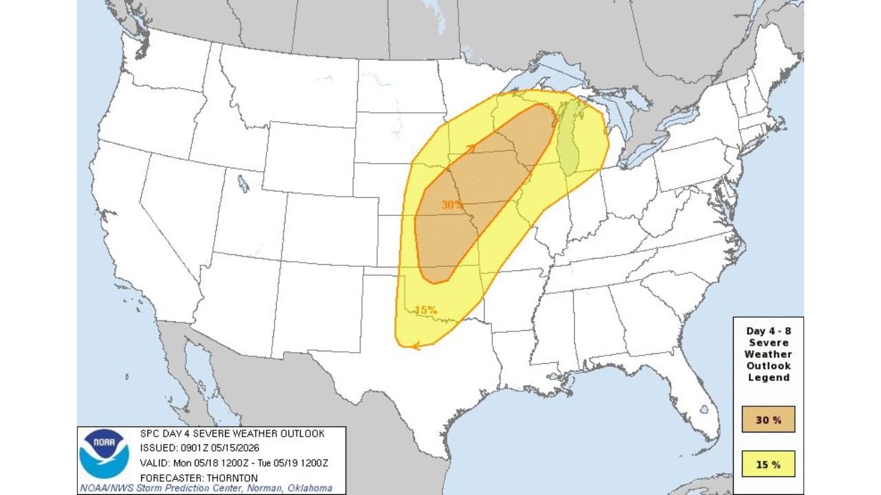
Kansas, Iowa, Illinois and Wisconsin Face a 30% Outbreak Risk With EF2 to EF3 Tornadoes, Very Large Hail and Damaging Winds Possible From Oklahoma to Wisconsin Monday May 18
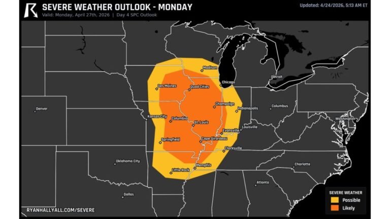
KANSAS — A severe weather outbreak remains possible on Monday May 18, 2026, with the SPC Day 4 outlook issued at 09:01Z on May 15, 2026 placing a large 30% severe risk from Oklahoma to Wisconsin. All severe hazards are likely, with the potential for very large hail, significant damaging winds, and a few strong to intense EF2 to EF3 tornadoes across the core threat zone.
Threat Zone Breakdown for Monday
30% Core Risk zone:
- Covers Kansas, Iowa, Missouri, and Illinois
- This is the highest risk corridor for all hazards including the strongest tornadoes
- Outlook valid from Monday May 18 at noon through Tuesday May 19 at noon
15% Broader Risk zone:
- Extends from Oklahoma and northern Texas in the south
- Pushes northeast through Wisconsin and into the Great Lakes region
- Cities including Oklahoma City, Wichita, Des Moines, Chicago, and Milwaukee inside this zone
Hazards Expected Monday
- EF2 to EF3 tornadoes — a few strong to intense tornadoes possible
- Very large hail — widespread across the 30% core zone
- Significant damaging winds — both supercell and linear storm modes
Oklahoma to Wisconsin on Alert
The breadth of this threat from Oklahoma all the way to Wisconsin makes this one of the larger outbreak footprints of the 2026 spring season. Anyone inside the 30% zone should have their severe weather plan finalized well before Monday.
Stay with CabarrusWeekly.com for updates as this Monday outbreak threat continues to develop.