Kentucky, Indiana and Ohio Face Marginal Excessive Rainfall Risk Tuesday May 5 Into Wednesday May 6 as Flash Flood Threat Emerges
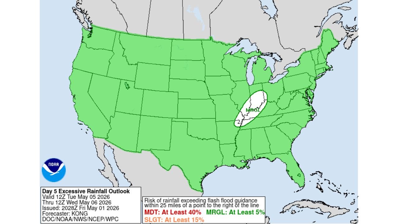
UNITED STATES — The Day 5 Excessive Rainfall Outlook issued by NOAA on Friday, May 1, 2026 has identified a Marginal Risk zone for excessive rainfall across parts of the Ohio Valley for the period from Tuesday, May 5 through Wednesday, May 6, 2026. The outlined area covers a concentrated zone centered over Kentucky, southern Indiana, and southwestern Ohio, where rainfall could exceed flash flood guidance thresholds.
What the Outlook Shows
The Marginal Risk zone — shown in white on the outlook map — is positioned over the Kentucky, southern Indiana, and southwestern Ohio corridor. This area carries at least a 5 percent probability of rainfall exceeding flash flood guidance within 25 miles of any point inside the outlined zone during the valid period of 12Z Tuesday, May 5 through 12Z Wednesday, May 6, 2026.
The rest of the contiguous United States is shown in green — indicating no excessive rainfall risk — for this same time period, making the Ohio Valley zone the sole area of concern nationally on this outlook.
What the Risk Levels Mean
The outlook uses three risk thresholds:
- Marginal Risk (MRGL): At least 5% probability — in place for the Kentucky and Ohio Valley zone
- Slight Risk (SLGT): At least 15% probability — not in place for any area on this outlook
- Moderate Risk (MDT): At least 40% probability — not in place for any area on this outlook
Why This Matters for the Ohio Valley
The emergence of an excessive rainfall signal this far out — five days in advance — for the Kentucky and Ohio Valley region aligns with the broader severe weather setup being watched for the May 5 through 7 window across the Deep South and Mid-South. Heavy rainfall accompanying any storm system during that period could produce flash flooding concerns across Kentucky, southern Indiana, and southwestern Ohio in addition to the severe wind and tornado threats further south.
Stay with CabarrusWeekly.com for continuing updates on the May 5 through 7 weather threat across the Ohio Valley and surrounding region.