Key Messages for Monday as EF2 Tornadoes Target Illinois and Missouri While Northern Alabama Watches for Late Night Arrival
NORMAN, Oklahoma — The Storm Prediction Center has issued formal Key Messages for Monday, April 27 — a significant step that signals the agency’s confidence in a major severe weather event across the middle Mississippi and lower Ohio Valleys. Numerous severe storms are expected Monday across this region, and the area is already being monitored for potential upgrades in threat level in later forecast updates.
The formal SPC Key Messages document three things every resident from Iowa to Alabama needs to understand before Monday arrives.
What the SPC Is Officially Saying
The Key Messages are direct and leave little room for interpretation.
Initial storms will be supercells capable of producing strong EF2 or greater tornadoes and very large hail. These are the early afternoon discrete storms that carry the most dangerous tornado potential of the entire event. As the day progresses, those supercells will undergo upscale growth into more extensive lines of storms, which will dramatically increase the threat for swaths of damaging wind gusts across a wide area.
The bottom line from the SPC is explicit: there will be a substantial threat for severe storms Monday with the potential for both damaging tornadoes and widespread large hail and wind damage.
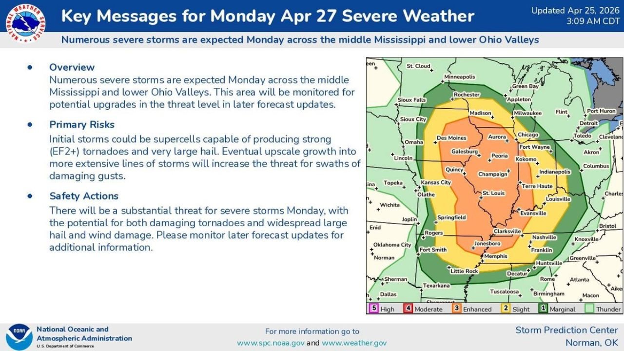
The area shown on the SPC outlook map has the Level 3 Enhanced Risk orange zone covering Galesburg, Peoria, Quincy, Champaign, St. Louis, Terre Haute, Springfield, Jonesboro, Clarksville, Memphis, and Decatur. The Level 4 Moderate Risk in red sits at the core of this zone. The threat extends broadly through Level 2 Slight and Level 1 Marginal zones reaching Minneapolis, Milwaukee, Detroit, Indianapolis, Columbus, Nashville, Huntsville, and Fort Smith.
The Red Level 4 Moderate Risk Zone
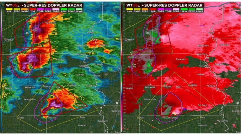
A Level 4 Moderate Risk is the second-highest category the SPC issues. It appears on the outlook map as a red zone and indicates a high probability of widespread significant severe weather. The cities sitting inside or immediately adjacent to this red zone include St. Louis, Quincy, Galesburg, Springfield Illinois, Terre Haute, and Jonesboro Arkansas. This is the corridor where supercell development is most likely during the early afternoon and where the long-track tornado threat is highest.
Illinois from the Quad Cities area south through Springfield and Carbondale sits in the most dangerous position on Monday. The flat terrain across central and southern Illinois provides no natural barrier to supercells tracking northeast, allowing individual rotating storms to maintain themselves over long distances.
Alabama’s Late Night Problem
For Alabama, Monday’s event is a different kind of threat than what Illinois and Missouri face in the afternoon. The volatile setup produces its most dangerous conditions north of Alabama during the day. Those storms then move into the northern half of Alabama late Monday night and into Tuesday.
The magnitude and timing of what reaches Alabama depends heavily on what happens to the storm system during its transit through Tennessee and Mississippi. If supercells hold together through the evening hours, northern Alabama including Huntsville, Decatur, and Florence could face a genuine tornado threat after midnight. If storms have merged into a squall line by then, the primary hazard becomes damaging straight-line winds arriving during the overnight hours.
Either scenario arriving at 2 or 3 AM in Alabama is more dangerous than the same storm arriving at 3 PM. Nighttime severe weather is the most deadly category — people are asleep, phones may be on silent, and reaction time to warnings is dramatically compressed.
Huntsville and Decatur sitting inside the outer Level 1 Marginal zone on the current outlook reflects the uncertainty about what the storm system looks like by the time it crosses the Tennessee border. That designation will almost certainly change as Monday approaches. Alabama residents in the northern half of the state should not treat the current Marginal designation as a sign that Monday is not their problem. It is a sign that the details are not yet resolved.
The Upgrade Language Matters
The SPC explicitly stating that the area will be monitored for potential upgrades in later forecast updates is not routine language. It means the agency already sees the possibility that current risk categories are too low and that additional confidence in the event will push formal designations higher before Monday arrives. A Level 3 Enhanced Risk that gets upgraded to Level 4 Moderate — or a Level 4 that gets pushed to Level 5 High — changes the urgency calculation significantly for millions of people.
Watch Sunday afternoon and evening SPC updates closely. The upgrades may already be in place before Monday morning.
What to Do With the Weekend That Remains
Illinois, Missouri, and Indiana residents have Saturday and Sunday to prepare. That is enough time to identify your shelter location, charge all devices, check that weather alerts are active on every phone in the household, and make a plan for what happens if a tornado warning is issued while you are at work or school on Monday.
Alabama residents have the same weekend plus Monday to prepare for a late night arrival. Set a weather alert specifically for Monday night before going to bed. The overnight arrival is the scenario that catches people completely off guard because the threat window for Alabama is hours after the main event is over further north.
CabarrusWeekly.com will continue tracking Monday’s developing outbreak and provide updates as SPC upgrades the risk categories and as the storm system approaches.