Northern Florida and Southern Georgia Face Slight Risk of Damaging Winds, Large Hail and Tornadoes This Saturday as Cold Front Pushes Through
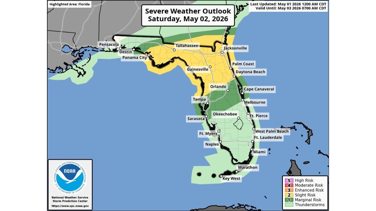
FLORIDA — The Storm Prediction Center has issued a Slight Risk — Level 2 of 5 for Saturday, May 2, 2026 across northern Florida and far southern Georgia, with mixed-mode convection expected ahead of a cold front from Saturday morning through the afternoon. The outlook was last updated at 12:00 AM CDT on May 1, 2026 and is valid through May 3, 2026 at 7:00 AM CDT.
Where the Slight Risk Is Focused
The Slight Risk zone covers a significant portion of northern and central Florida, stretching from the Panhandle eastward through Tallahassee, Jacksonville, Gainesville, Orlando, Tampa, and down toward Sarasota and Okeechobee. Cities directly within or near the Slight Risk area include Pensacola, Destin, Panama City, Tallahassee, Jacksonville, Palm Coast, Gainesville, Daytona Beach, Orlando, Cape Canaveral, Tampa, Melbourne, and Sarasota.
A broader Marginal Risk zone extends further south covering Fort Myers, Naples, Fort Lauderdale, West Palm Beach, Miami, and down toward Marathon and Key West.
The Primary Threat Saturday
The main threat with Saturday’s storm system will be damaging winds associated with the most robust storm clusters and line segments pushing ahead of the cold front. However, if more discrete storm development occurs, the threat for large hail and a couple of tornadoes would increase.
Hazards to watch Saturday include:
- Damaging winds — primary threat
- Large hail — if discrete storms develop
- A couple of tornadoes — possible with discrete storm mode
- Heavy rainfall
When to Expect the Storms Saturday
The timing of the threat runs from Saturday morning through the afternoon as the cold front pushes across northern Florida and far southern Georgia. The front’s interaction with Gulf moisture and instability ahead of it will determine how organized and intense the storm clusters become during this window.
Stay with CabarrusWeekly.com for continuing updates on Saturday’s severe weather threat across Florida and southern Georgia.