Kansas, Oklahoma and Texas Face Dual Storm Threat Friday as Crashing Cold Front and Dryline Set Up Tornado and Large Hail Risk
KANSAS — A complex and potentially volatile severe weather setup is taking shape across southern Kansas, Oklahoma and Texas for Friday, as forecast models show two distinct storm modes developing along a crashing cold front and sharpening dryline.
Guidance suggests the atmosphere could support both a fast-moving line of storms and discrete supercells — with the exact balance between those modes determining how significant the tornado and large hail threat becomes.
Two Possible Storm Modes Emerging
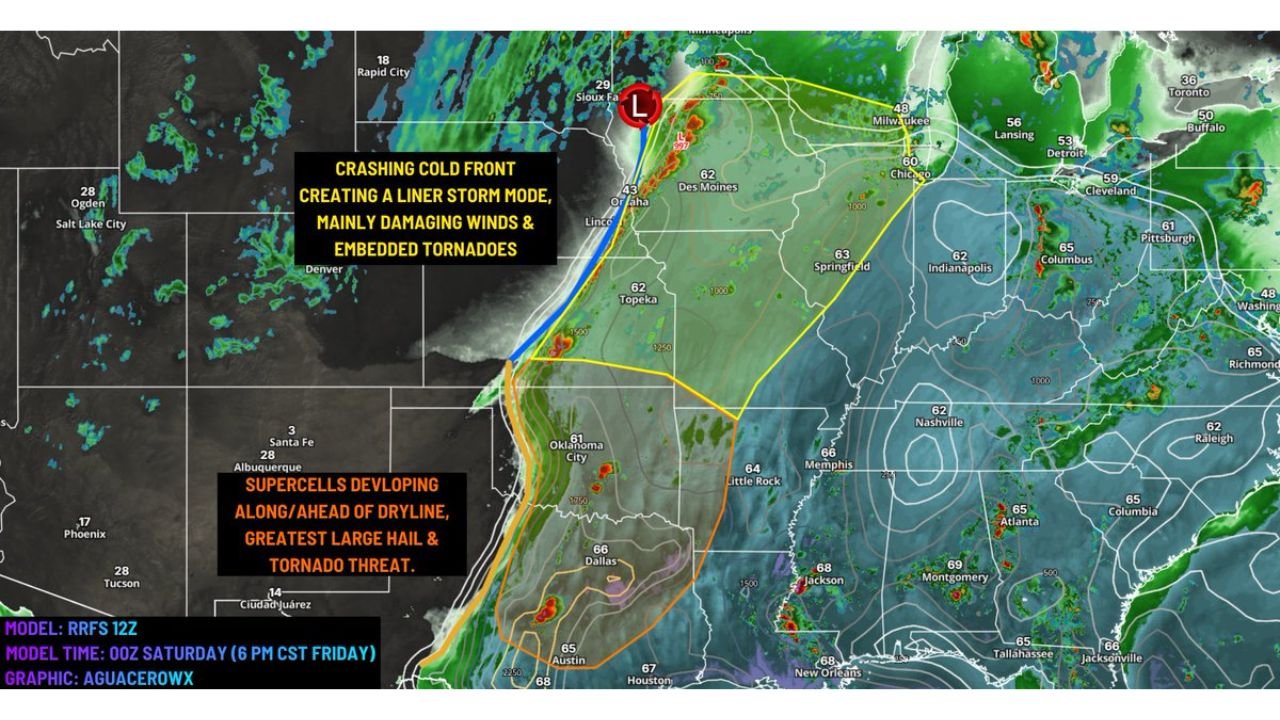
Latest model trends, including high-resolution guidance, indicate a strong cold front diving south across the Central Plains while a dryline sharpens across western Oklahoma and north-central Texas.
This setup could produce:
- A linear storm mode along the cold front, favoring damaging winds and embedded tornadoes
- Discrete supercells along and ahead of the dryline, capable of large hail and stronger tornadoes
If storms quickly congeal into a solid line, the primary risk may shift toward damaging straight-line winds with brief, embedded tornadoes.
However, if storms remain isolated — particularly across southern Kansas, central Oklahoma and parts of north Texas — the threat could include larger hail and more significant tornado potential.
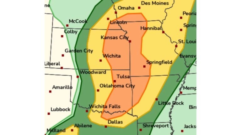
Southern Kansas, Oklahoma and Texas in the Bullseye
Model depictions highlight the greatest supercell potential from:
- Southern Kansas
- Central and eastern Oklahoma
- North and central Texas
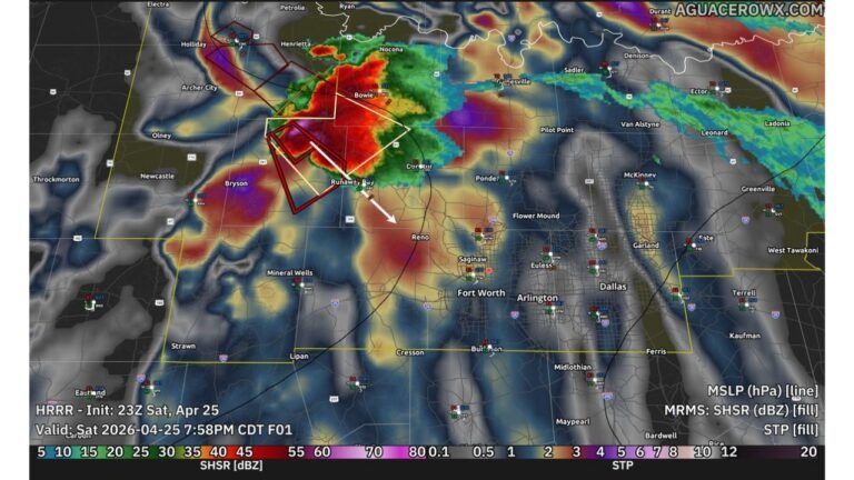
Supercells forming along or just east of the dryline may tap into strong instability and wind shear. Large hail — potentially over 2 inches in diameter — appears possible in the most intense storms.
A few tornadoes could develop, especially if storms can initiate before the cold front undercuts the unstable air mass.
Low Pressure and Embedded Tornado Risk to the North
Farther north, closer to the surface low tracking through the Upper Midwest, storms may form into a more organized line.
In that region, including parts of:
- Nebraska
- Iowa
- Northern Kansas
The primary risk may be damaging winds. However, embedded circulations within the line could still produce tornadoes, particularly near the low-pressure center where wind shear is maximized.
Model Differences Add Uncertainty
Some forecast models suggest a faster-moving cold front that would favor a quicker transition to a squall line.
Other guidance indicates a slower front, allowing instability to build farther north and promoting more discrete supercell structures.
The orientation of the upper-level trough and the timing of frontal passage will ultimately determine:
- Whether supercells dominate
- How far north instability spreads
- How widespread the tornado threat becomes
Forecast confidence remains moderate, but guidance has become somewhat more uncertain compared to previous runs.
What This Means for North Carolina
This severe setup is centered well west of North Carolina and does not directly impact Cabarrus County at this time.
However, large storm systems crossing the Plains often influence downstream weather patterns across the Southeast in subsequent days.
CabarrusWeekly.com will continue monitoring national severe weather developments and will provide updates if the pattern begins shifting toward the Carolinas.
For now, residents across Kansas, Oklahoma and Texas should stay alert for updated forecasts as Friday approaches, especially in areas along the dryline where discrete supercells may develop.