Arkansas, Tennessee and Kentucky Face EF2 Tornado Capability Tuesday With Weaker Tornadoes Possible Across Surrounding States
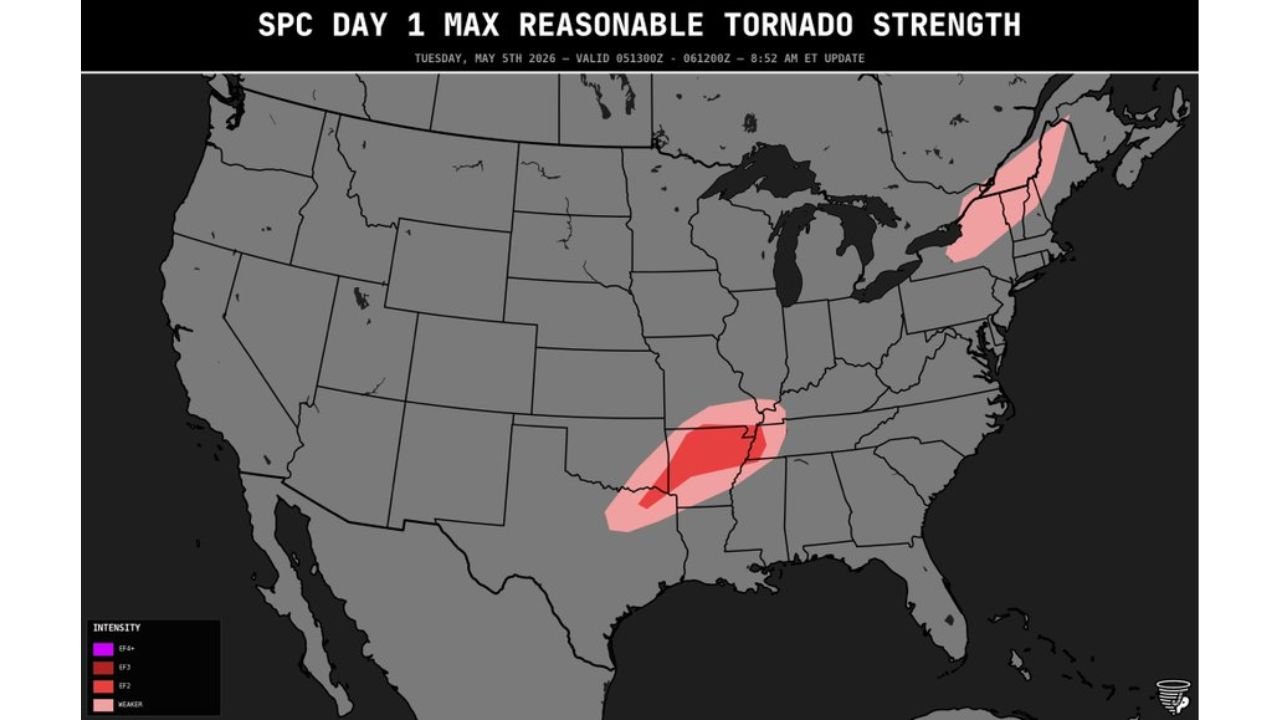
ARKANSAS, TENNESSEE AND KENTUCKY — The SPC Day 1 Maximum Reasonable Tornado Strength outlook valid Tuesday, May 5, 2026 shows tornadoes forming in the core red shaded zone across Arkansas, Tennessee and Kentucky carrying the capability of reaching EF2 intensity. The outlook was updated at 8:52 AM ET Tuesday and is valid through 6:00 PM ET.
EF2 Capable Tornadoes Possible in the Core Zone
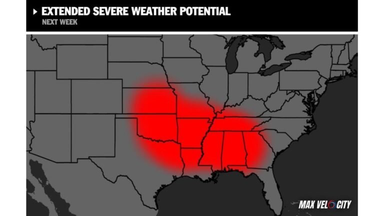
The pronounced dark red shading on the tornado strength outlook covers a corridor centered across Arkansas, Tennessee and Kentucky. Any tornado that forms within this zone today has the capability of reaching EF2 strength — meaning winds of 111 to 135 MPH capable of causing significant structural damage.
Weaker Tornadoes Possible in the Surrounding Light Red Zone
The lighter pink shading surrounding the core extends the tornado threat into portions of Mississippi, Louisiana, Missouri and southern Illinois. Tornadoes forming in this outer zone are expected to be mostly weaker end if they do develop, but still pose a real danger to anyone in their path.
A separate tornado capable zone is also indicated across upstate New York and New England on today’s outlook.
Tornado Strength Summary Tuesday May 5
| Zone | Tornado Capability | States |
|---|---|---|
| Dark red core | Up to EF2 | Arkansas, Tennessee, Kentucky |
| Light pink surrounding zone | Mostly weaker tornadoes | Mississippi, Louisiana, Missouri, southern Illinois |
| Northeast zone | Weaker tornadoes | Upstate New York, New England |
Residents across Arkansas, Tennessee and Kentucky must be underground or in an interior room on the lowest floor if a tornado warning is issued today. Do not wait to see or hear the tornado before taking shelter.
Stay with CabarrusWeekly.com for live Tuesday tornado and severe weather updates across Arkansas, Tennessee and Kentucky.