Dallas–Fort Worth, Waco and Central Texas Face Strong-to-Severe Storm Threat Tuesday Afternoon Into Night With Tornadoes, Hail and Flooding Possible
TEXAS — Another round of strong to severe thunderstorms is expected to develop across North and Central Texas Tuesday afternoon and continue into Tuesday night, with the Dallas–Fort Worth Metroplex sitting squarely inside the primary threat area.
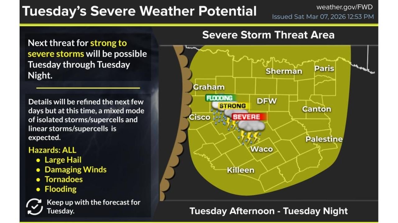
The National Weather Service office in Fort Worth highlights a broad zone of concern stretching from Graham and Cisco east through DFW and Canton, and south toward Waco and Killeen, with severe weather hazards and localized flooding possible.
Threat Area Covers DFW to Waco
The projected severe storm corridor includes:
- Dallas–Fort Worth (DFW)
- Waco
- Graham
- Cisco
- Sherman
- Paris
- Canton
- Palestine
- Killeen
This zone encompasses much of North and Central Texas, where atmospheric conditions are expected to support multiple storm modes.
Forecasters indicate that both isolated supercells and linear storm segments could develop — a combination that increases the range of potential impacts.
All Hazards on the Table
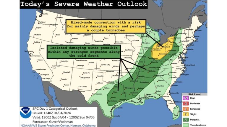
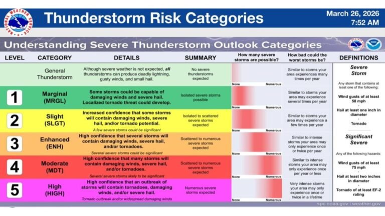
According to the outlook, all major severe weather hazards are possible Tuesday, including:
- Large hail
- Damaging wind gusts
- Tornadoes
- Flooding
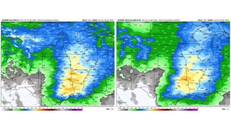
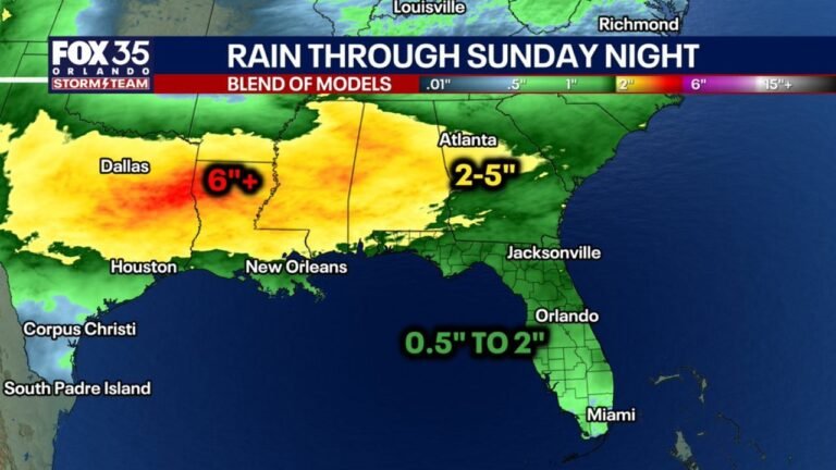
The mention of flooding suggests that some storms could produce heavy rainfall rates, particularly if storms train over the same areas.
Confidence Higher This Round
Unlike recent marginal setups, confidence appears stronger with this system due to an approaching upper-level disturbance that will provide more reliable lift.
Upper-level energy is expected to enhance storm development Tuesday afternoon, improving the likelihood that storms organize and intensify.
This added lift, combined with instability and moisture, supports the potential for stronger storm structures capable of producing hail and tornadoes.
Timing: Afternoon Through Night
Storms are expected to develop Tuesday afternoon and continue into the evening and nighttime hours.
Evening severe weather events can pose increased risk, as visibility decreases and people may be indoors or asleep when warnings are issued.
Residents across the DFW Metroplex and surrounding cities should remain weather-aware throughout the day Tuesday.
Mixed Storm Modes Increase Risk Variety
The forecast suggests a mixed storm mode scenario, meaning:
- Discrete supercells may form initially, posing a tornado and large hail risk.
- Storms may later evolve into lines, increasing the damaging wind and heavy rainfall threat.
This evolution can result in multiple waves of impact rather than a single short-lived storm period.
Bottom Line
North and Central Texas — including Dallas–Fort Worth, Waco, Graham, and surrounding communities — face a strong-to-severe storm threat Tuesday afternoon into Tuesday night. Tornadoes, large hail, damaging winds, and localized flooding are all possible as a more organized weather system moves into the region.
CabarrusWeekly.com will continue monitoring updates as forecasters refine timing and hazard details ahead of Tuesday’s storms.