Virginia, North Carolina and Maryland Could Face Regional Tornado Episode Monday, March 16 — Setup Drawing Comparisons to February 2016
UNITED STATES — A potentially significant severe weather episode is developing for Monday, March 16, across Virginia, North Carolina and Maryland, with meteorologists warning that the setup bears similarities to the February 23–24, 2016 event that longtime Mid-Atlantic residents may remember.
While it is still several days out, the broader atmospheric pattern — the “synoptic” setup — is raising concern for a possible regional tornado day.
Why Forecasters Are Concerned
Forecast guidance shows a potent upper-level disturbance swinging into the eastern United States, taking on what meteorologists call a “negative tilt” — a configuration that often enhances storm strength.
In simple terms, that shape gives the system extra energy and lift, increasing the odds that storms can organize and intensify.
At the surface, warm and humid air is expected to stream northward into:
- Eastern North Carolina
- Central and eastern Virginia
- Southern Maryland
That combination of moisture, instability and powerful winds aloft creates an environment supportive of rotating thunderstorms.
Supercells Ahead of the Line
Some high-resolution forecast models are depicting “prefrontal” storms — isolated supercells that could form ahead of the main squall line.
If those discrete storms develop, they would have the greatest potential to produce:
- Large hail
- Damaging winds
- Tornadoes
With robust wind shear (winds changing speed and direction with height) and a strengthening jet stream overhead, any isolated storm could quickly become a rotating supercell.
Then Comes the Squall Line
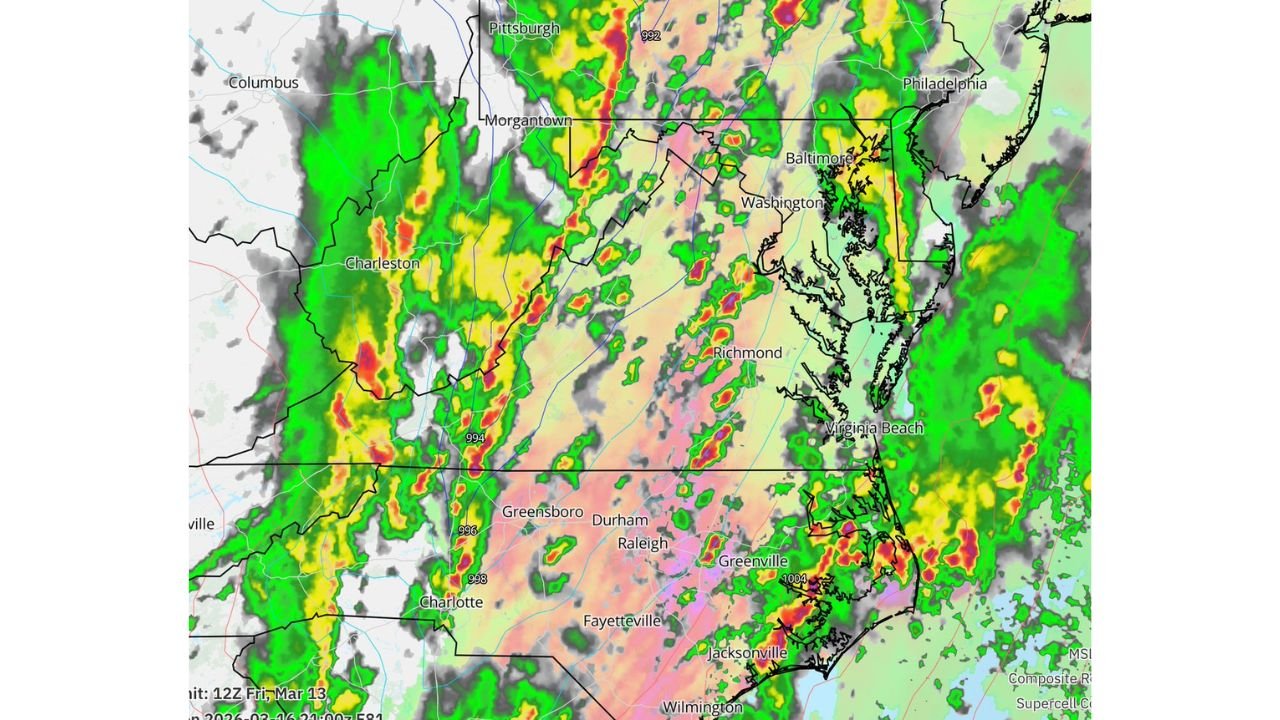
Later in the day or evening, a fierce squall line is expected to sweep through from west to east.
That line could bring:
- Widespread damaging wind gusts
- Embedded tornadoes
- Quick spin-up circulations within the line
Communities from Charlotte and Raleigh, North Carolina, to Richmond and Virginia Beach, Virginia, and north toward Washington, D.C., and Baltimore, Maryland, could see strong to severe storms.
A Rare “Tornado Day” Setup
The Mid-Atlantic region typically experiences only one or two notable tornado days per year.
Meteorologists are signaling that Monday could be one of those days, depending on how the timing and storm evolution unfolds.
While details will continue to change, the overall pattern is one that has historically supported impactful severe weather events in this region.
What Residents Should Do Now
With several days remaining before the event, now is the time to:
- Review your severe weather safety plan
- Ensure you have multiple ways to receive warnings
- Identify a safe, interior shelter location
- Monitor forecast updates through the weekend
Because some storms could form ahead of the main line, warnings may be issued quickly and with little lead time.
Bottom Line
Virginia, North Carolina and Maryland face the potential for a regional tornado episode Monday, March 16, as a powerful upper-level system interacts with warm, humid air at the surface.
While specifics are still being refined, the atmospheric ingredients are aligning in a way that warrants early awareness and preparation.
CabarrusWeekly.com will continue tracking forecast developments and provide updated timing and impact details as new data becomes available.