North Carolina, South Carolina, Virginia, Maryland, and Washington DC Face Rare Level 4 Severe Storm Risk Monday With Tornadoes and 75+ MPH Winds Possible
NORTH CAROLINA — A rare and potentially dangerous severe weather setup is expected Monday across North Carolina, South Carolina, Virginia, Maryland, and the Washington DC region, where forecasters warn that strong tornadoes and damaging winds exceeding 75 mph could develop during the afternoon and evening.
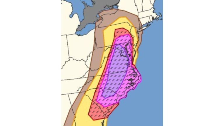
Meteorologists say this event stands out because the Storm Prediction Center has issued a rare Level 4 out of 5 severe weather risk across parts of the Carolinas and the Mid-Atlantic — an unusually high threat level for this region.
Rare Level 4 Severe Weather Risk Issued for the Carolinas and Mid-Atlantic
Forecast maps show a large corridor of significant severe weather potential stretching from eastern North Carolina through Virginia and into parts of Maryland and the Washington DC metro area.
Within the core red-shaded region, forecasters expect the highest likelihood of dangerous storms capable of producing tornadoes and widespread damaging winds.
Cities including Raleigh, Fayetteville, Richmond, Virginia Beach, and Washington DC fall within or near the area where the most intense storms may develop.
This type of high-end severe weather risk is rarely issued this far east in the Mid-Atlantic, making the situation especially notable.
Strong Tornadoes and 75+ MPH Wind Gusts Possible
Meteorologists warn that substantial severe storms are likely across the highlighted region Monday afternoon and evening.
Thunderstorms developing ahead of a powerful storm system may become supercells — rotating storms capable of producing tornadoes and destructive wind damage.
Forecast guidance indicates wind gusts exceeding 75 mph could accompany the strongest storms, potentially causing widespread tree damage, structural impacts, and power outages.
In addition to damaging winds, several tornadoes — possibly strong — cannot be ruled out if supercells develop ahead of the main storm line.
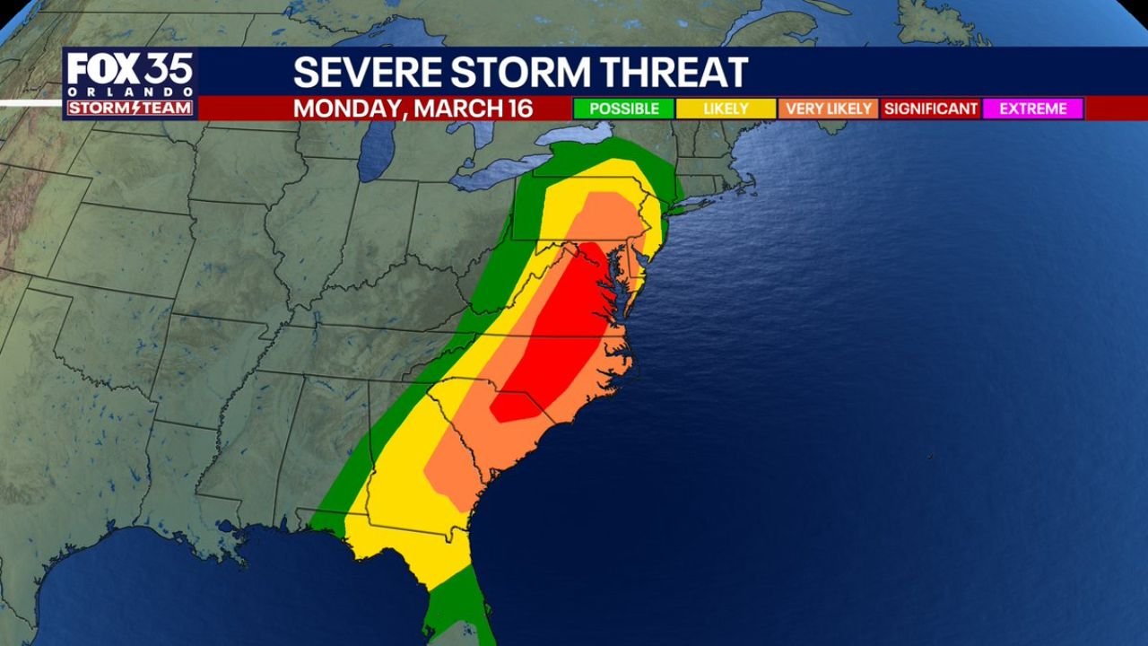
Storm Threat Expands Across the Southeast
While the most dangerous storms are expected across the Carolinas and Mid-Atlantic, severe weather risk will extend across a broader area.
Parts of Georgia and South Carolina fall within zones where storms are likely or very likely, meaning damaging winds and isolated tornadoes remain possible.
Farther south, the severe weather threat also extends into central and northern Florida, where scattered thunderstorms could reach as far south as the Orlando metropolitan area.
Although the Florida threat appears lower than the Carolinas, a few storms could still produce gusty winds and locally severe conditions.
Storms Likely to Develop Monday Afternoon and Evening
Meteorologists say the most active period for severe storms will likely occur during Monday afternoon and evening, when atmospheric instability and wind shear reach peak levels.
During this window, thunderstorms may rapidly strengthen as they track northeast across the region.
Communities within the highest-risk areas could see rapidly developing storms capable of producing damaging winds, large hail, and tornadoes.
Because of the potential severity of these storms, forecasters emphasize that residents should closely monitor weather updates throughout the day.
Residents Urged to Prepare for Rapidly Changing Weather
With a rare Level 4 severe weather threat in place, weather experts urge residents across North Carolina, South Carolina, Virginia, Maryland, and Washington DC to review their severe weather safety plans.
Strong thunderstorms and tornadoes can develop quickly, sometimes with limited warning time. Having multiple ways to receive weather alerts can help ensure residents are notified if warnings are issued.
Experts recommend identifying a safe shelter location inside homes or workplaces, especially in areas within the highest-risk zone.
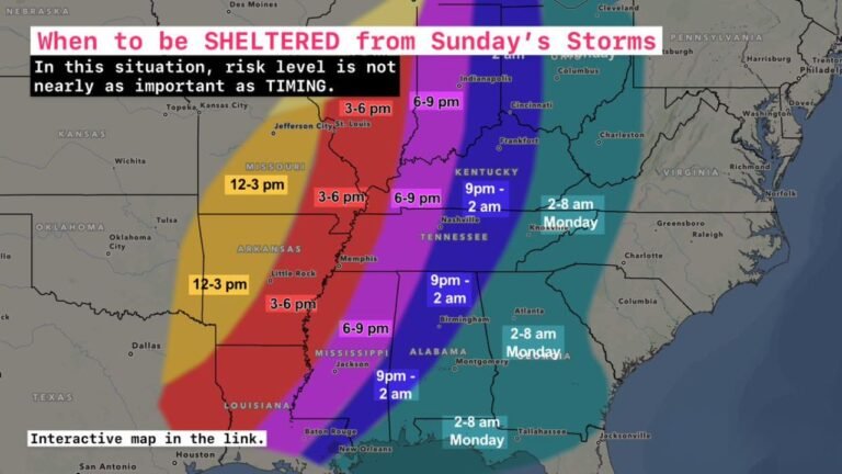
Forecast maps and severe weather outlook graphics referenced in this report were compiled using meteorological briefing materials.
Stay with CabarrusWeekly.com for continuing coverage of this developing severe weather situation. If storms impact your community, share your local conditions with the CabarrusWeekly.com audience to help others stay informed.