Severe Weather Threat Targets Oklahoma to Iowa Thursday and Shifts to Arkansas and Memphis Friday
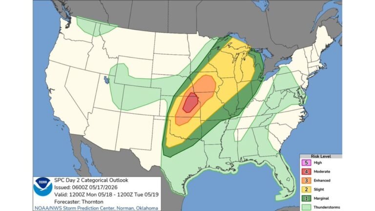
UNITED STATES — The Storm Prediction Center has outlined severe weather risk areas for both Thursday April 23 and Friday April 24, with a multi-day severe weather stretch beginning as early as Wednesday and potentially extending through the weekend across a broad corridor from the Southern Plains into the Mid-South.
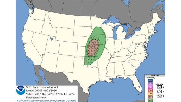
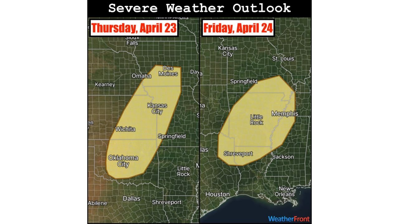
Thursday’s Risk Covers Oklahoma City to Des Moines
Thursday’s severe weather risk zone has been expanded to cover a large north-to-south corridor stretching from Oklahoma City and Wichita northward through Kansas City, Springfield, and Des Moines. Southwest Iowa, western Missouri, eastern Kansas, and much of Oklahoma all fall within the outlined risk area.
Cities squarely inside Thursday’s threat zone include Oklahoma City, Wichita, Kansas City, Springfield, Des Moines, and Omaha. The risk footprint is large, indicating a widespread severe weather event capable of impacting millions across the Plains and lower Midwest.
Friday’s Bull’s-Eye Shifts East to Arkansas and Memphis
As the storm system tracks eastward, Friday’s severe weather risk centers on Arkansas and the surrounding region. The Friday outlook zone covers Little Rock, Shreveport, Memphis, Jackson, and Springfield, with the threat pushing into portions of Tennessee and Mississippi as well.
| Day | Primary Risk Zone | Key Cities Threatened |
|---|---|---|
| Thursday Apr 23 | SW Iowa, W Missouri, E Kansas, Oklahoma | Oklahoma City, Wichita, Kansas City, Des Moines |
| Friday Apr 24 | Arkansas, W Tennessee, N Louisiana | Little Rock, Memphis, Shreveport, Jackson |
Severe Potential Begins as Early as Wednesday
The severe weather window is not limited to Thursday and Friday alone. Severe potential exists as early as Wednesday as the atmospheric setup begins to come together ahead of the main Thursday event. The threat is then expected to continue through the weekend as the pattern remains active and storm energy pushes progressively eastward.
A Multi-Day Severe Stretch Taking Shape
This setup represents a significant multi-day severe weather event for the Plains, Midwest, and Mid-South. Residents across Oklahoma, Kansas, Missouri, Iowa, Arkansas, and Tennessee should monitor forecasts closely through the remainder of the week and have severe weather plans in place before Wednesday.
Stay with CabarrusWeekly.com for live severe weather outlook updates across the Plains and Mid-South through the weekend.