Louisiana, Mississippi, Alabama, Georgia, Florida, North Carolina, Virginia, and Washington DC Under Multi-Day Severe Weather Threat With Tornadoes and 75+ MPH Winds Possible
SOUTHEAST UNITED STATES — A significant stretch of severe weather is unfolding from the Gulf Coast into the Mid-Atlantic, with storms expected from Sunday through Monday across Louisiana, Mississippi, Alabama, Georgia, Florida, North Carolina, Virginia, and Washington DC. The system carries the potential for strong tornadoes, damaging winds exceeding 75 mph, and large hail as the storms track east across the region.
Severe Storms Begin Across Louisiana, Mississippi, and Alabama Sunday
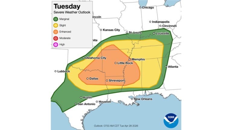
The first round of severe weather is developing across Louisiana, Mississippi, Alabama, and nearby parts of Arkansas and Tennessee. Storm activity across this region is capable of producing damaging winds, large hail, and tornadoes as the system organizes along a strong frontal boundary.
The highest tornado potential during this phase includes areas near Jackson, Tupelo, Memphis, and Huntsville, where storms are expected to intensify during the day.
The severe weather environment in this region also supports large hail and intense thunderstorm wind gusts, increasing the potential for damage across several states in the Lower Mississippi Valley.
Widespread Damaging Winds Possible in the Mississippi Valley
Storm maps also highlight a corridor where wind gusts above 75 mph are possible, especially across northern Mississippi, western Tennessee, and parts of Kentucky.
Cities such as Memphis, Paducah, and Nashville fall within the region where strong thunderstorms could organize into a fast-moving line capable of producing widespread wind damage.
These storms can produce long paths of destructive straight-line winds, bringing down trees and power lines and creating power outages across multiple communities.
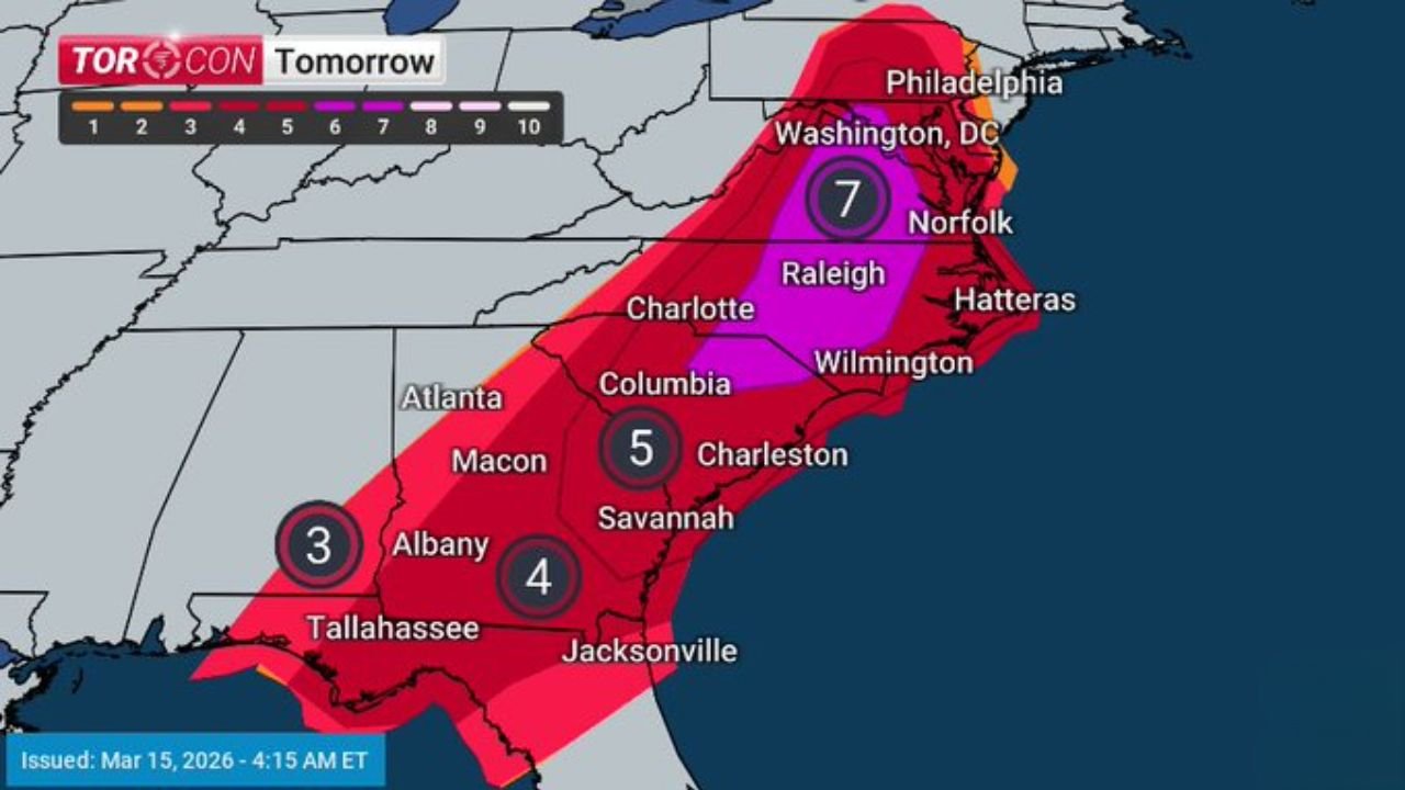
Severe Weather Shifts Toward the Carolinas and Mid-Atlantic Monday
As the storm system moves east, the severe weather threat will shift Monday toward Georgia, South Carolina, North Carolina, Virginia, Maryland, and the Washington DC area.
This region includes major population centers such as Raleigh, Wilmington, Norfolk, Richmond, and Washington DC, where severe thunderstorms could develop later in the day.
Storm conditions across these states may support rotating thunderstorms capable of producing tornadoes, along with damaging winds and large hail.
Large Hail and Strong Winds Remain Major Threats
In addition to tornado potential, the storm system may produce hail up to two inches in diameter along with destructive wind gusts across parts of the Southeast and Mid-Atlantic.
Wind gusts exceeding 75 mph are possible with the strongest storms, which can cause structural damage, bring down large tree limbs, and lead to scattered power outages.
Because the storm system covers a wide geographic area, the severe weather impacts could extend across several states during the event.
Overnight Storms Add Additional Risk
Part of the severe weather threat continues overnight between Sunday and Monday, which increases the potential danger across some regions.
Storms moving during nighttime hours can be more hazardous because warnings may occur while people are sleeping. The overnight threat includes damaging winds and possible tornadoes as the storm system continues moving east.
Severe Weather Preparedness Important Across Multiple States
The severe weather threat across the South and East spans more than a full day and covers several major population centers.
Residents across Louisiana, Mississippi, Alabama, Georgia, Florida, North Carolina, Virginia, and Washington DC are encouraged to monitor conditions closely and remain prepared for rapidly changing weather.
Storm outlook maps and severe weather projections referenced in this report were compiled using meteorological briefing materials.
Stay with CabarrusWeekly.com for continuing coverage as this severe weather system moves across the southern and eastern United States. Readers who experience storms in their area can share local conditions with the CabarrusWeekly.com community to help keep others informed.