Pennsylvania, Ohio, West Virginia and Maryland Face Sunday Severe Storm Threat With Large Hail and Damaging Winds Expected
OHIO VALLEY — A developing severe weather setup is expected to bring scattered but potentially impactful thunderstorms Sunday across the Ohio Valley into the northern Mid-Atlantic, with large hail and damaging winds as the primary concerns.
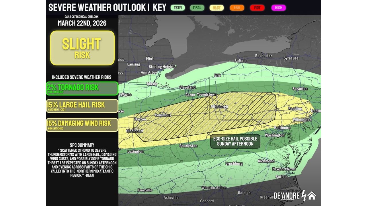
Slight Risk Expands Across Key States
The latest outlook highlights a Level 2 (Slight Risk) stretching from parts of Ohio, Kentucky, West Virginia, and Pennsylvania into Maryland and New Jersey.
Cities including Columbus, Cincinnati, Pittsburgh, Charleston, and Baltimore fall within or near this risk zone, meaning scattered storms could become strong to severe during the afternoon and evening hours.
While not expected to be a widespread outbreak, the setup supports isolated severe storms capable of producing significant impacts.
Large Hail Emerges as the Primary Threat
The most notable concern with this system is large hail, with some storms potentially producing hail up to egg-size, especially across central and western Pennsylvania, eastern Ohio, and northern West Virginia.
Atmospheric conditions favor strong updrafts, which allow hailstones to grow larger before falling — a key signal that hail could be the dominant hazard.
Damaging Winds Also a Major Concern
Alongside hail, damaging wind gusts are expected to develop as storms organize and move eastward.
Forecast guidance indicates a 15% risk of damaging winds, meaning some storms could produce gusts strong enough to down trees, damage power lines, and create hazardous travel conditions.
As storms cluster into lines later in the evening, the wind threat could become more widespread.
Tornado Risk Remains Low but Not Zero
There is also a low-end tornado risk (around 2%), mainly focused across parts of Ohio and western Pennsylvania.
While the overall tornado threat is limited due to less favorable low-level moisture, forecasters note that a brief, isolated tornado cannot be ruled out, especially during the early stages of storm development.
Timing: Afternoon Development, Evening Impacts
Storms are expected to begin developing Sunday afternoon across the Ohio Valley, particularly in Indiana, Ohio, and Kentucky, before tracking east into the Mid-Atlantic by evening and nighttime.
This means areas like Pennsylvania, Maryland, and New Jersey could see storms arrive later in the day, potentially impacting evening plans and travel.
Why This Setup Supports Severe Weather
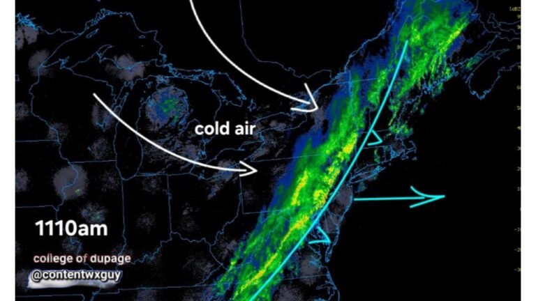
The combination of warming temperatures, increasing instability, and an approaching cold front is creating an environment favorable for storm development.
Additionally, strong winds aloft and steep lapse rates are enhancing storm intensity, particularly for hail production.
Even with somewhat limited surface moisture, these ingredients are enough to support rotating storms and severe thunderstorm development.
What Residents Should Watch For
Residents across the risk zone should stay alert for:
- Rapidly changing weather conditions Sunday afternoon and evening
- Strong wind gusts capable of causing localized damage
- Large hail that could damage vehicles and property
- Brief heavy rain and lightning with passing storms
Now is a good time to review severe weather safety plans and stay weather-aware, especially if traveling later in the day.
Stay with CabarrusWeekly.com for continued updates as this Sunday severe weather threat develops across the Ohio Valley and Mid-Atlantic.