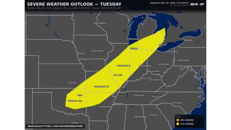
Tomorrow, Chicago, St. Louis, Indianapolis, Milwaukee, and Kansas City Face Large Hail, Damaging Winds, and a Brief Tornado Risk as Severe Weather Pushes Across the Midwest Tuesday
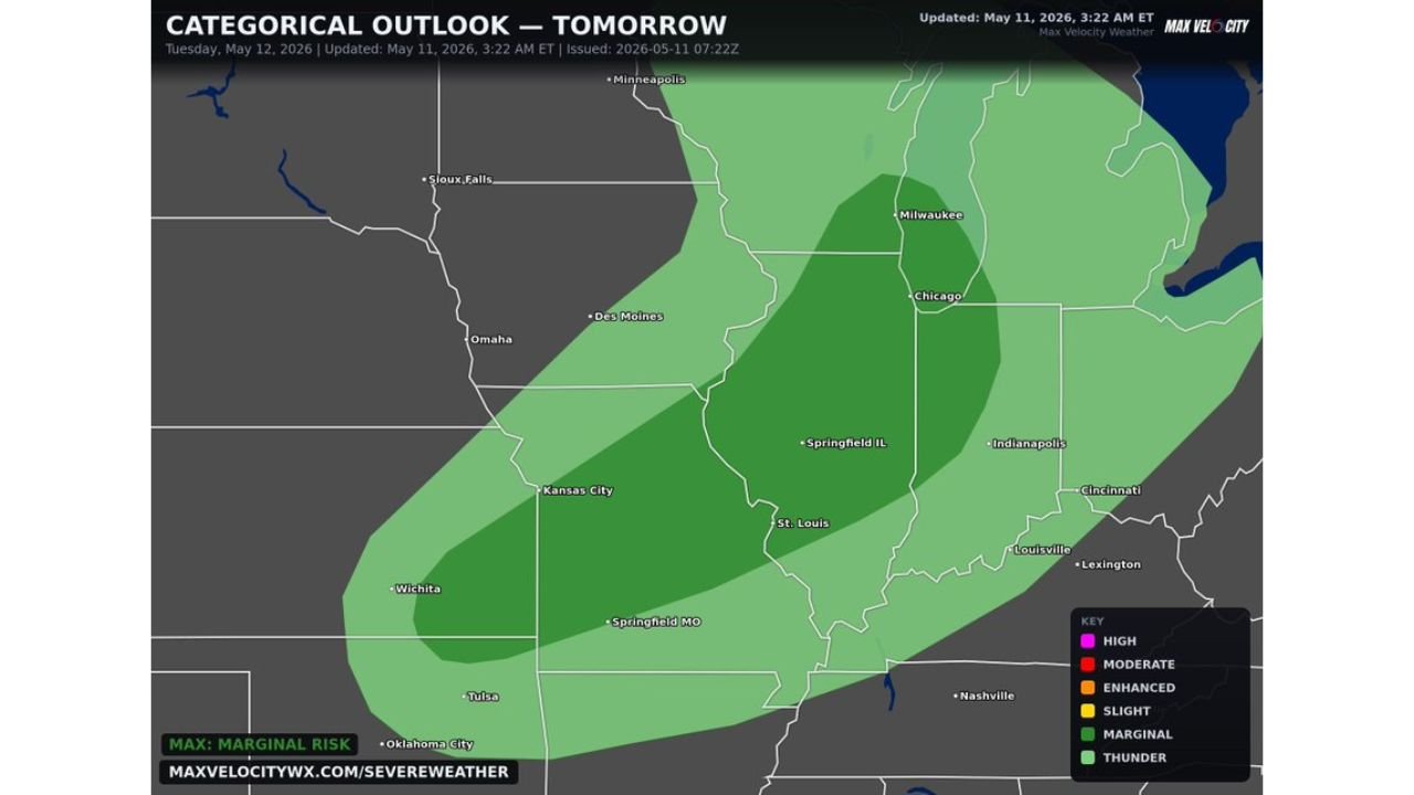
MIDWEST — More severe weather is on the way for the Midwest on Tuesday May 12, 2026, with large hail as the main concern but damaging winds and a brief tornado cannot be ruled out. The categorical outlook updated at 3:22 AM ET on May 11, 2026 shows a Slight to Marginal Risk covering a large swath of the central Midwest.
Threat Zone Covers the Chicago to St. Louis Corridor
The outlook map shows two distinct risk zones across the Midwest:
- Slight Risk — core zone centered over Springfield IL, St. Louis, Indianapolis, Chicago, and Milwaukee
- Marginal Risk — broader surrounding area extending toward Kansas City, Springfield MO, Des Moines, Cincinnati, Louisville, Lexington, and Nashville
Cities including Omaha, Sioux Falls, Wichita, Tulsa, and Oklahoma City sit outside the current threat area.
Hazards Tuesday
- Large hail — primary and main concern
- Damaging winds — possible with stronger cells
- Brief tornado — cannot be ruled out
Wednesday Shifts to Ohio Valley and Northeast
The severe weather threat does not end Tuesday. The risk area is forecast to shift east toward the Ohio Valley and Northeast on Wednesday, with more localized severe weather possible as the system continues pushing east.
Stay with CabarrusWeekly.com for live updates as this Midwest severe weather threat develops through Tuesday and into Wednesday.