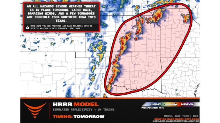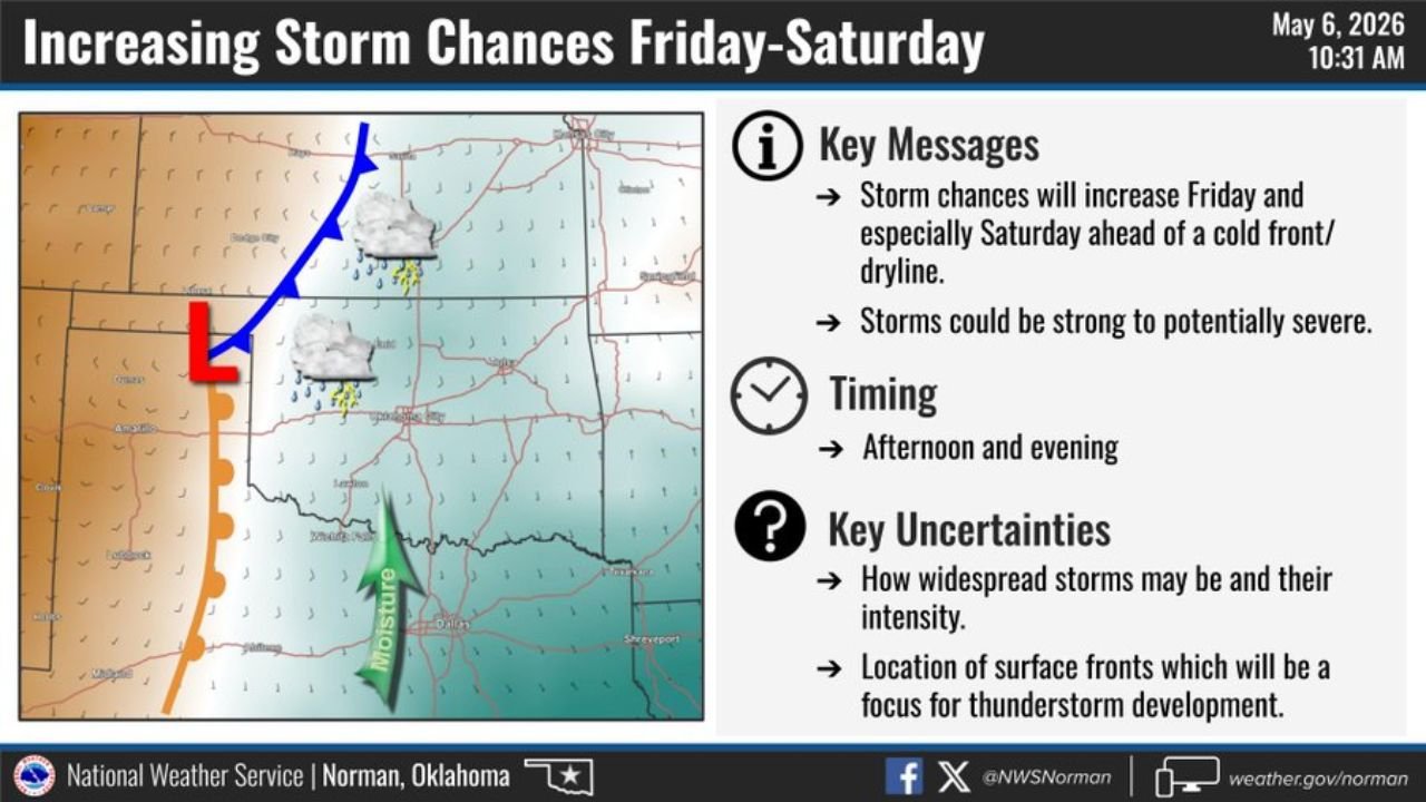
Oklahoma and Texas Face Strong to Severe Storm Chances Friday and Saturday Afternoon as Two Cold Fronts Move Through the Region
OKLAHOMA AND TEXAS — The National Weather Service Norman has issued a key message outlook for Friday, May 8 and Saturday, May 9, 2026, as two cold fronts move into Oklahoma and Texas bringing increasing storm chances with a few strong to potentially severe storms possible mainly during the afternoon and evening hours on both days.
Key Messages From NWS Norman — May 6, 2026
- Storm chances will increase Friday and especially Saturday ahead of a cold front and dryline
- Storms could be strong to potentially severe
- Primary timing is afternoon and evening both days
- Key uncertainties remain on storm coverage, intensity and exact front locations
What to Expect Friday and Saturday
Storm development will be tied to the position of surface cold fronts and a dryline moving through the region. The exact location of these boundaries will serve as the focus for thunderstorm initiation each day. Coverage and intensity of storms remains uncertain at this time but strong to severe storms cannot be ruled out across Oklahoma and Texas during the afternoon and evening windows on both days.
Key Uncertainties Heading Into the Weekend
- How widespread storms will be and how intense they may become
- Exact location of surface fronts acting as the trigger for storm development
Timing Summary
| Day | Storm Chance | Primary Window |
|---|---|---|
| Friday May 8 | Increasing ahead of cold front | Afternoon and evening |
| Saturday May 9 | Highest chance ahead of cold front and dryline | Afternoon and evening |
Residents across Oklahoma and Texas should monitor forecast updates through the end of the week as confidence on coverage and intensity increases closer to Friday.
Stay with CabarrusWeekly.com for continuing severe weather updates across Oklahoma and Texas heading into the weekend.