Alabama Faces Active and Complex Week With Storms Monday Night, Severe Risk Tuesday and 2 to 4 Inches of Rain Through Sunday May 3
ALABAMA — An active and complex weather pattern is taking shape across Alabama through the coming week, bringing two rounds of storms, a Slight Risk of severe weather Tuesday across northern portions of the state, temperatures swinging from the low 80s down to the upper 60s, and 2 to 4 inches of total rainfall expected across the northern half of the state through Sunday, May 3.
Today — Warm, Dry and Quiet
Most of Alabama will remain warm and dry today, Sunday April 26, with temperatures climbing into the low to mid 80s. A few showers may push into the southwest corner of the state later this morning, but afternoon activity will be few and far between. Enjoy the quiet — it will not last long.
Monday April 27 — Warm Day, Storms Arrive Late Night
Monday will be another warm and dry day with highs between 80 and 84 degrees. A band of showers and storms will move into North Alabama late Monday night into early Tuesday morning, with the primary window for heavier activity running from around midnight through 6:00 AM Tuesday.
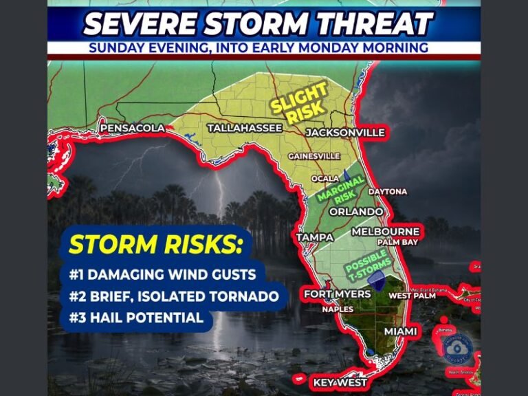
The SPC has defined a Marginal Risk (Level 1 of 5) for this overnight activity north of a line from Fayette to Cullman to Scottsboro. The overall severe threat for this round is not especially high due to weakening dynamics and limited instability. The main concern is strong and gusty winds.
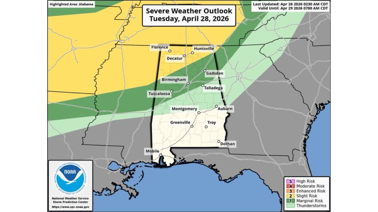
Tuesday April 28 — Slight Risk of Severe Storms Returns
Another and more significant round of storms is likely late Tuesday afternoon and Tuesday night. The SPC has issued a Slight Risk (Level 2 of 5) north of a line from Millport to Guntersville to Bridgeport, with a Marginal Risk (Level 1 of 5) extending as far south as Eutaw, Talladega, and Heflin.
Instability will be higher for the Tuesday round compared to Monday night, though dynamic support remains somewhat uncertain at this time. Tuesday’s high is forecast at 82 degrees with an overnight low of 65 degrees.
Risk Summary by Day
| Day | Risk Level | Area | Primary Threat |
|---|---|---|---|
| Monday night into Tuesday AM | Marginal Risk Level 1 | North of Fayette to Cullman to Scottsboro | Gusty winds |
| Tuesday afternoon and night | Slight Risk Level 2 | North of Millport to Guntersville to Bridgeport | Severe storms |
| Tuesday — Marginal | Marginal Risk Level 1 | Eutaw, Talladega, Heflin | Storms |
Temperature Outlook for the Week
| Date | High | Low |
|---|---|---|
| Sunday April 26 | 84°F | 62°F |
| Monday April 27 | 84°F | 62°F |
| Tuesday April 28 | 82°F | 65°F |
| Wednesday April 29 | 81°F | 65°F |
| Thursday April 30 | 75°F | 56°F |
| Friday May 1 | 71°F | 53°F |
| Saturday May 2 | 68°F | 51°F |
| Sunday May 3 | 70°F | 47°F |
Temperatures based on Birmingham-Shuttlesworth International Airport data.
7-Day Rainfall Totals Through Sunday May 3
The 7-day precipitation forecast ending Sunday May 3 at 8:00 AM EDT shows substantial rainfall totals accumulating across Alabama and the broader region:
| Zone | Expected Rainfall |
|---|---|
| Northern Alabama (highest totals) | 2.3 to 3.6 inches |
| Central Alabama | 1.4 to 2.9 inches |
| Southern Alabama | 0.8 to 1.2 inches |
| Coastal and southwest Alabama | 0.4 to 1.0 inches |
The northern half of the state is expected to see 2 to 4 inches of total rainfall through the period, while 1 to 2 inches is likely across much of South Alabama.
Rest of the Week and Weekend
Rain and storms will diminish Wednesday morning as the active pattern temporarily eases. Thursday will bring the highest rain chance to the southern quarter of Alabama, south of a surface front. Friday looks relatively dry for most of the state.
The weekend of May 2 to 3 may bring additional periods of rain based on global model guidance, though it is too early to specify timing or any severe weather potential for that period.
Stay with CabarrusWeekly.com for continuing updates on Alabama’s active weather week ahead.