Saturday May 16, Kansas, Oklahoma, and North Texas Face a 15% Slight Risk as SPC Introduces Day 6 Severe Weather Outlook With Damaging Winds and Large Hail Possible if Storms Form
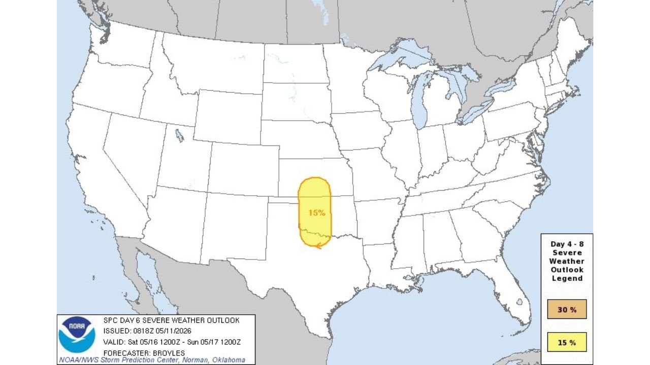
KANSAS, OKLAHOMA, AND NORTH TEXAS — The Storm Prediction Center has introduced a Day 6 Slight Risk covering 15% of the area across parts of Kansas, Oklahoma, and North Texas for Saturday May 16, 2026. The outlook was issued at 8:18 AM CDT on May 11, 2026 and is valid from Saturday May 16 at noon through Sunday May 17 at noon CDT.
What the Day 6 Outlook Shows
The 15% severe weather probability zone is tightly focused over a corridor stretching from central Kansas southward through Oklahoma and into North Texas. The threat zone is relatively compact but well-defined for a Day 6 outlook — a signal that forecaster confidence in the general area is already taking shape nearly a week out.
Hazards if Storms Develop
If storms form within the outlined area, the following hazards are possible:
- Damaging winds
- Large hail
Still Days Away — Monitor Closely
With Saturday still several days out, details on storm timing, coverage, and exact placement of the highest risk will become clearer as the week progresses. A Day 6 Slight Risk issuance from SPC is a notable early signal worth watching for anyone across Kansas, Oklahoma, and North Texas.
Stay with CabarrusWeekly.com for updated forecasts as this Saturday severe weather threat develops through the week.