Virginia, Maryland and Baltimore Metro Watch for Severe Storms This Evening With Strongest Threat Expected Between 7 and 10 PM
UNITED STATES — Severe weather is possible across Virginia, Maryland, and the Baltimore Metro area on Wednesday, April 29, 2026, with the most likely window for storms around Baltimore running between 7 and 10 PM. The best chance for severe weather today is centered on Virginia, while conditions around Baltimore depend heavily on afternoon sunshine breaking through.
Why Baltimore’s Severe Risk Depends on the Sun
Low clouds and showers are keeping conditions fairly stable around the Baltimore Metro into the afternoon. This stability is acting as a limiting factor for severe storm development in the immediate area. However, if sunshine breaks through during the afternoon hours, the atmosphere will destabilize and the chance for severe weather will increase significantly.
As conditions stand, the most likely time for storms around Baltimore is this evening between 7 and 10 PM.
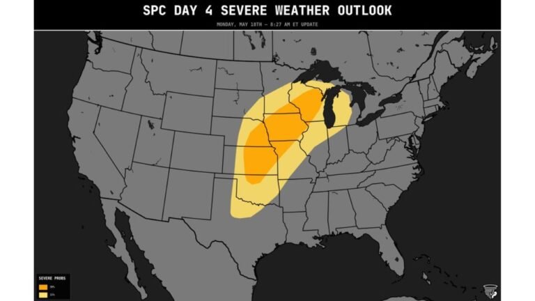
Virginia Holds the Best Severe Weather Chance Today
Across Virginia, the setup is more favorable for severe storm development. The atmosphere is better positioned to support stronger storms south and west of the Baltimore Metro, making Virginia the focus area for the highest severe weather potential across this region today.
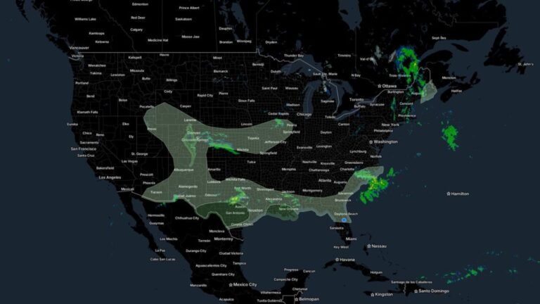
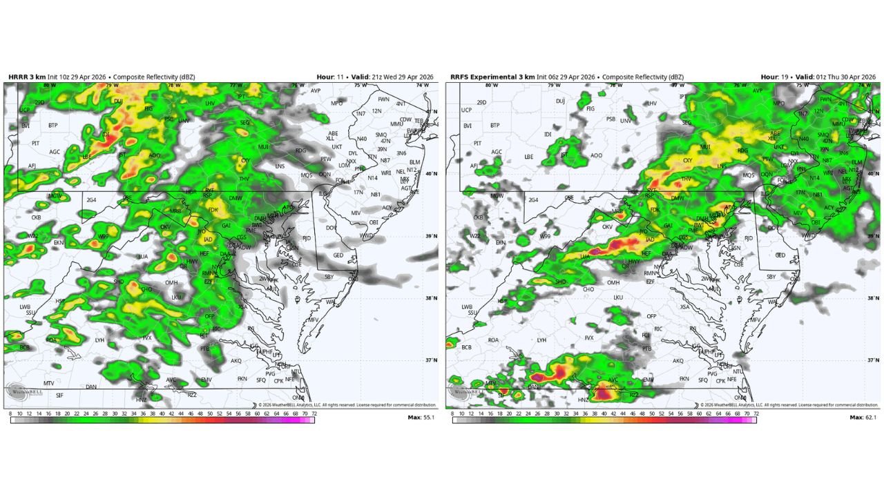
What Radar Shows Heading Into the Evening
HRRR radar data valid 9:00 PM Wednesday, April 29, 2026 shows a widespread area of showers and storms pushing through Virginia, Maryland, Washington D.C., and surrounding areas, with the most intense cells concentrated across central and northern Virginia and the Washington metro corridor.
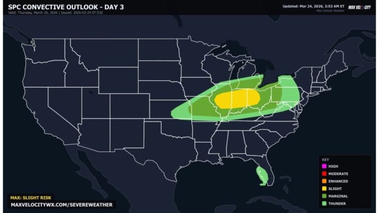
By 1:00 AM Thursday, April 30, 2026, the RRFS model shows the storm activity pushing further through the region, with intense cells firing across northern Virginia, the Washington D.C. area, and into Maryland, including activity near Baltimore-Washington International Airport and surrounding communities.
Hazards Possible With the Evening Storms
- Gusty and damaging winds
- Heavy downpours and lightning
- Isolated severe storms — particularly across Virginia
- Storms possible around Baltimore between 7 and 10 PM
The Key Variable to Watch This Afternoon
The afternoon sun is the single biggest factor determining how severe tonight’s storms become around the Baltimore Metro. Cloud cover keeping temperatures down limits instability and keeps the threat lower. Any clearing that allows temperatures to climb will change the picture quickly heading into the evening hours.
Residents across Virginia, Maryland, and the Baltimore area should monitor conditions closely through the afternoon and remain weather-aware heading into the evening.
Stay with CabarrusWeekly.com for continuing updates as this evening storm threat develops across Virginia and Maryland.