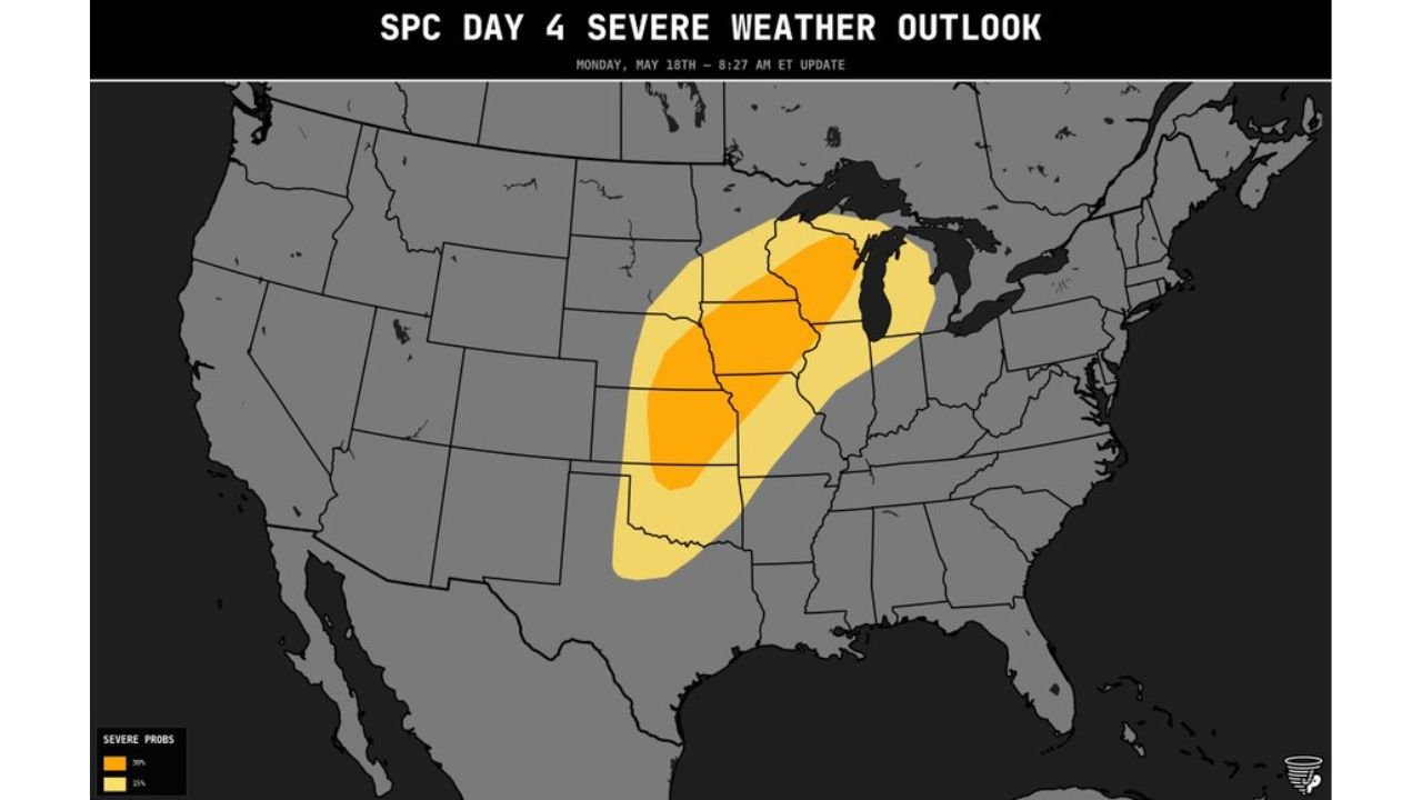
Wisconsin, Iowa, Illinois, Kansas and Oklahoma Face a Large 30% Enhanced Level 3 Outbreak Risk With Strong and Intense Tornadoes Likely From Northern Wisconsin to Northern Oklahoma Monday May 18
IOWA — The SPC Day 4 severe weather outlook updated at 8:27 AM ET on May 15, 2026 has placed a large 30% severe risk equivalent to an Enhanced Level 3 out of 5 covering a massive corridor from northern Wisconsin all the way down to northern Oklahoma. All hazards will be likely on Monday May 18, with the threat for strong and intense tornadoes specifically called out across the entire risk zone.
What the 30% Risk Zone Covers
The core 30% Enhanced-equivalent risk stretches across:
- Iowa, Illinois, and Indiana through the center of the corridor
- Kansas and Nebraska on the western flank
- Northern Wisconsin and Michigan on the northern end
- Northern Oklahoma marking the southern boundary
The broader 15% risk zone surrounds the core area extending further into surrounding states in all directions.
All Hazards Likely Monday
- Strong to intense tornadoes specifically flagged across the full corridor
- Giant hail widespread across the 30% zone
- Widespread damaging winds with both supercell and linear storm modes expected
- High end ceiling on this outbreak per overnight guidance
A High End Outbreak Setup
A 30% risk spanning from northern Wisconsin to northern Oklahoma on a Day 4 outlook is an exceptionally large and serious signal. The corridor covers multiple major metro areas and agricultural regions across the central United States, making advance preparation critical.
Stay with CabarrusWeekly.com for frequent updates as this Monday outbreak threat continues to develop.