Oklahoma to Michigan Braces for Damaging Winds, Large Hail, and Tornadoes as Severe Weather Returns Tuesday
UNITED STATES — A severe weather outbreak is set to sweep from Oklahoma to Michigan on Tuesday, May 19, 2026, bringing threats of damaging winds, large hail, and tornadoes to millions across the central and upper midwestern United States.
The Severe Weather Is Not Done With the Region Yet
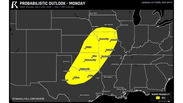
Just one day after a historic Monday severe weather setup, Tuesday brings another round of dangerous storms. This outlook was issued on Saturday, May 16, 2026 at 5:10 AM ET, giving residents along the entire corridor time to prepare before conditions deteriorate Tuesday.
The Threats Heading Into Tuesday
Forecasters are highlighting three specific hazards for Tuesday’s storm system:
- Damaging winds
- Large hail
- A few tornadoes
While this setup does not carry the same historic weight as Monday’s CIG 2 outlook, it is still a significant and dangerous severe weather event that should not be taken lightly.
The Cities and States in the Threat Zone
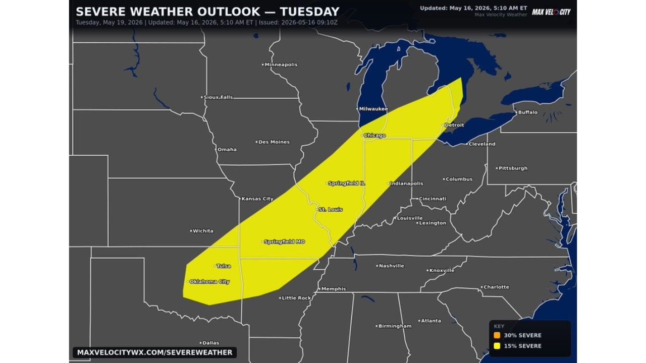
The severe weather corridor stretches in a diagonal band from the southern plains all the way into the Great Lakes region. Cities directly within the threat zone include:
- Oklahoma City and Tulsa, Oklahoma
- Springfield, Missouri
- St. Louis, Missouri
- Springfield, Illinois
- Chicago, Illinois
- Milwaukee, Wisconsin
- Detroit, Michigan
Probability Breakdown for Tuesday
| Probability Level | Coverage Area |
|---|---|
| 30% Severe | Core of the threat corridor |
| 15% Severe | Broader zone from Oklahoma to Michigan |
The 15 percent severe weather zone covers the widest area, stretching across the full Oklahoma to Michigan corridor. A 30 percent severe zone sits within the core of that band, indicating the highest concentration of storm activity.
When Storms Will Move Through
The severe weather threat is tied to Tuesday, May 19, 2026. Residents across the entire highlighted zone should be weather-aware throughout the day and into the evening hours as the storm system pushes through.
Preparation Remains Critical
With back-to-back days of severe weather targeting the central United States, storm fatigue is a real concern. Residents in the Tuesday threat zone should remain just as alert as they were for Monday. Keep weather alerts active, know your nearest shelter, and stay indoors when storms approach.
Stay with CabarrusWeekly.com for the latest updates on this developing severe weather threat through Tuesday.