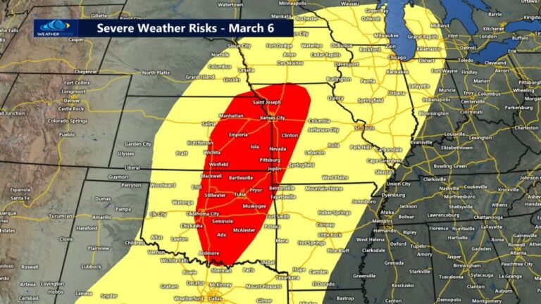
Arkansas, Western Kentucky and Northeast Texas Face Supercells Capable of Gorilla Hail and Strong Tornadoes Tuesday Afternoon and Evening With Central and North Arkansas as the Highest Tornado Risk Zone
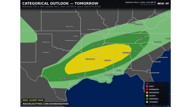
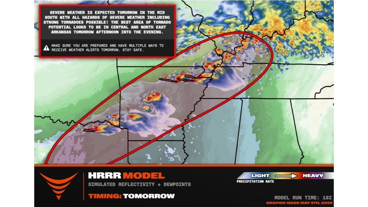
ARKANSAS — Severe weather is expected across the Mid South on Tuesday, May 5, 2026, with supercells capable of dropping gorilla hail and producing strong tornadoes targeting a corridor from northeast Texas through Arkansas and into western Kentucky. All hazards of severe weather are possible, with the best area for tornado potential concentrated across central and northeastern Arkansas during the afternoon into the evening hours.
Central and Northeastern Arkansas Face the Highest Tornado Risk
The tornado threat is expected to be maximized across central and northern Arkansas along a terrain-enforced warm frontal zone. Simulated reflectivity for Tuesday shows the most intense storm activity concentrated in an oval-shaped corridor from northeast Texas through the heart of Arkansas toward western Kentucky, with deep red and purple storm cores visible across the Arkansas corridor on forecast radar.
The graphic issued May 4, 2026 identifies the best tornado potential as central and northeastern Arkansas Tuesday afternoon into the evening.
All Hazards of Severe Weather Are on the Table Tuesday
- Hail — gorilla hail capable supercells expected
- Tornado — strong tornadoes possible, highest threat in central and northern Arkansas
- Wind — damaging wind gusts across the full risk corridor
Risk Corridor Tuesday
| Zone | Primary Threat |
|---|---|
| Central and northeastern Arkansas | Highest tornado risk along warm frontal zone |
| Western Kentucky | Isolated tornado threat |
| Northeastern Texas | Isolated tornado and gorilla hail threat |
| Full Mid South corridor | All severe weather hazards possible |
Residents across Arkansas, western Kentucky and northeast Texas must have multiple ways to receive weather alerts active before Tuesday afternoon and have a shelter plan ready well before storms arrive.
Stay with CabarrusWeekly.com for live Tuesday severe weather updates across Arkansas, western Kentucky and northeast Texas.