Texas, Oklahoma, Kansas, Missouri, Illinois, Indiana and Michigan Enter Rare 5-Day Severe Storm Stretch With Expanding Tornado and Hail Threat
UNITED STATES — A prolonged and potentially dangerous severe weather pattern is expected to unfold across the central United States, with five consecutive days of at least a 15% severe storm risk from Saturday through Wednesday.
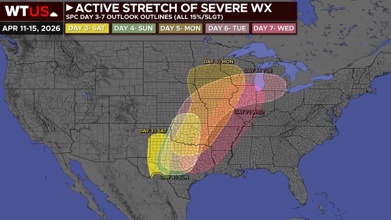
Rare Multi-Day Severe Weather Pattern Sets Up Across Plains and Midwest
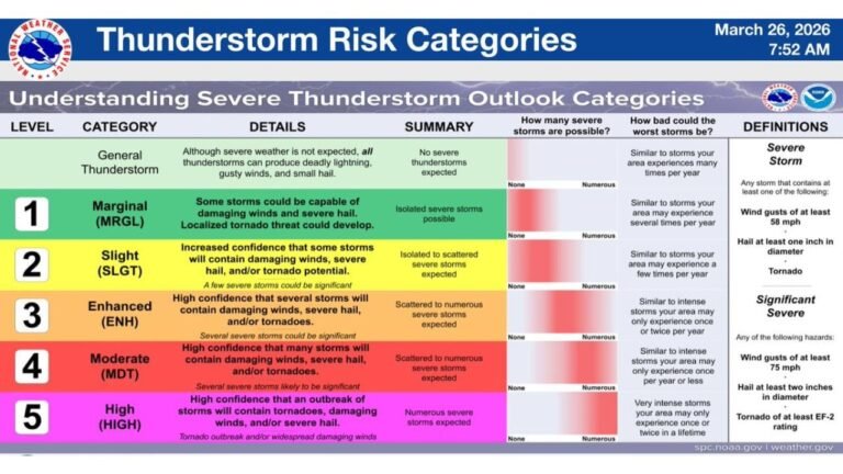
Forecast data shows an unusually persistent setup where severe storms will develop daily and shift steadily from the Southern Plains into the Midwest and Great Lakes. Each day carries a 15% risk level, equivalent to a Slight Risk (Level 2 of 5), signaling organized storm potential rather than isolated activity.
This type of extended pattern significantly raises concern, as multiple regions will face repeated or overlapping storm threats over several days.
Saturday Focus: West Texas Sees Initial Severe Development
The severe weather cycle begins Saturday with storms developing across West Texas, where conditions support isolated to scattered severe storms.
The primary threats include damaging wind gusts and large hail, especially in areas where storms can intensify quickly during the afternoon and evening hours.
Sunday Shift: Storm Threat Moves East Across Texas and Southern Plains
On Sunday, the risk area shifts eastward across Texas and into parts of Oklahoma, although the setup becomes more conditional.
If storms fully develop, damaging winds and large hail remain the main threats, with a possible tornado risk emerging depending on how atmospheric conditions evolve.
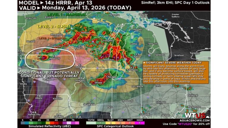
Monday Escalation: Central Plains Into Upper Midwest Under Widespread Threat
By Monday, a stronger system begins to organize, pushing the severe weather corridor into Kansas, Nebraska, Missouri, and Iowa, with impacts extending toward the Upper Midwest.
With increasing moisture and stronger upper-level dynamics, a more widespread and potentially more robust severe weather event is expected, with all hazards possible including tornadoes.
Tuesday Peak Potential: Midwest and Great Lakes Face Significant Severe Event
Tuesday appears to be one of the most concerning days, as storms expand into Illinois, Indiana, Michigan, and surrounding Midwest states.
Forecast signals point toward a very widespread severe weather event, with the potential for significant impacts including strong tornadoes, damaging winds, and large hail.
Wednesday Continuation: Storm Threat Extends From Plains Into Midwest
By Wednesday, the system continues moving eastward, maintaining a severe threat from the Southern Plains into the Midwest, including parts of Missouri, Illinois, Indiana, and nearby regions.
However, forecast uncertainty increases, as storm intensity will depend on how Tuesday’s activity evolves.
This remains a long-duration severe weather pattern, meaning multiple regions could be impacted over consecutive days.
Stay with CabarrusWeekly.com for continued updates, and share what conditions you are seeing in your area as this severe weather pattern unfolds.