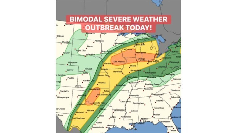
Missouri, Illinois, Arkansas and Surrounding States Trending Toward Major Severe Weather Outbreak on Monday April 27
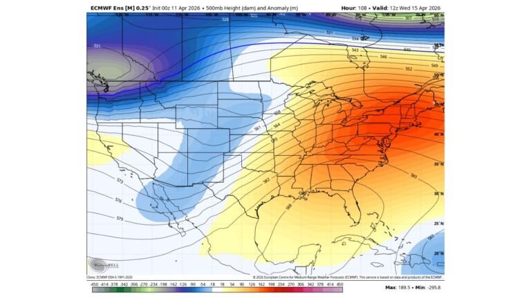
CENTRAL AND MID-SOUTH UNITED STATES — Monday, April 27, 2026 is continuing to trend toward a major severe weather outbreak across a broad corridor of the central United States, with ensemble guidance indicating a very favorable and wide-ranging environment featuring 50-plus knot flow at 1 kilometer altitude alongside CAPE values exceeding 2,500 J/kg across much of the risk zone.
A Broad and Dangerous Environment Taking Shape
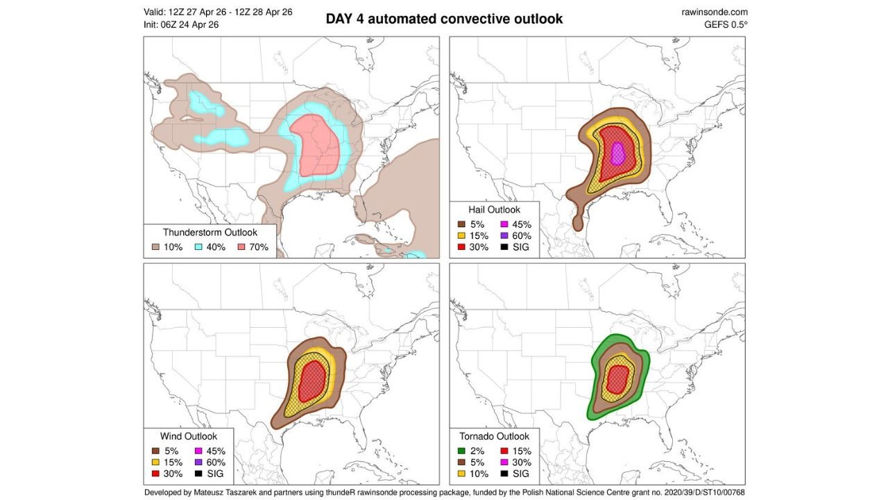
The automated convective outlook based on the 06Z GEFS update valid April 27 shows an exceptionally large severe weather footprint. The thunderstorm outlook alone places a 70% thunderstorm probability across a wide swath of the central Plains and Mid-South, with 40% coverage extending across an enormous portion of the country from the Rockies to the East Coast.
Many ensemble members are in strong agreement on the severity of this setup, making confidence in a significant outbreak increasingly high.
Four Hazard Outlooks All Point to the Same Core Zone
All four hazard categories — thunderstorms, hail, wind, and tornadoes — converge on a concentrated high-risk corridor centered across Missouri, Illinois, Arkansas, and into the surrounding region.
Hail Outlook:
| Probability | Risk Level |
|---|---|
| 60% | Significant hail — core zone across Missouri and Illinois |
| 45% | Elevated hail risk surrounding core |
| 30% | Broad hail threat extending into Arkansas and surrounding states |
| SIG | Significant hail explicitly indicated in core |
Wind Outlook:
| Probability | Risk Level |
|---|---|
| 30% and SIG | Core zone — damaging winds nearly certain in highest risk area |
| 15% | Broader wind threat across surrounding states |
Tornado Outlook:
| Probability | Risk Level |
|---|---|
| 30% | Highest tornado probability — core of Missouri and Illinois corridor |
| 15% | Elevated tornado risk across broader surrounding area |
| 10% | Outer tornado threat zone |
| SIG | Significant tornadoes explicitly indicated |
What SIG Designation Means
The SIG hatching appearing on both the wind and tornado outlook maps is a critical signal. SIG indicates that forecasters expect not just severe weather — but significantly severe weather, meaning EF2-or-stronger tornadoes and/or 65-plus knot wind gusts are considered likely within the hatched zone. This level of confidence at four days out is rare and alarming.
Who Is in the Crosshairs for Monday
The greatest concentration of all hazards points directly at Missouri, southern Illinois, and Arkansas, with the surrounding threat extending into Kansas, Oklahoma, Tennessee, Mississippi, and Kentucky. The thunderstorm coverage map suggests virtually no part of the central United States will be untouched by storm activity Monday.
Monday is shaping up as the most significant severe weather day of the current multi-day sequence and potentially one of the more significant severe weather days of the 2026 spring season so far.
Begin preparations now. Identify your shelter, establish a family communication plan, and do not rely on mobile homes for protection. Stay with CabarrusWeekly.com for continuing coverage as Monday’s outbreak potential continues to come into focus.