Increased Atmospheric Forcing Closing In on the Mid South With Strong Long Track Tornadoes Expected in the Coming Hours
MID SOUTH — An area of increased atmospheric forcing is closing in on the Mid South and is expected to fire additional storms within the next few hours, bringing the main threat for strong, long-track tornadoes to the region. Forecasters are warning that those calling this event a bust should expect a significant surprise in the hours ahead.
Forcing Is Closing In — Storms Will Fire
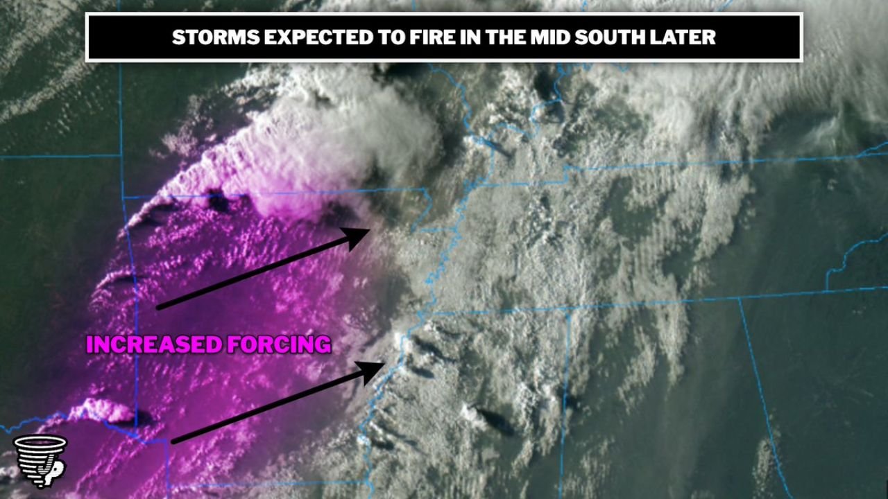
Satellite imagery shows a well-defined zone of increased forcing — depicted in bright pink on the satellite loop — pushing into the region and closing in on the Mid South. This forcing mechanism is what is needed to overcome any remaining cap and trigger the most dangerous storm development of the day.
As this zone moves in, additional storms are expected to fire and organize, with the environment primed to support strong, long-track tornado-producing supercells once convective initiation occurs.
Do Not Dismiss This Threat
Forecasters are explicitly pushing back against the narrative that Monday’s event is a bust. The atmospheric ingredients for significant and dangerous tornadoes remain in place, and the incoming forcing is expected to be the trigger that unlocks storm development across the Mid South in the next few hours.
Anyone across the Mid South who has let their guard down must re-engage with this threat immediately. Shelter plans should be refreshed and warning sources kept active through the evening hours.
Stay with CabarrusWeekly.com for continuous live updates as this storm threat evolves across the Mid South.