Why Monday’s Tornado Outbreak Was Suppressed: Warm 700mb Temperatures Along the Mississippi River Were the Key Factor
MISSISSIPPI VALLEY — A detailed post-event analysis of Monday, April 27, 2026 is revealing the atmospheric reason why supercell development was suppressed across the Mississippi River corridor during the afternoon — the area that had been highlighted as the bullseye for the most significant tornado threat. Warmer than expected temperatures at the 700 millibar level acted as a strengthened cap, preventing the robust convective development that all pre-event guidance had pointed toward.
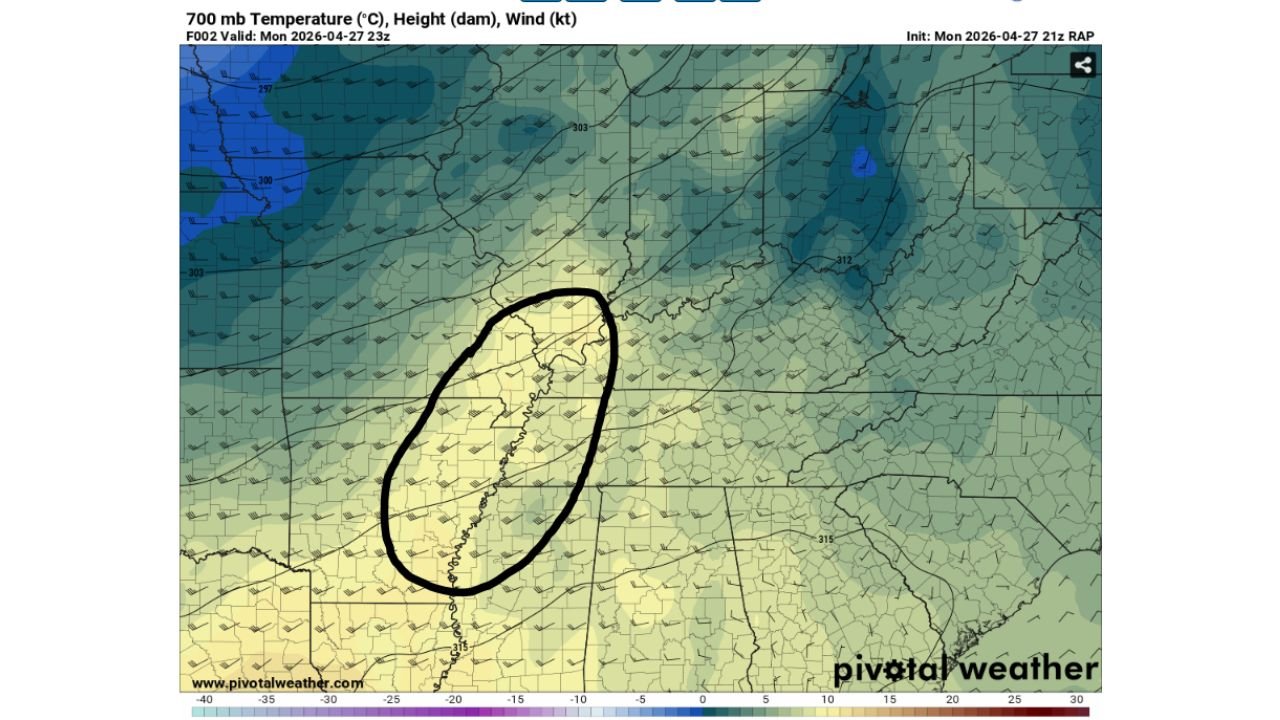
What Happened — The 700mb Cap Was Too Warm
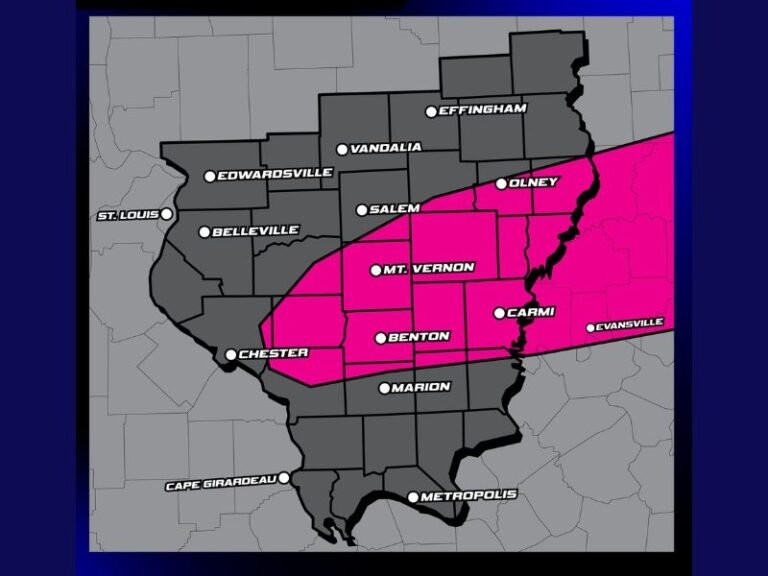
RAP model analysis valid at 23Z Monday April 27 shows 700 millibar temperatures of 8 to 10 degrees Celsius across the circled zone along the Mississippi River — the exact area where supercells were expected to fire during the afternoon and early evening hours.
Research indicates that 700mb temperatures of approximately 7 to 8 degrees Celsius are already considered too warm for thunderstorm development in April. The actual observed values of 8 to 10 degrees pushed well beyond that threshold — creating a capping inversion strong enough to prevent supercells from breaking through in the primary risk zone, despite all other atmospheric ingredients being in place.
Why Models Missed It
Weather models had indicated a more favorable cap erosion scenario through the afternoon. What models could not fully capture was the precise magnitude of warmth at the 700mb level that would persist across the Mississippi River corridor through the critical convective initiation window. This subtle but critical difference between modeled and actual temperatures was enough to suppress the outbreak in its most anticipated location.
What This Means for Forecast Science
This event is a clear example of how a single atmospheric layer — in this case the 700mb cap — can be the deciding factor between a major tornado outbreak and a largely suppressed severe weather day. All of the following ingredients were present and favorable:
- Sufficient low-level moisture
- Strong wind shear
- High instability — CAPE values in the 2,000 to 3,000-plus J/kg range
- Favorable helicity and tornado parameter values
Yet one layer of warmer than expected air was enough to keep the lid on convection across the primary risk zone. This underscores why forecasting tornado outbreaks remains one of the most challenging tasks in meteorology — and why even the best models and forecasters can miss significant events when subtle mid-level temperature details are not resolved correctly.
The event serves as an important reminder that preparation for high-end forecasts is never wasted — the atmosphere on Monday had every ingredient for a major outbreak, and only a narrow margin of warmth at one atmospheric level prevented it from verifying.
Stay with CabarrusWeekly.com for continuing post-event analysis and the latest severe weather coverage.