Supercell Tornadoes Threaten the Mississippi River Corridor Tuesday as Intense Storm System Locks Onto the Mid-South
UNITED STATES — A dangerous severe weather outbreak is underway across the South on Tuesday, with more than 270 severe storm reports already recorded in the last 24 hours and a concentrated supercell tornado threat now emerging along the Mississippi River corridor as storms push through Arkansas, Tennessee, and surrounding states.
More Than 270 Storm Reports and the Worst Is Still Coming
The damage is already significant heading into Tuesday. Over 270 severe storm reports have been logged in the past 24 hours, and forecasters warn the threat is far from over. More severe weather is expected to develop and push eastward throughout the day.
Where the Greatest Tornado Danger Is Focused Right Now
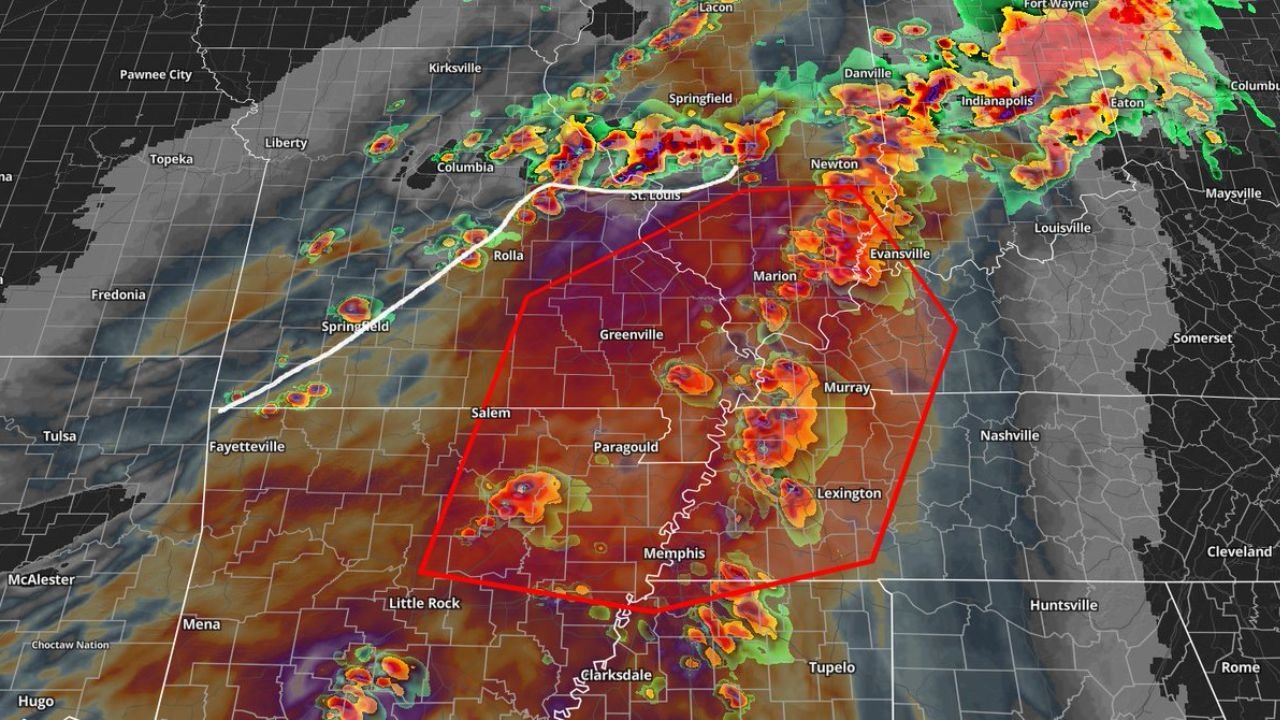
The most critical threat is now centered along the Mississippi River, where the greatest concentration of OWS supercells is expected. A red-highlighted zone on radar covers an area stretching through Paragould, Greenville, Memphis, Lexington, Murray, Marion, and Evansville, representing the highest risk for strong to intense tornadoes.
A white boundary line — marking the front — runs from southwest to northeast through the region, passing near Rolla, Springfield, St. Louis, and Columbia. That front is expected to remain discrete to semi-discrete for a few hours before eventually organizing into a line later in the day.
The Supercell and Tornado Threat Explained
Forecasters warn that if storms along the boundary are able to latch onto or move slightly ahead of the front, strong to intense tornadoes will be possible. The wind threat is also expected to slowly increase throughout the day as the system continues to evolve.
Storms are currently visible on radar across a wide area from Tulsa and Fayetteville in the west through St. Louis and into Indiana and Ohio to the northeast, with the most intense activity concentrated in the red-outlined supercell zone along the Mississippi River valley.
The States and Cities at Greatest Risk
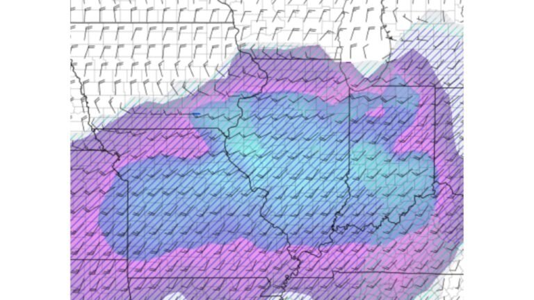
The Enhanced Risk zone covers a concentrated area through Arkansas, Louisiana, and Mississippi. Cities directly within or near this zone include Fort Smith, Little Rock, Mountain View, Texarkana, Shreveport, Monroe, Greenville, and Jackson.
A broader Level 2 of 5 risk zone surrounds the Enhanced area, stretching toward Memphis, Nashville, Huntsville, Birmingham, Springfield, Cape Girardeau, Bowling Green, and Montgomery.
What the Enhanced Risk Zone Could Produce
Residents inside the Enhanced Risk area face the following hazards:
- Damaging wind
- Very large hail
- A few tornadoes — including strong to intense
- Flash flooding
What the Wider Level 2 Zone Could See
Those in the surrounding Level 2 of 5 area remain at risk for:
- Damaging wind
- Large hail
- Isolated tornado
- Flash flooding
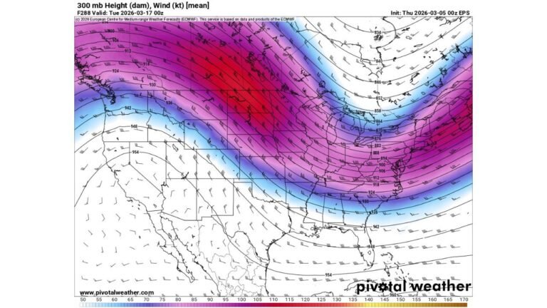
How the Storm System Is Expected to Evolve
The boundary currently cutting through the region is a key factor in how dangerous this outbreak becomes. Storms firing along and ahead of that front have the greatest potential to produce significant tornadoes. As the day progresses, those discrete supercells are expected to eventually merge into a squall line, shifting the primary threat toward damaging straight-line winds.
The risk area extends from the Dallas and Durant corridor in the southwest through the Mississippi River valley and into western Tennessee and Kentucky. The northern fringe of the threat touches Springfield, Columbia, and St. Louis, with the storm system also producing activity as far northeast as Indianapolis and Fort Wayne.
With storm reports already surpassing 270 in 24 hours, a focused supercell zone locked onto the Mississippi River, and the wind threat building throughout the afternoon, this remains one of the most significant severe weather outbreaks across the South so far this season.
Stay with CabarrusWeekly.com for continuing updates as this outbreak develops throughout the day.