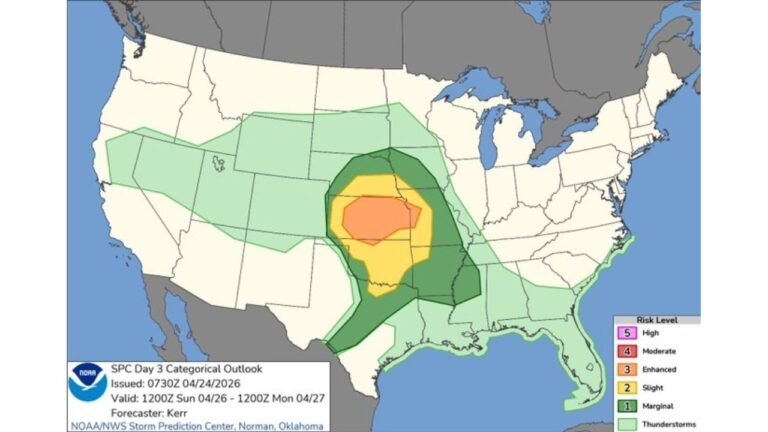
Gulf Coast From San Antonio to Mobile Faces Tornado Threat Friday as Storm System Targets the Coastline
UNITED STATES — Tornadoes are possible along the Gulf Coast on Friday, May 1, 2026, with a tornado probability zone stretching from the San Antonio and Houston corridor eastward through New Orleans and into Mobile. The outlook was updated at 3:15 AM ET on April 30, 2026 and is valid for Friday, May 1, 2026.
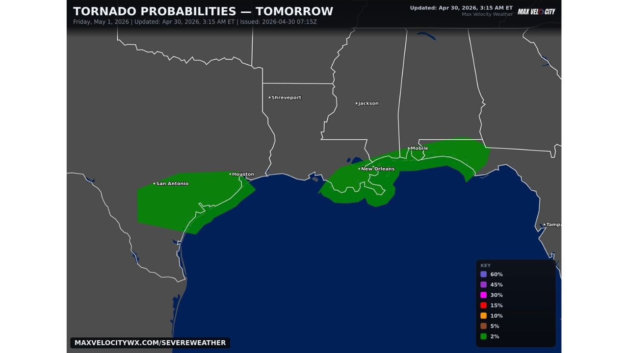
Where the Tornado Threat Is Focused Friday
The tornado probability map shows a 2 percent tornado risk zone — the opening level of the probability scale — covering a concentrated band along and near the Gulf Coast. The threat zone runs in two connected areas:
Western Zone: Stretching from south of San Antonio through the Houston corridor and along the Texas Gulf Coast southward toward the coastline.
Eastern Zone: Covering the area around New Orleans and pushing eastward through southern Louisiana, coastal Mississippi, and into the Mobile, Alabama area.
The threat is focused tightly along the immediate Gulf Coast and does not extend significantly inland toward cities like Shreveport or Jackson, which sit outside the outlined probability zone.
What a 2 Percent Tornado Probability Means
A 2 percent tornado probability represents the lowest threshold on the outlook scale, indicating that tornadoes are possible but not expected to be widespread or highly organized. The risk is real and warrants awareness, particularly for communities along the Gulf Coast that fall within the outlined zone.
Residents across the San Antonio to Houston coastline and from New Orleans through Mobile should remain weather aware heading into Friday and monitor any warnings issued during the day.
Stay with CabarrusWeekly.com for continuing updates as this Gulf Coast tornado threat develops on Friday.