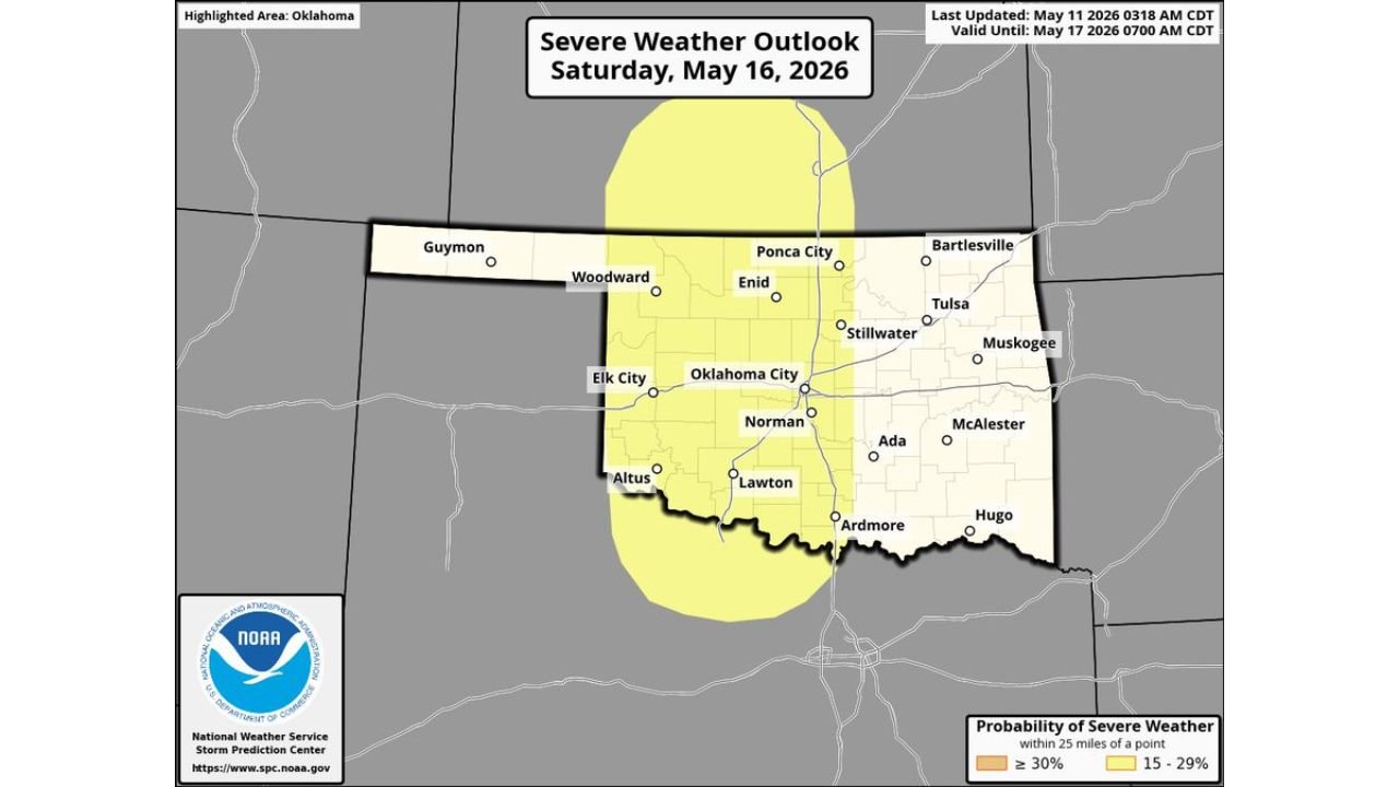
Saturday May 16, Oklahoma City, Norman, Enid, Lawton, and Altus Face a 15% Severe Weather Risk as All Hazards Remain Possible Across North Texas, Central Oklahoma, and South Central Kansas
CENTRAL OKLAHOMA — A Day 6 severe weather outlook has been issued for Saturday, May 16, 2026, with a 15% severe weather probability added across parts of North Texas, West and Central Oklahoma, and South Central Kansas. All hazards are possible with this system, according to the NOAA Storm Prediction Center outlook updated at 3:18 AM CDT on May 11, 2026.
Threat Zone Covers Central Oklahoma Core
The severe weather outlook map shows the threat zone centered directly over central Oklahoma, with the following cities inside the risk area:
- Oklahoma City and Norman — within the core threat zone
- Enid, Ponca City, and Stillwater — northern portion of the zone
- Lawton, Altus, and Ardmore — southern portion of the zone
- Elk City and Woodward — western edge of the threat area
Cities including Tulsa, Bartlesville, Muskogee, and Guymon sit outside or along the far edges of the current outlook.
All Hazards on the Table
The outlook specifically states all hazards are possible, meaning the threat includes:
- Tornadoes
- Large hail
- Damaging winds
The probability level sits at 15 to 29% across the highlighted zone, with the outlook valid through May 17, 2026 at 7:00 AM CDT.
Still Days Away — But Worth Watching
With Saturday still several days out, the outlook carries uncertainty. However, a Day 6 severe risk issuance for this corridor is a signal worth monitoring closely as the week progresses and forecast confidence increases.
Stay with CabarrusWeekly.com for updates on this developing Saturday severe weather threat across Oklahoma and North Texas.