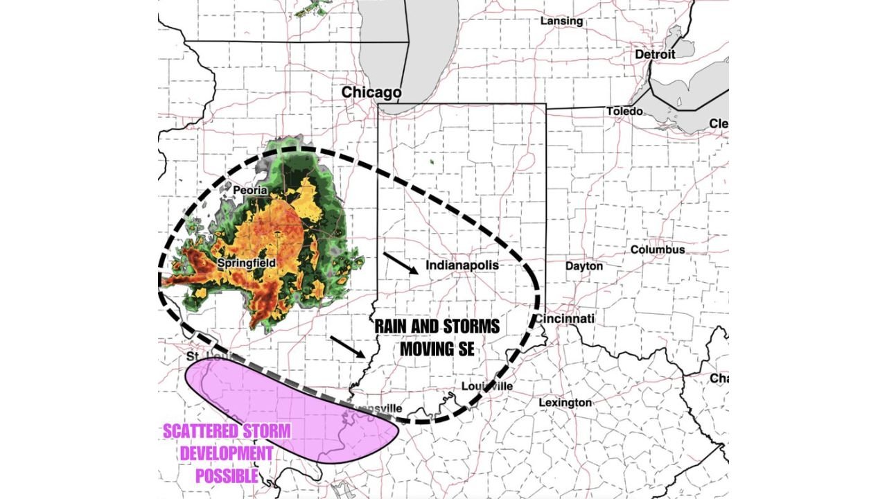
Illinois and Indiana Face Morning Rain and Storms Moving Southeast Near Peoria, Springfield and Indianapolis With Scattered Storm Development Possible on the Southern Edge Friday May 15
SPRINGFIELD, ILLINOIS — Rain and storms are moving through Illinois and Indiana this Friday morning May 15, 2026, with the heaviest activity currently centered over Peoria and Springfield and pushing southeast toward Indianapolis, Dayton, Cincinnati, and Louisville. Scattered storm development is also possible along the southern edge of the system. Mostly dry conditions are expected across both states once the morning activity clears.
Where the Storms Are Right Now
Current radar as of 6:55 AM ET on May 15, 2026 shows:
- Heavy storm core centered over Peoria and Springfield in central Illinois
- Entire system tracking southeast toward Indianapolis and Cincinnati
- Scattered storm development possible on the southern fringe near the St. Louis and Evansville corridor
What to Expect Through the Morning
The storm system is moving southeast at a steady pace. Cities in the path include:
- Indianapolis — rain and storms arriving through the mid morning hours
- Dayton, Cincinnati, and Louisville — activity expected to push through later in the morning
- Lexington on the far southeastern edge of the system
Dry Conditions Return by Midday
Once the morning rain and storms move out, mostly dry conditions are expected to return across Illinois and Indiana for the remainder of the day. The southern scattered storm zone near Evansville may see lingering activity slightly longer.
Stay with CabarrusWeekly.com for live radar updates as this morning storm system moves through Illinois and Indiana.