Missouri, Kansas, Oklahoma and Illinois Face Damaging Winds, Large Hail and Tornadoes Near Kansas City, St. Louis, Tulsa and Oklahoma City as a 5-Day Severe Weather Stretch Continues Tuesday May 19
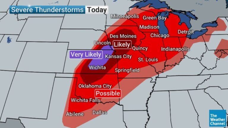
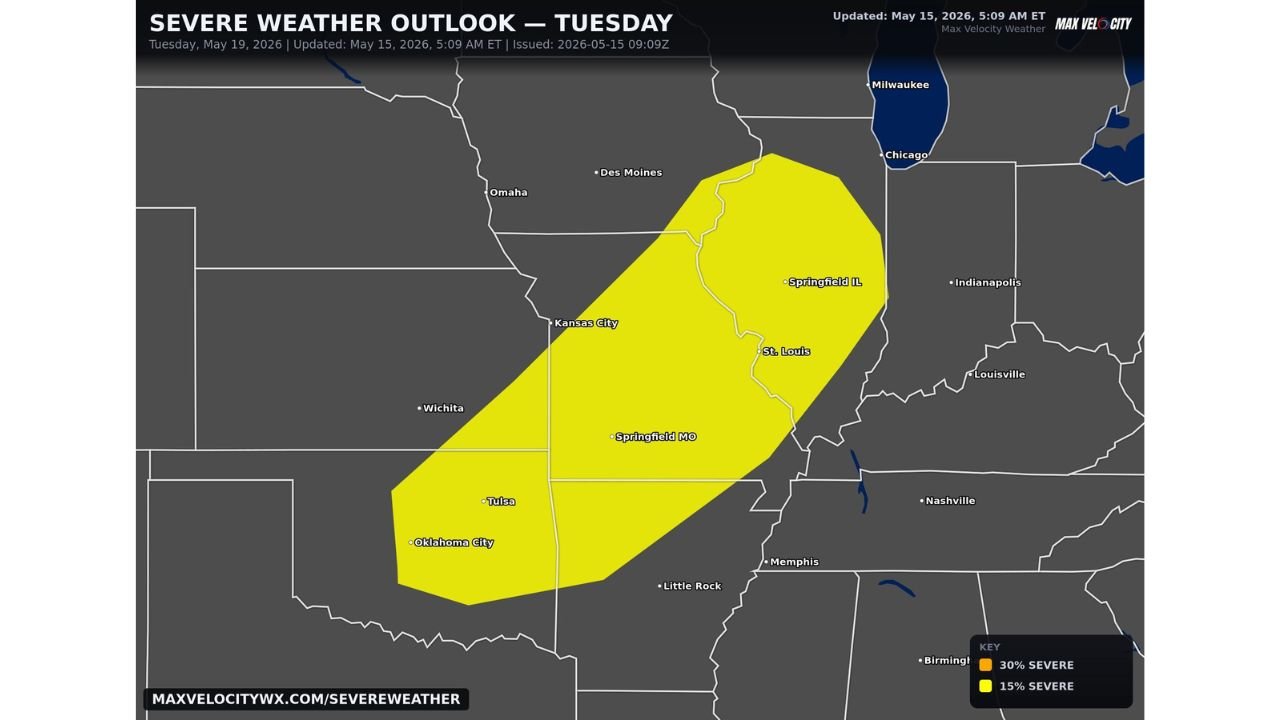
KANSAS CITY, MISSOURI — More severe weather is anticipated across the Southern Plains and Midwest on Tuesday May 19, 2026, extending an already active severe weather stretch to at least 5 consecutive days. The outlook updated at 5:09 AM ET on May 15, 2026 shows a 15% severe risk zone covering a broad corridor from Oklahoma City northeast through Kansas City, St. Louis, and Springfield IL, with damaging winds, large hail, and a few tornadoes all possible.
Threat Zone for Tuesday
The 15% severe risk zone covers:
- Oklahoma City, Tulsa, and Springfield MO on the southern and western end
- Kansas City and St. Louis through the center of the corridor
- Springfield IL on the northeastern edge
- Little Rock and Memphis on the southeastern fringe
Cities including Omaha, Des Moines, Chicago, Milwaukee, Indianapolis, Louisville, and Nashville sit outside the current Tuesday risk area.
Hazards Expected Tuesday
- Damaging winds primary concern across the corridor
- Large hail possible with stronger storm cells
- A few tornadoes cannot be ruled out
Five Days of Severe Weather and Counting
Tuesday’s threat comes on the back of an already dangerous multi-day severe weather pattern that began earlier in the week. This very active stretch is expected to last at least 5 days, making it one of the most prolonged severe weather sequences of the 2026 spring season.
Stay with CabarrusWeekly.com for daily updates as this 5-day severe weather stretch continues across the Plains and Midwest.