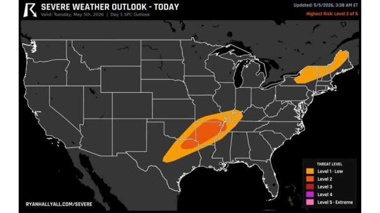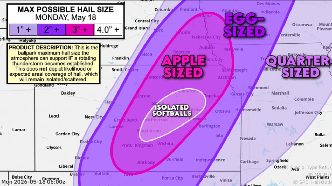
Kansas and Nebraska Face Isolated Softball Size Hail Monday May 18 Including Wichita, Hutchinson, McPherson, Manhattan and Salina With Apple Size Hail Reaching Lincoln and Topeka
WICHITA, Kansas – Isolated softball size hail of 4 inches or larger is possible across central Kansas today, Monday, May 18, if rotating supercells are able to become established for a few hours. The maximum possible hail size map for Monday, May 18 shows four distinct hail size zones from Kansas through Nebraska, with apple size, egg size and quarter size hail zones extending across a wide corridor.
Four Hail Size Zones for Monday May 18
The maximum possible hail size map shows what the atmosphere can support if a rotating supercell becomes established. These are isolated and scattered potential maximums, not guaranteed coverage across the entire zone:
- Isolated Softball size hail of 4 inches or larger shown in white covers the innermost zone centered on Wichita, Hutchinson, McPherson, Kingman, Pratt and Salina, Kansas. A 4 inch softball is large enough to cause catastrophic damage to vehicles, roofs and anyone caught outdoors.
- Apple size hail of 3 inches or larger shown in bright pink surrounds the softball zone and covers Manhattan, Topeka, Lincoln, Nebraska City, Beatrice, Concordia, Smith Center, Great Bend and Emporia, Kansas and southern Nebraska.
- Egg size hail of 2 inches or larger shown in purple extends the hail threat north through Omaha, Grand Island, Fremont, Central City, Columbus, Aurora and Maryville, with the zone also covering Kansas City, Saint Joseph, Atchison and Chillicothe.
- Quarter size hail of 1 inch or larger shown in light purple covers the outermost zone reaching Des Moines, Indianola, Ottumwa, Kirksville, Marshall, Columbia, Jefferson City, Sedalia, Warsaw, Burlington, Iola, Nevada, Carthage, Springfield and West Plains.
What Each Hail Size Does to Property
Understanding what these hail sizes mean on the ground is critical for Monday, May 18:
- Softball size hail at 4 inches or larger will total vehicles instantly, punch through roof decking, shatter skylights and solar panels and cause life-threatening injury to anyone caught outdoors across the Wichita and Hutchinson corridor.
- Apple size hail at 3 inches or larger will crack windshields, dent vehicles severely, destroy gutters and cause significant roof damage across Manhattan, Topeka, Lincoln and Concordia.
- Egg size hail at 2 inches or larger will crack windshields, dent metal roofing and cause crop damage across Omaha, Grand Island and Kansas City.
- Quarter size hail at 1 inch or larger is the minimum threshold for significant hail damage and will dent vehicles and strip leaves from trees across the broader outer zone through Des Moines and Columbia.
This Is a Maximum Potential Map, Not a Guarantee
This map shows the maximum hail size the atmosphere can support if a rotating supercell thunderstorm becomes established today. It does not show the likelihood or expected area of coverage. Hail at these sizes will remain isolated and scattered rather than covering the entire zone. However, wherever a supercell does establish itself across the Wichita, Hutchinson and Salina corridor today, softball size hail is a real possibility for that community on Monday, May 18.
Move All Vehicles Under Cover Right Now
Anyone across Wichita, Hutchinson, McPherson, Kingman, Pratt, Salina, Manhattan, Topeka and Lincoln must move all vehicles into a garage or under solid cover before storms develop this afternoon. A 4 inch softball of hail falling at terminal velocity will total any unprotected vehicle in seconds and is capable of breaking bones if it strikes a person directly.
WaldronNews.com will continue tracking this isolated softball size hail threat across Kansas and Nebraska and will provide updates as supercell development and hail reports emerge throughout Monday, May 18.