Cold Front to Drench the Mid-Atlantic With Up to 2.70 Inches of Rain From Wednesday Through Monday as Holiday Weekend Faces Scattered Showers Gusty Thunderstorms and Temperatures Dropping Near 60
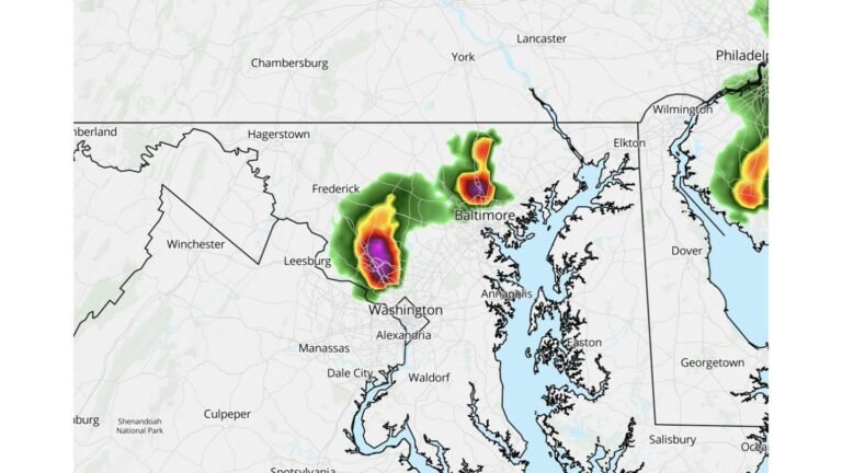
MID-ATLANTIC — A wet and unsettled weather pattern is moving into the Mid-Atlantic region starting late Wednesday, as a cold front arrives with gusty thunderstorms and brings an end to the ongoing heat wave. That front is then expected to stall near the Mid-Atlantic for several days, keeping shower chances and cooler than normal temperatures in the forecast straight through the holiday long weekend.
What Is Setting This Wet Pattern in Motion
The driver behind this multi-day wet stretch is a cold front pushing into the region late Wednesday. Once it arrives, it will not clear out quickly. Instead, the front is forecast to stall and linger near the Mid-Atlantic, keeping the area locked into a pattern of intermittent showers, drizzle, and storm chances from Wednesday all the way through Monday. This is not a washout scenario for every hour of every day, but rain will be a recurring presence throughout the period.
A Full Day by Day Breakdown
| Day | Conditions | High Temperatures |
|---|---|---|
| Wednesday | Scattered to widespread showers and storms late afternoon and evening, lingering overnight | Not specified |
| Thursday | Intermittent showers, period of steadier rain possible | 65 to 70 degrees |
| Friday | Intermittent showers, period of steadier rain possible | Near 60 degrees |
| Saturday | Scattered showers, pockets of drizzle and mist possible | Near 60 degrees |
| Sunday | Scattered showers possible, maybe a thunderstorm, extended dry periods likely as front lifts north of D.C. | Near 70 degrees |
| Monday | Scattered showers and storms possible, highest chances afternoon and evening as front sags south | 70s |
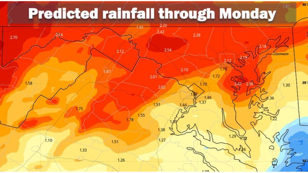
How Much Rain Is Expected Through Monday
Rainfall totals through Monday are forecast to reach 1.5 to 2 inches across most of the region, spread out over several days rather than falling all at once. The predicted rainfall map shows totals ranging from approximately 1.08 inches on the lower end up to 2.70 inches in the highest totals areas, with a large portion of the region sitting in the 1.50 to 2.54 inch range through Monday.
Holiday Weekend Outdoor Plans Will Need Flexibility
While the forecast carries consistent shower chances, it is important to note that it will not rain all the time. There will be windows for outdoor activities, particularly over the weekend. Sunday stands out as the best opportunity for extended dry periods as the front briefly lifts north of D.C., with temperatures recovering to near 70 degrees. Staying flexible with timing will be the key to making the most of outdoor plans.
One Silver Lining in This Wet Pattern
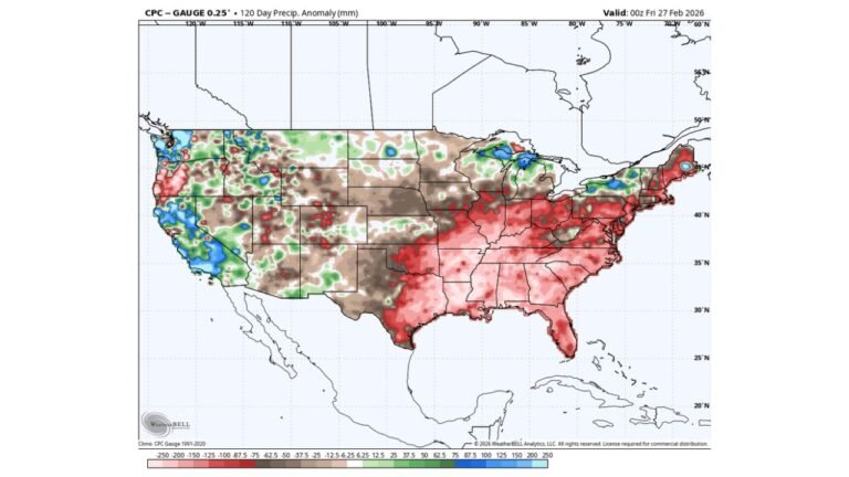
Whatever rain falls through Monday will be very beneficial for ongoing drought conditions across the region. The combination of 1.5 to 2 inches of rainfall spread over several days gives the ground the best chance to absorb the moisture effectively.
Stay with CabarrusWeekly.com for daily updates as this wet holiday weekend pattern continues to be refined.