Active Storm Pattern Returns to the West by April 24 With Denver Facing Possible Late Season Snow
COLORADO — A significant atmospheric pattern shift is taking shape for the 6 to 10 day window, with a deep upper-level trough digging into the Western United States by April 24, 2026, bringing an active and potentially impactful weather setup to the Rockies and High Plains — including the possibility of late-season snow for Denver.
Deep Trough Locks Into the Western U.S. by April 24
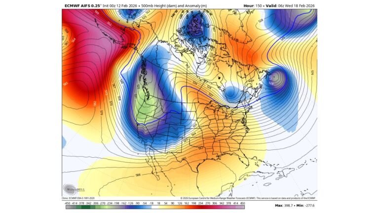
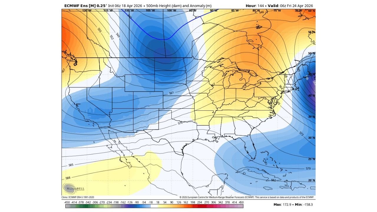
Upper-level height anomaly data valid April 24, 2026 shows a powerful negative anomaly centered over the central Rockies and High Plains, with the core of the trough positioned across Colorado, Wyoming, and the surrounding region. This configuration signals well-below-normal heights digging into the West, driving active storm potential across the area.
Meanwhile, strong positive anomalies dominate the Eastern U.S., indicating a sharp contrast between the stormy West and a warmer, more settled East through this period.
Denver May Not Be Done With Snow Yet
The trough positioning and upper-level pattern leave the door open for Denver to see additional late-season snowfall before April closes out. The exact storm track remains uncertain, and small shifts north or south in the system’s path will determine how much wintry weather Colorado’s Front Range ultimately receives.
Residents along the Front Range and in the higher elevations should avoid locking in any assumptions based on app forecasts, as the setup remains in flux through the extended range.
Drought Relief Possible if Storm Track Shifts South
The active pattern also carries the potential for meaningful drought relief across portions of the drought-stricken West and Southern Plains — but only if the storm track trends far enough south to tap into adequate moisture. A more northerly track would deliver cold and wind without the precipitation desperately needed across drought-affected areas.
The setup is described as tricky, with outcomes ranging from significant snow and drought-busting rain to a drier, colder outcome depending on how the pattern evolves over the next several days.
Patience Warranted Through the Extended Forecast
With multiple solutions still in play, confidence in specific storm details remains low through the April 24 timeframe. Automated forecast tools and weather apps are likely to struggle with this type of pattern, and residents across Colorado and the broader West should follow updated guidance closely as the week progresses.
Stay with CabarrusWeekly.com for continuing pattern updates and storm tracking across Colorado and the Western United States through late April.