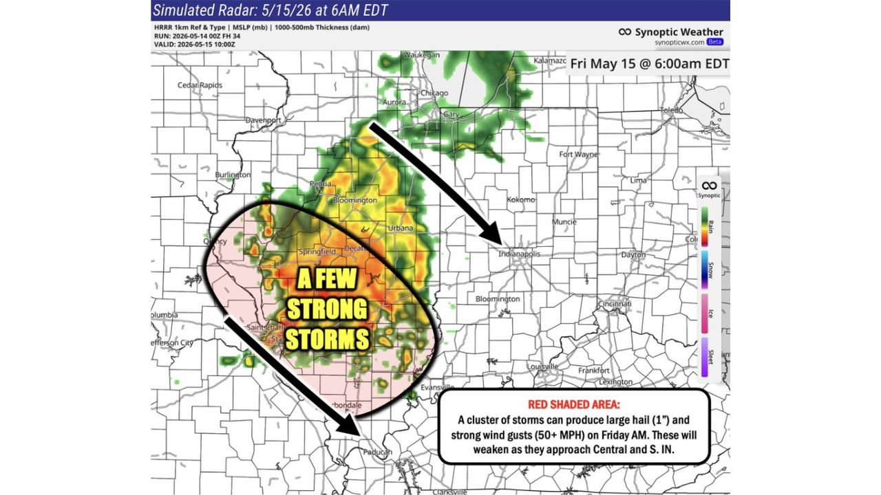
Illinois Faces a Friday Morning Storm Cluster With 1-Inch Hail and 50 MPH Wind Gusts Near Springfield, Peoria and Bloomington Before Weakening Into Central Indiana by Midday May 15
CENTRAL ILLINOIS — A cluster of storms is likely across central and southern Illinois Friday morning May 15, 2026, with the potential for large hail up to 1 inch and wind gusts of 50 MPH or greater in the red shaded zone. Simulated radar valid at 6:00 AM EDT Friday May 15 shows the heaviest storm activity centered over Springfield, Peoria, Bloomington, and Urbana before the system pushes east into central and southern Indiana in a much weaker state by midday.
Where the Strong Storm Risk Is Focused
The red shaded area on the storm cluster map highlights the primary zone of concern:
- Peoria, Bloomington, Springfield, Urbana, and Decatur — core strong to severe storm zone
- St. Louis metro area — southern edge of the storm cluster
- Evansville corridor — southeastern fringe as storms exit Illinois
Hazards in the Red Zone Friday Morning
- Large hail up to 1 inch — possible with stronger cells
- Wind gusts 50 MPH or greater — primary damaging threat
- Storm cluster pushes east into central and southern Indiana but weakens significantly before exiting around midday
Indiana Gets a Weaker Version
By the time this storm cluster reaches Indianapolis and central Indiana, it is expected to be considerably weaker. The main threat stays focused on central and southern Illinois during the morning hours.
Stay with CabarrusWeekly.com for live updates as this Friday morning storm cluster moves through Illinois and into Indiana.