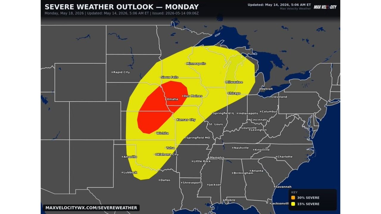
Kansas, Nebraska, Iowa, Illinois and Michigan Face a Possible Severe Weather Outbreak With Strong Tornadoes, Very Large Hail and Damaging Winds Near Omaha, Kansas City and Des Moines Monday May 18
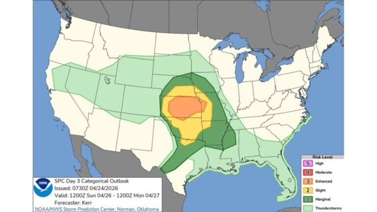
KANSAS — A severe weather outbreak is possible across a massive portion of the United States on Monday May 18, 2026, with the highest concern focused on the corridor between Kansas and Michigan. The severe weather outlook updated at 5:06 AM ET on May 14, 2026 shows a 30% severe risk centered over Omaha, Kansas City, Wichita, and Des Moines — with discrete supercells and lines of thunderstorms both possible.
Threat Zone Breakdown for Monday
The outlook map shows two clearly defined risk levels:
30% Severe Risk — Core Outbreak Zone:
- Omaha, Des Moines, Kansas City, and Wichita sit directly inside the highest risk area
- This zone represents the greatest probability of strong tornadoes, very large hail, and damaging winds
15% Severe Risk — Broader Threat Zone:
- Extends from Sioux Falls and Minneapolis in the north
- Pushes east through Chicago, Milwaukee, and Detroit
- Stretches south toward Tulsa, Oklahoma City, and Springfield MO
All Major Hazards Elevated
- Strong tornadoes — elevated risk between Kansas and Michigan
- Very large hail — widespread threat across the core zone
- Damaging winds — possible with both discrete supercells and squall lines
- Discrete supercells and lines of thunderstorms — both storm modes possible
This Is a Rapidly Growing Threat
The 30% severe risk zone centered over Omaha and Kansas City on a Day 4 outlook is a significant signal. The combination of discrete supercells and organized lines of storms means multiple hazard types could occur simultaneously across the same areas.
Stay with CabarrusWeekly.com for daily updates as this major Monday outbreak threat continues to rapidly develop.