Indiana, Ohio, Kentucky and Illinois Face Widespread Storm Risks Near Indianapolis, Cincinnati, Columbus and Louisville Saturday May 16 This Afternoon and Evening
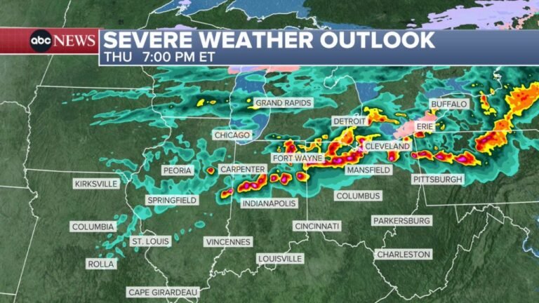
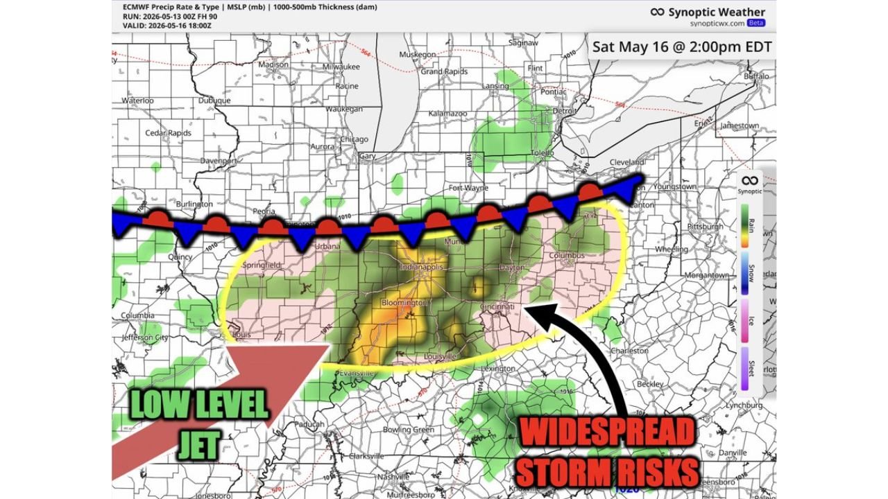
INDIANAPOLIS, INDIANA — Trends are pointing toward widespread storm potential across Indiana, Ohio, Kentucky, and Illinois on Saturday afternoon and evening, May 16, 2026. Simulated radar valid at 2:00 PM EDT Saturday May 16 shows a concentrated zone of significant storm activity centered around Indianapolis, Cincinnati, Columbus, Bloomington, and Louisville, fueled by a low-level jet pushing moisture northward from the south.
Where the Highest Storm Risk Is Focused
The simulated radar and storm risk zone highlights a well-defined area of widespread storm potential:
- Core risk zone — Indianapolis, Bloomington, Cincinnati, Columbus, Louisville, and Dayton
- Northern boundary — cold front stretching from Springfield IL through Urbana, Fort Wayne, and toward Cleveland
- Southern fuel source — a strong low-level jet feeding warm, moist air directly into the threat area from the southwest
Cities including Chicago, St. Louis, Detroit, and Pittsburgh sit outside or along the outer edges of the core risk zone.
Storm Timing Saturday
- Activity begins to develop: Saturday afternoon
- Peak storm window: Saturday evening
- Most exposed cities: Indianapolis, Cincinnati, Columbus, Louisville, and Dayton
Still a Few Days Away — Details Will Sharpen
Forecast confidence will increase as Saturday approaches. The overall pattern, however, is trending toward a more widespread and impactful storm event across the central Midwest and Ohio Valley for the weekend.
Stay with CabarrusWeekly.com for updated forecasts as this Saturday storm risk comes into sharper focus.