Washington D.C. and Virginia Face Two Waves of Showers and Storms With Damaging Wind Gusts and Heavy Downpours Possible Near the Beltway Wednesday May 13 This Evening
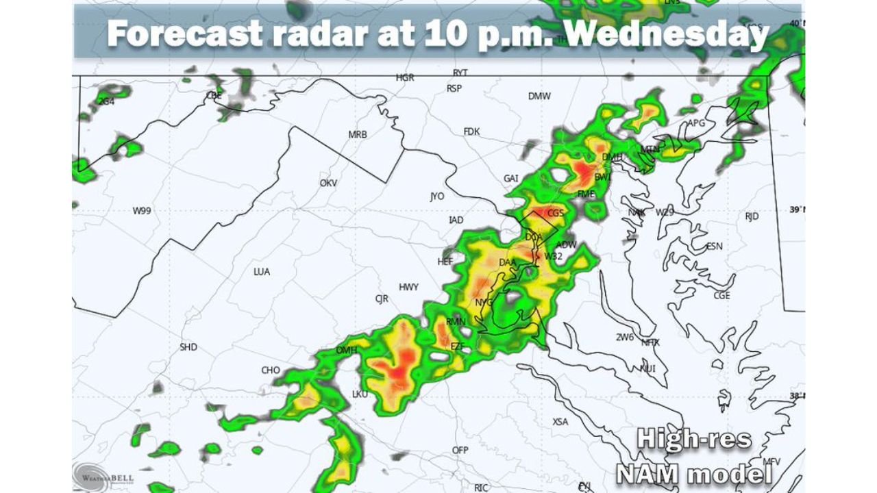
WASHINGTON D.C. AND VIRGINIA — Two waves of showers and storms are pushing through the Washington D.C. and Beltway region today, Wednesday May 13, 2026. The first wave will be light and scattered, but the second wave arriving between 8 PM and midnight brings the risk of gusty thunderstorms, heavy downpours, and a possible severe thunderstorm with damaging wind gusts mainly across western areas.
Two Rounds of Rain Moving Through Today
Wave 1 — Midafternoon to Early Evening: The first round of showers will be hit or miss and is not expected to amount to much. Coverage will be scattered and intensity generally light across the region.
Wave 2 — 8 PM to Midnight: The second and more significant wave arrives after dark, bringing:
- Gusty thunderstorms with heavy downpours
- Possible severe thunderstorm with damaging wind gusts — mainly in western areas
- Activity expected to weaken as it shifts east toward the Beltway area
Rainfall Totals Stay Modest Despite Two Waves
Combined rainfall totals from both waves are forecast to average only around 0.25 inches. Some areas could see slightly more while others may see very little rain overall.
The 8 PM to Midnight Window Is the One to Watch
The midafternoon wave is manageable. The 8 PM to midnight period carries the greatest risk, particularly for areas west of the Beltway where the strongest storms are most likely before weakening eastward.
Stay with CabarrusWeekly.com for the latest updates as these two storm waves move through the Washington D.C. and Virginia region tonight.