Kansas, Missouri and Oklahoma Face Significant Severe Weather With Very Large Hail and Intense Damaging Winds Near the I-40 Corridor and Wichita Thursday May 14 This Afternoon and Evening
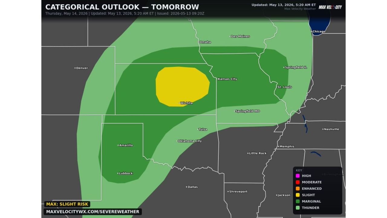
KANSAS — Significant severe weather is expected across the Central Plains on Thursday May 14, 2026, with supercells capable of producing very large hail and intense damaging winds during the afternoon and evening hours. The categorical outlook updated at 5:20 AM ET on May 13, 2026 shows a Slight Risk centered directly over Wichita and the surrounding I-40 corridor, making this the highest risk zone for Thursday.
Threat Zone Breakdown for Thursday
The outlook map shows three distinct risk levels across the region:
- Slight Risk — core zone centered over Wichita and the I-40 corridor in Kansas
- Marginal Risk — broader zone covering Kansas City, Omaha, Tulsa, Oklahoma City, and Springfield MO
- Thunder Risk — outer fringe extending toward Amarillo, Lubbock, Dallas, Des Moines, St. Louis, and Springfield IL
Cities including Denver, Nashville, Memphis, and Little Rock sit outside the current threat area.
Hazards Expected Thursday
- Very large hail — primary and main threat
- Intense damaging winds — possible with supercell development
- Especially dangerous near the I-40 corridor in Kansas
Protect Your Vehicle Now
With very large hail as the primary threat, anyone in or near Wichita and the I-40 corridor should secure vehicles in a garage or covered area before storms arrive Thursday afternoon.
Stay with CabarrusWeekly.com for live updates as this Central Plains severe weather threat develops Thursday.