Multiple Intense Supercells Rapidly Developing From Iowa Into Southern Wisconsin and Northern Illinois This Evening
IOWA, SOUTHERN WISCONSIN, AND NORTHERN ILLINOIS — The latest forecast radar, valid 19z Friday April 17, 2026, is showing multiple intense supercells and multicell clusters developing directly inside the tornado risk area this afternoon and evening. Storms are rapidly organizing from Iowa into southern Wisconsin and northern Illinois — and some could become strong and long-tracked before merging into larger clusters tonight.
What Is Developing Right Now
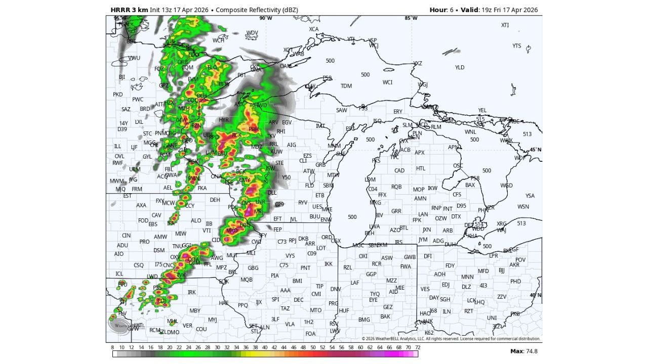
The 3km composite reflectivity valid 19z April 17 shows intense returns with the highest values — deep red and purple cores reaching 74.8 dBZ — concentrated across the Iowa and southern Wisconsin corridor. Multiple discrete supercell signatures are visible within the active zone.
| Threat | Details |
|---|---|
| Storm type | Multiple intense supercells and multicell clusters |
| Primary hazards | Damaging winds, large hail, tornadoes |
| Long-track potential | Yes — discrete storms before merging into clusters |
| Coverage area | Iowa into southern Wisconsin and northern Illinois |
The Key Concern Tonight
Storms that remain discrete and separate before merging carry the highest tornado potential. Once they merge into a larger cluster or squall line, the wind threat becomes dominant. The window when these storms are still discrete — right now through early evening — is the most dangerous tornado window for Iowa, southern Wisconsin, and northern Illinois.
Keep all alerts active. Get to shelter immediately if a warning drops for your county.
Stay with CabarrusWeekly.com for live storm updates across Iowa, Wisconsin, and Illinois tonight.