Rare Day 7 Severe Weather Outlook Covers Nashville to Memphis and Upper Cumberland Region for Monday April 27
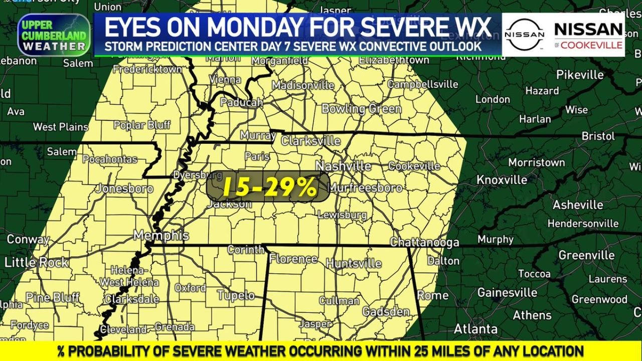
UPPER CUMBERLAND, TENNESSEE — The Storm Prediction Center has issued a rare Day 7 severe weather convective outlook for Monday April 27, 2026, placing the entire Upper Cumberland region and areas to the west under a 15 to 29 percent probability of severe storms occurring within 25 miles of any location — as a powerful cold front approaches from the west and targets a broad corridor from Memphis through Nashville and into western Kentucky.
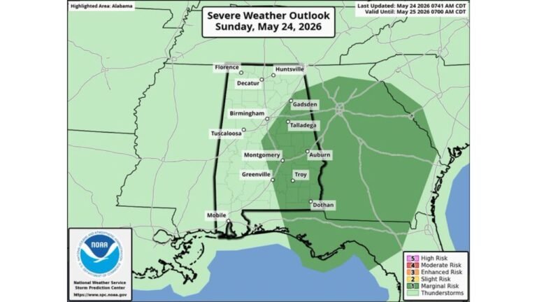
15 to 29 Percent Severe Risk Covers Memphis to Nashville and Beyond
The Day 7 severe weather outlook map shows the risk zone blanketing a large multi-state corridor. Cities directly within the 15 to 29 percent severe probability zone include Memphis, Jackson, Dyersburg, Clarksville, Nashville, Murfreesboro, Paducah, Murray, and Bowling Green. The risk footprint extends southward into Huntsville, Cullman, Florence, Corinth, and Tupelo and pushes northward into portions of western Kentucky and southern Illinois.
The Upper Cumberland communities of Cookeville and surrounding counties sit within the eastern edge of the risk area, with the core of the threat concentrated across Middle Tennessee and the western portions of the state.
A Rare Day 7 Outlook Signal
Day 7 severe weather convective outlooks from the SPC are issued relatively infrequently and only when atmospheric signals are sufficiently strong and consistent across multiple forecast models to justify highlighting a risk at that range. The issuance of this outlook for Monday reflects a high-confidence signal that severe storm potential is real and developing — even if specific storm timing, coverage, and hazard details remain uncertain at this distance.
Week Ahead — Warm and Quiet Through Thursday Before Pattern Shifts
Before Monday’s threat arrives, the region will enjoy a stretch of pleasant spring weather. Highs will climb into the upper 70s to near 80 degrees Tuesday and Wednesday under mostly sunny skies, with overnight lows in the lower 50s. Thursday brings further warmth with highs near or above 80 degrees and abundant sunshine.
Friday marks the transition point, with mostly sunny skies giving way to an isolated shower or thunderstorm possible in the afternoon as the pattern begins to evolve. Highs Friday will be in the lower 80s.
| Day | Conditions | High | Low |
|---|---|---|---|
| Tuesday/Wednesday | Sunny, pleasant | Upper 70s to 80°F | Lower 50s |
| Thursday | Sunny, warming | Near or above 80°F | Lower 50s |
| Friday | Mostly sunny, isolated storm possible | Lower 80s | Mid 50s to 60°F |
| Saturday | Storm chances increasing | Mid to upper 70s | Mid 50s to 60°F |
| Sunday | Low chance showers | Mid to upper 70s | Mid 50s to 60°F |
| Monday | Severe weather possible | To be determined | To be determined |
Saturday Storm Potential Also Being Watched
Before Monday arrives, Saturday carries its own lower-end potential for strong to severe storms as rain and storm chances increase Friday night into the weekend. The SPC has not yet introduced severe probabilities for Saturday, but forecasters are actively monitoring the setup as the pattern transitions toward the more active weekend and early next week configuration.
Residents across Middle Tennessee, western Kentucky, and northern Alabama should file Monday’s severe weather threat away now and return for updated forecasts as confidence and specific details sharpen through the week.
Stay with CabarrusWeekly.com for live severe weather outlook updates across Tennessee, Kentucky, and northern Alabama through Monday April 27.