Southern Mississippi Faces Possible Supercell Development Wednesday as Confluence Bands Could Trigger Storms Ahead of the Cold Front
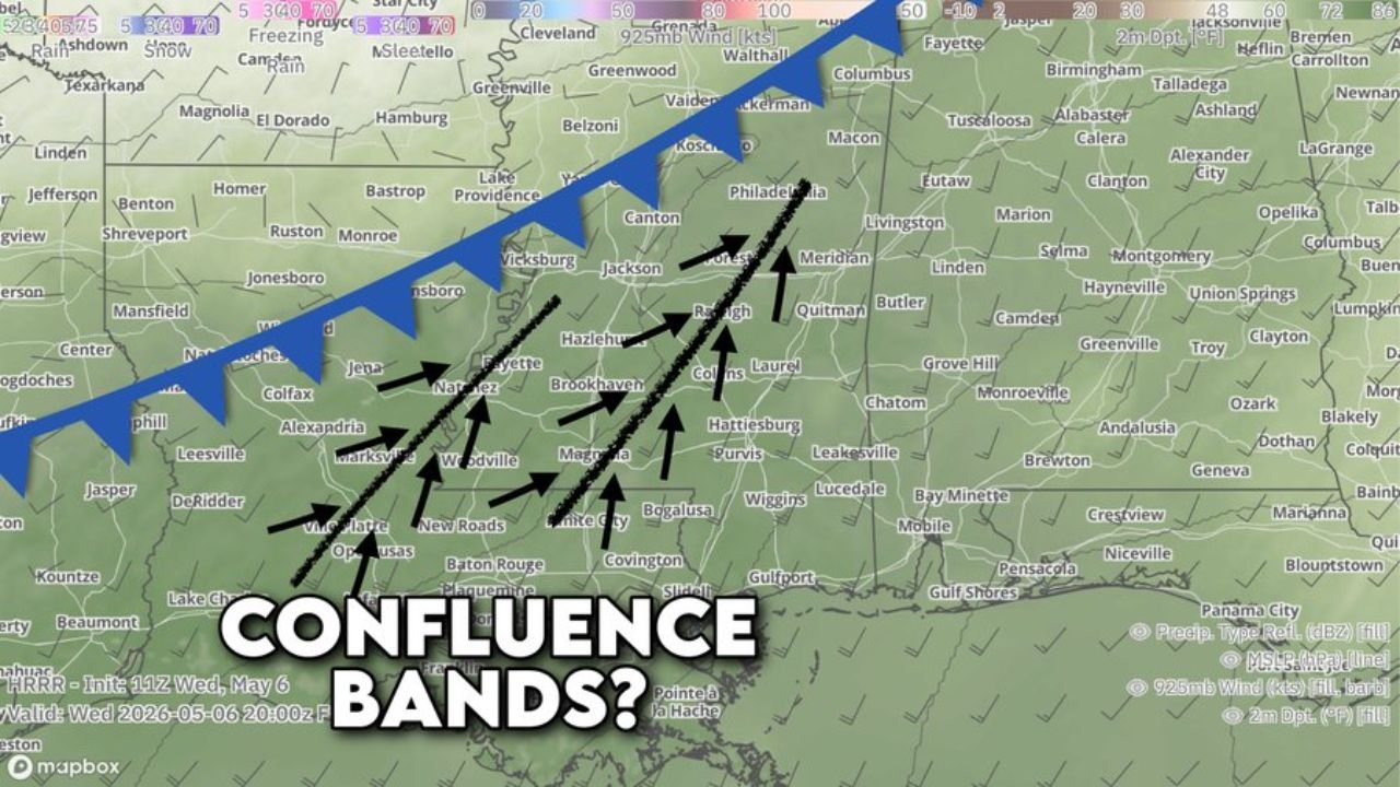
SOUTHERN MISSISSIPPI — A focused question is emerging for Wednesday, May 6, 2026 across southern Mississippi — whether confluence bands developing ahead of the approaching cold front will be capable of popping supercells across the region. Forecast data valid at 8:00 PM CDT Wednesday shows converging airflow across southern Mississippi creating the conditions where strips of gathering air could kick air pockets upward and generate storms in an area not currently inside the main risk zone.
What Are Confluence Bands and Why Do They Matter Today
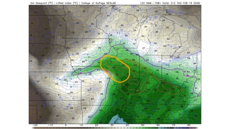
Confluence bands are strips of converging surface air that force air upward, generating storms even in the absence of a direct frontal boundary. As the cold front approaches from the northwest, airflow across southern Mississippi is converging from multiple directions, as shown by the arrow pattern on the forecast radar image. This convergence zone is centered across a corridor from Natchez and Brookhaven through Hattiesburg, Collins and Purvis.
If this convergence is strong enough to break the cap, isolated supercells could develop ahead of the main cold front across southern Mississippi during the afternoon and evening hours.
Area of Focus Wednesday
The confluence band signal on forecast radar is concentrated across:
- Natchez, Woodville and the southwest Mississippi corridor
- Brookhaven, Hazlehurst and Collins
- Hattiesburg, Purvis and Bogalusa
The broader cold front boundary runs across central Mississippi from Vicksburg through Jackson and toward Meridian, with the confluence zone developing well south of the front across the southern tier of the state.
This Remains a Conditional Threat
Supercell development in this zone is not guaranteed. Whether storms actually fire will depend on whether the confluence bands are strong enough to overcome the capping inversion ahead of the front. Forecasters are monitoring the situation closely through Wednesday afternoon.
Stay with CabarrusWeekly.com for live updates on storm development across southern Mississippi Wednesday afternoon and evening.